

Urban and Small Stream Flood Advisory For Parts of Central AL
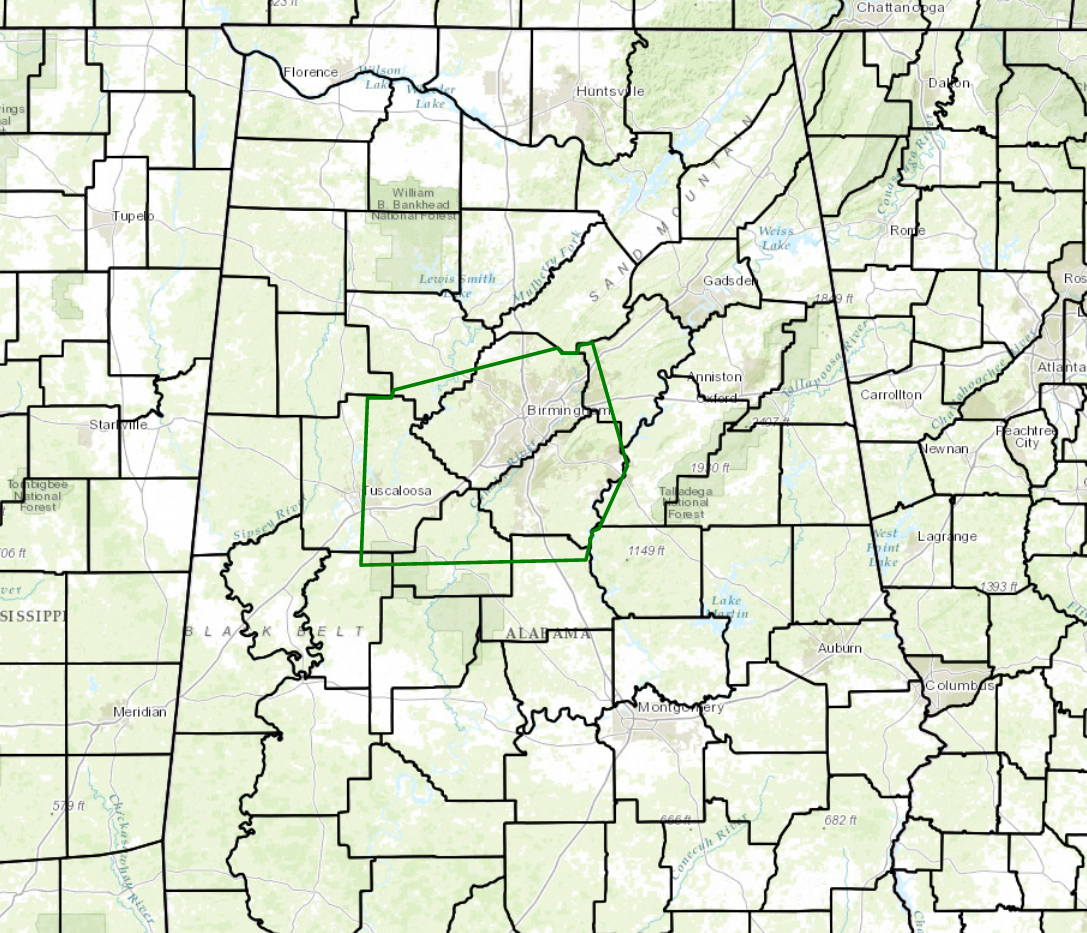
The National Weather Service in Birmingham has issued an Urban and Small Stream Flood Advisory until 1:45 PM CST for:
North central Chilton County in Alabama
Southwestern St. Clair County in Alabama
Shelby County in Alabama
Central Bibb County in Alabama
Southwestern Talladega County in east central Alabama
Northeastern Hale County in west central Alabama
Central Tuscaloosa County in west central Alabama
Southeastern Walker County in Alabama
Jefferson County in Alabama
At 1143 AM CST, Doppler radar indicated heavy rain causing urban and small stream flooding in the advisory area. One to three inches of rain have already fallen. Another half inch of rain is possible the next few hours. So runoff flooding will continue.
Some locations that will experience flooding include Birmingham, Tuscaloosa, Hoover, Vestavia Hills, Alabaster, Bessemer, Homewood, Northport, Pelham, Mountain Brook, Trussville, Helena, Hueytown, Gardendale, Irondale, Leeds, Moody, Calera, Fairfield and Chelsea.
Turn around, don’t drown when encountering flooded roads. Most flood deaths occur in vehicles. Keep children away from storm drains, culverts, creeks and streams. Water levels can rise rapidly and sweep children away.
Category: Alabama's Weather, Severe Weather
About the Author (Author Profile)
Scott Martin is an operational meteorologist, professional graphic artist, musician, husband, and father. Not only is Scott a member of the National Weather Association, but he is also the Central Alabama Chapter of the NWA president. Scott is also the co-founder of Racecast Weather, which provides forecasts for many racing series across the USA. He also supplies forecasts for the BassMaster Elite Series events including the BassMaster Classic.Subscribe
If you enjoyed this article, subscribe to receive more just like it.


