

Tornado Warning Continues For Pike County Until 4:45 PM CST
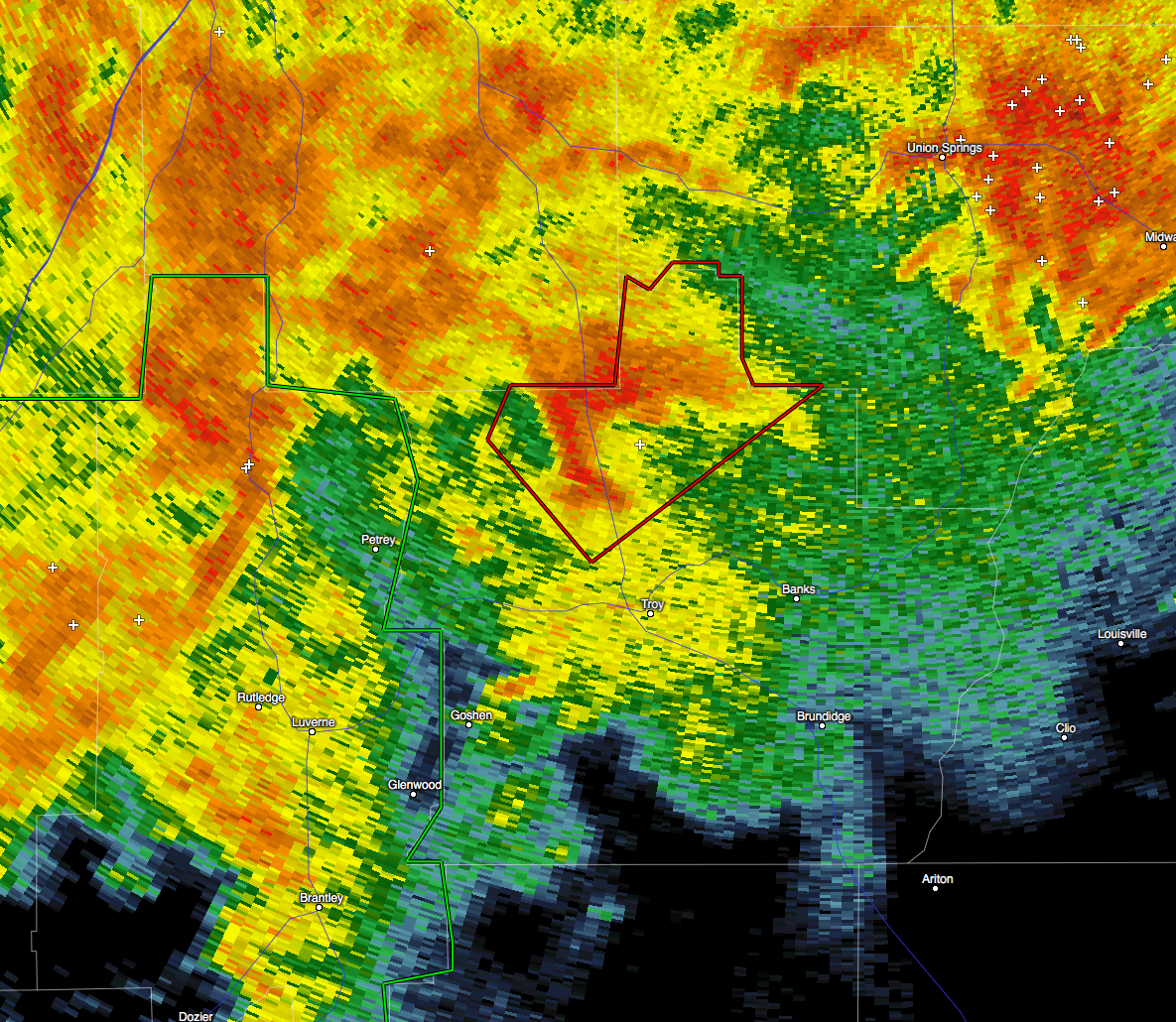
…A TORNADO WARNING REMAINS IN EFFECT UNTIL 445 PM CST FOR
NORTHWESTERN PIKE COUNTY…
At 402 PM CST, a severe thunderstorm capable of producing a tornado
was located over Troy Municipal Airport, or near Troy, moving
northeast at 30 mph.
HAZARD…Tornado.
SOURCE…Radar indicated rotation.
IMPACT…Flying debris will be dangerous to those caught without
shelter. Mobile homes will be damaged or destroyed. Damage
to roofs, windows, and vehicles will occur. Tree damage is
likely.
Locations impacted include…
Troy, Troy Municipal Airport, Orion and China Grove.
Category: Alabama's Weather, Current Warnings, Severe Weather
About the Author (Author Profile)
Scott Martin is an operational meteorologist, professional graphic artist, musician, husband, and father. Not only is Scott a member of the National Weather Association, but he is also the Central Alabama Chapter of the NWA president. Scott is also the co-founder of Racecast Weather, which provides forecasts for many racing series across the USA. He also supplies forecasts for the BassMaster Elite Series events including the BassMaster Classic.Subscribe
If you enjoyed this article, subscribe to receive more just like it.


