

Central Alabama Weather Update At 5:45 PM
From NWS Birmingham:
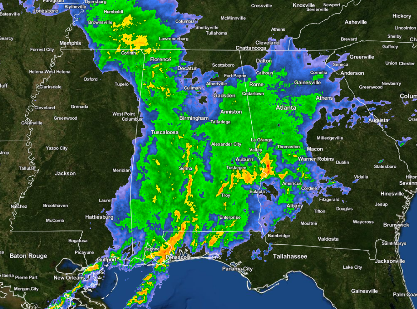
A moderate threat for severe weather continues in the extreme southeastern counties, coincident with the current tornado watch. Over the next several hours, the warm front should seemingly reset further south thanks to all of the convective contamination. The threat should slowly diminish as the current cells exit into Georgia, allowing for the cancellation of the current watch.
The bigger question is what to do with the overnight threat. The widespread convection has certainly rain-cooled the entire threat area, and it is looking like it will be extremely difficult, if not impossible to rebound enough to keep the current forecast in place. The wildcard of the substantial LLJ that is expected to develop just before midnight has me a bit concerned. But, most other evidence just doesn’t hold up, especially a rebound of surface instability. There could be a few elevated storms that develop around 10pm through midnight, but at this point will opt to remove all mention of a threat after 6pm. Will keep a close eye on the trends over the next several hours to see if any threat can redevelop. Stay tuned.
Category: Alabama's Weather, Severe Weather
About the Author (Author Profile)
Scott Martin is an operational meteorologist, professional graphic artist, musician, husband, and father. Not only is Scott a member of the National Weather Association, but he is also the Central Alabama Chapter of the NWA president. Scott is also the co-founder of Racecast Weather, which provides forecasts for many racing series across the USA. He also supplies forecasts for the BassMaster Elite Series events including the BassMaster Classic.Subscribe
If you enjoyed this article, subscribe to receive more just like it.


