

Severe Weather Risks Has Dropped Considerably & Confined To East Alabama
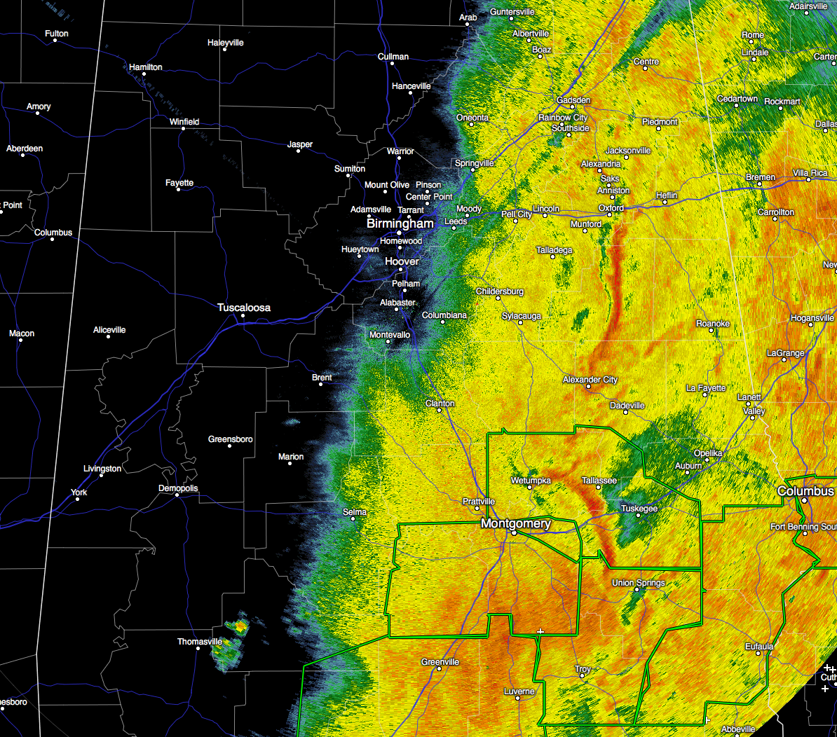
I believe we can sound an all clear now, as the severe weather threat for Central Alabama has come to an end. As matter of fact, rain has come to an end for most of western Alabama. A wake low has formed, so you may experience some strong, gusty winds on the backside of the rain mass as it passes by. The only warnings in effect in for Central Alabama are Flash Flood Warnings in the southeastern parts of the area.
The atmosphere has been worked over pretty well across the area, and so the risk for any severe development through the remainder of the night for Central Alabama is very, very slim. There still could be an isolated strong storm or two, but this has really translated into a flash flooding event.
I’ll have a post later tonight with rainfall totals across the area. I have seen readings already in the 4-5 inch range, but I’m sure that there will be some even higher.
Category: Alabama's Weather, Severe Weather
About the Author (Author Profile)
Scott Martin is an operational meteorologist, professional graphic artist, musician, husband, and father. Not only is Scott a member of the National Weather Association, but he is also the Central Alabama Chapter of the NWA president. Scott is also the co-founder of Racecast Weather, which provides forecasts for many racing series across the USA. He also supplies forecasts for the BassMaster Elite Series events including the BassMaster Classic.Subscribe
If you enjoyed this article, subscribe to receive more just like it.


