

Snow/Sleet About To Enter West Alabama
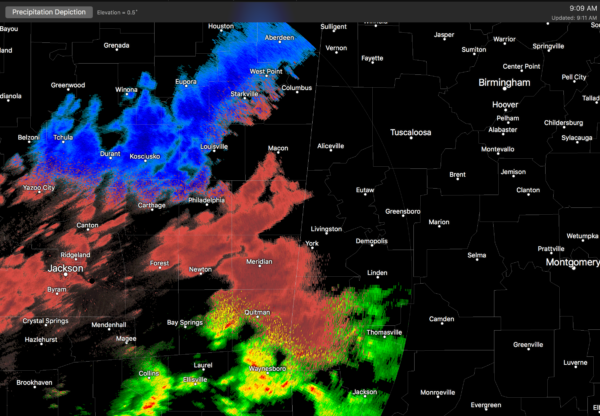
A large area of sleet and snow is about to enter West Alabama…
With temperatures dropping below freezing, icy spots will develop on bridges soon after the precipitation begins, and driving conditions will worsen this afternoon and tonight as snow/sleet continues to increase.
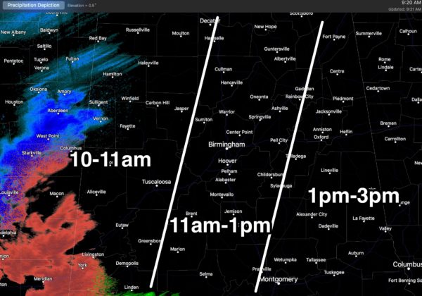
*Initially ice will form on bridges, but all roads have potential to become icy, especially where heavier sleet/snow/freezing rain falls. We are in the business of forecasting the state of the atmosphere, and not road conditions; we learned in 2014 we certainly aren’t road engineers, but I would sure not encourage driving this afternoon and tonight.
*With temperatures reaching the teens early tomorrow, road conditions, mostly likely, won’t improve until tomorrow afternoon. Even then we will have a hard time getting part 32 degrees, but the sky will become mostly sunny during the day.
*Precipitation will be mostly sleet initially across Central Alabama, changing to snow later today and tonight as cold air deepens.
*Mostly sleet and freezing rain will fall across South Alabama late tonight. All precipitation will end during the pre-dawn hours tomorrow.
*We can’t rule out a few isolated power outages where heavier snow/sleet/freezing rain comes down tonight.
*The weekend will be very cold, with lows in the teens tomorrow and Sunday. The high tomorrow will be in the low 30s, followed by upper 30s Sunday.
Stay tuned for updates throughout the day…
Category: Alabama's Weather
About the Author (Author Profile)
James Spann is one of the most recognized and trusted television meteorologists in the industry. He holds the AMS CCM designation and television seals from the AMS and NWA. He is a past winner of the Broadcast Meteorologist of the Year from both professional organizations.Subscribe
If you enjoyed this article, subscribe to receive more just like it.


