

A Warm And Breezy Late Midday
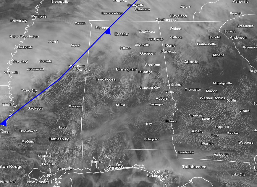
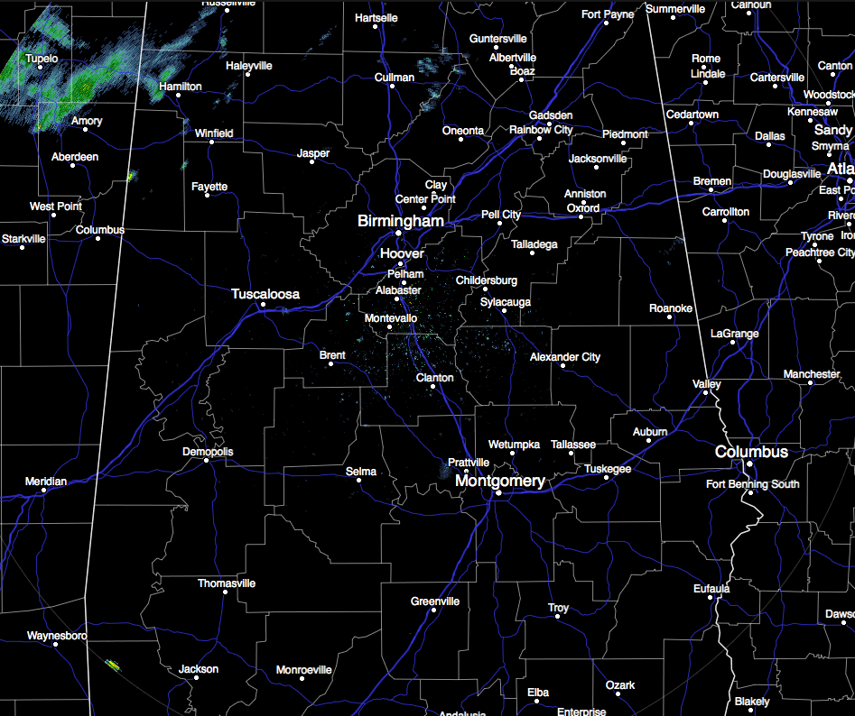
It’s a warm and breezy late midday hour across Central Alabama. We are watching a surface front slowly progressing into the state. This boundary is producing more clouds, and a few showers are showing up on radar across Northwest Alabama. These showers will be working through North Alabama the rest of today. Good news is that there is little upper-level support for the front, as the main low pressure center is over the Great Lakes. Therefore, there is no risk of severe weather, and we probably won’t have much thunder as well. Afternoon highs will generally be in the 70s, with a few lower 80s possible in the southern parts of the area. Scattered showers will persist throughout the overnight hours, and lows will be in the 50s and 60s. Rain amounts throughout the day should be under one-half inch.
Temperatures Across Central Alabama
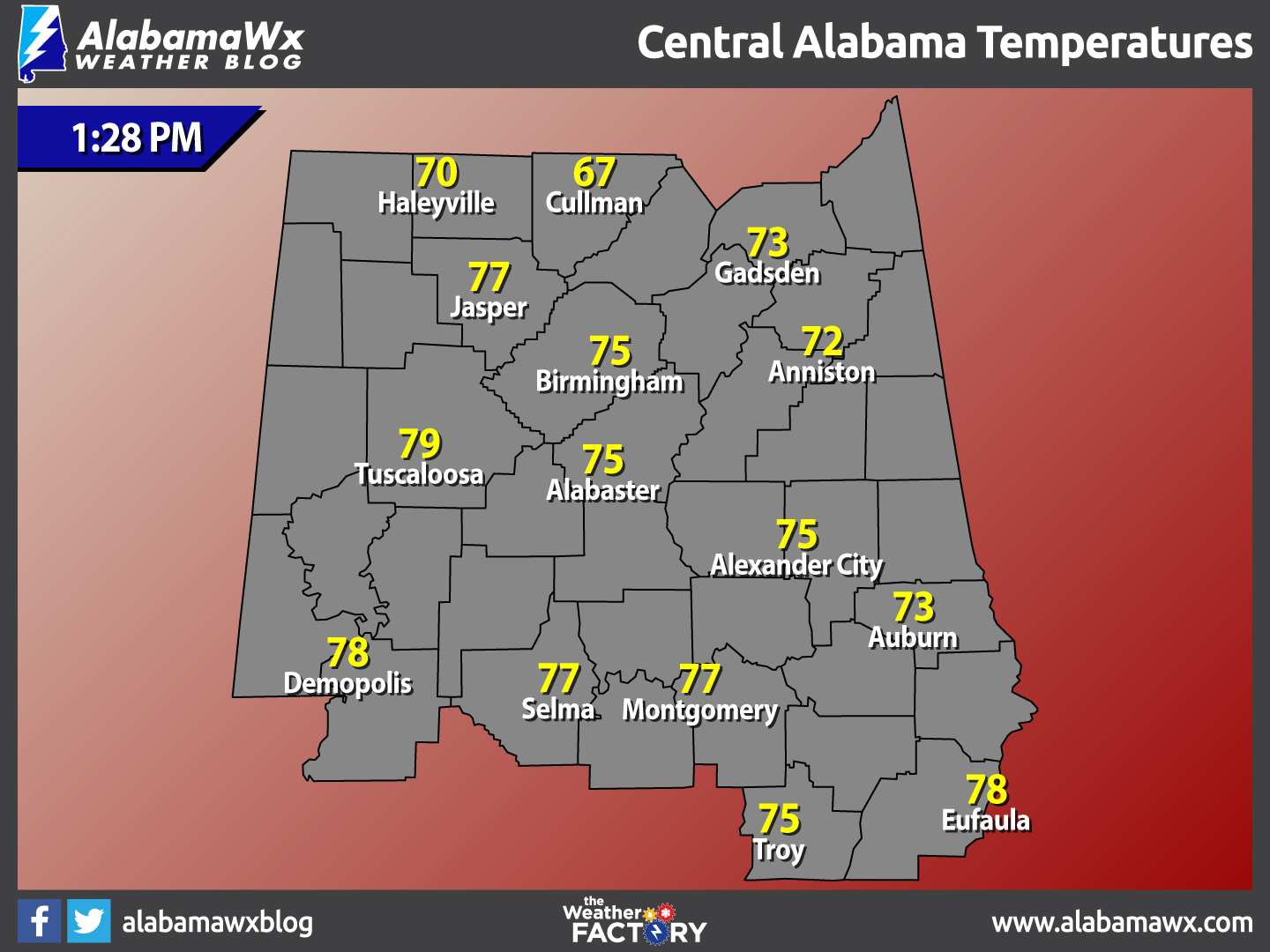
At 1:28 PM, temperatures are ranging from the upper 60s in the northern parts of the area, to the upper 70s in the southern parts of the area. The warm spot is currently Tuscaloosa at 79 degrees. The cool spot is Cullman at 67 degrees.
Birmingham’s Climatology And Records
The normal high for January 17th is 52, while the normal low is 32. The record high for today was set back in 1943 at 79 degrees. The record low was set back in 1982 at 0 degrees.
Wednesday’s Forecast
The front will stall across Central Alabama, and that means we will have more clouds than sun, cooler temperatures, and there will be a few passing showers from time to time. Nothing too heavy, but overall, likely just a gray day for most of us. Highs will be in the 60s and 70s across the area.
For Those Who Are Beach Bound
Partly sunny days with mostly cloudy nights throughout the week, with a slight chance of rain each day through Wednesday, and increasing for the end of the week and weekend. Highs will be in the 70s, with lows in the 60s. Click here to see the Beach Forecast Center page.
National High & Low Temperature
The warmest high temperature for the United States on Monday was 84 degrees, recorded at two locations (Marathon, Florida and Harlingen, Texas). The coldest low temperature for the United States on Monday night into early this morning was -26 degrees, recorded at Stanley, Idaho.
On This Day In Weather History: 1990
Twenty cities across the southeastern half of the country reported record high temperatures for the date. Record highs included 61 degrees at Williamstown PA and 85 degrees at Brownsville TX. Evening thunderstorms produced large hail and damaging winds from eastern Texas to Mississippi.
Central Alabama Chapter Of The NWA
The Central Alabama Chapter of the National Weather Association will be hosting famed engineer and storm chaser Tim Marshall. He will speak at Vulcan Museum starting at 6:00 PM on the evening of Tuesday, January 24th. This is an event you won’t want to miss. Look for details on the chapter’s website.
Follow The Blog On Social Media
Remember that we are also on Facebook and on Twitter.
WeatherBrains
This is the weekly netcast that’s all about weather featuring many familiar voices, including our meteorologists at ABC 33/40. You can listen anytime on the web, or on iTunes. You can find it here.
Forecaster: Scott Martin (Twitter: @scottmartinwx)
Category: Alabama's Weather
About the Author (Author Profile)
Scott Martin is an operational meteorologist, professional graphic artist, musician, husband, and father. Not only is Scott a member of the National Weather Association, but he is also the Central Alabama Chapter of the NWA president. Scott is also the co-founder of Racecast Weather, which provides forecasts for many racing series across the USA. He also supplies forecasts for the BassMaster Elite Series events including the BassMaster Classic.Subscribe
If you enjoyed this article, subscribe to receive more just like it.


