

Cloudy & Cooler Across Much Of Central Alabama At Midday
Thanks to a weak surface front that moved through Central Alabama last night, temperatures will be running about 5-10 degrees cooler than highs on Tuesday. That front has stalled out over the central part of the state. Skies at the midday hour are mostly cloudy across much of the area, with a little less cloud cover in the southern locations in Central Alabama. There are a few scattered light showers out there mainly east of I-65 and south of I-20. These are moving off to the east.
For the remainder of the day across the area, the sky will be mostly cloudy and a little light rain is possible in spots, especially in the northeastern 2/3rds of the area, but most of the day will be dry. Afternoon highs will be in the mid 60s to the mid 70s across the area from north to south. Showers will be on the increase tonight, and a few thunderstorms will be possible as well. The risk of rain is small in the southeast, and increases as you move northwest. Lows will be in the lower 50s to the lower 60s across the area.
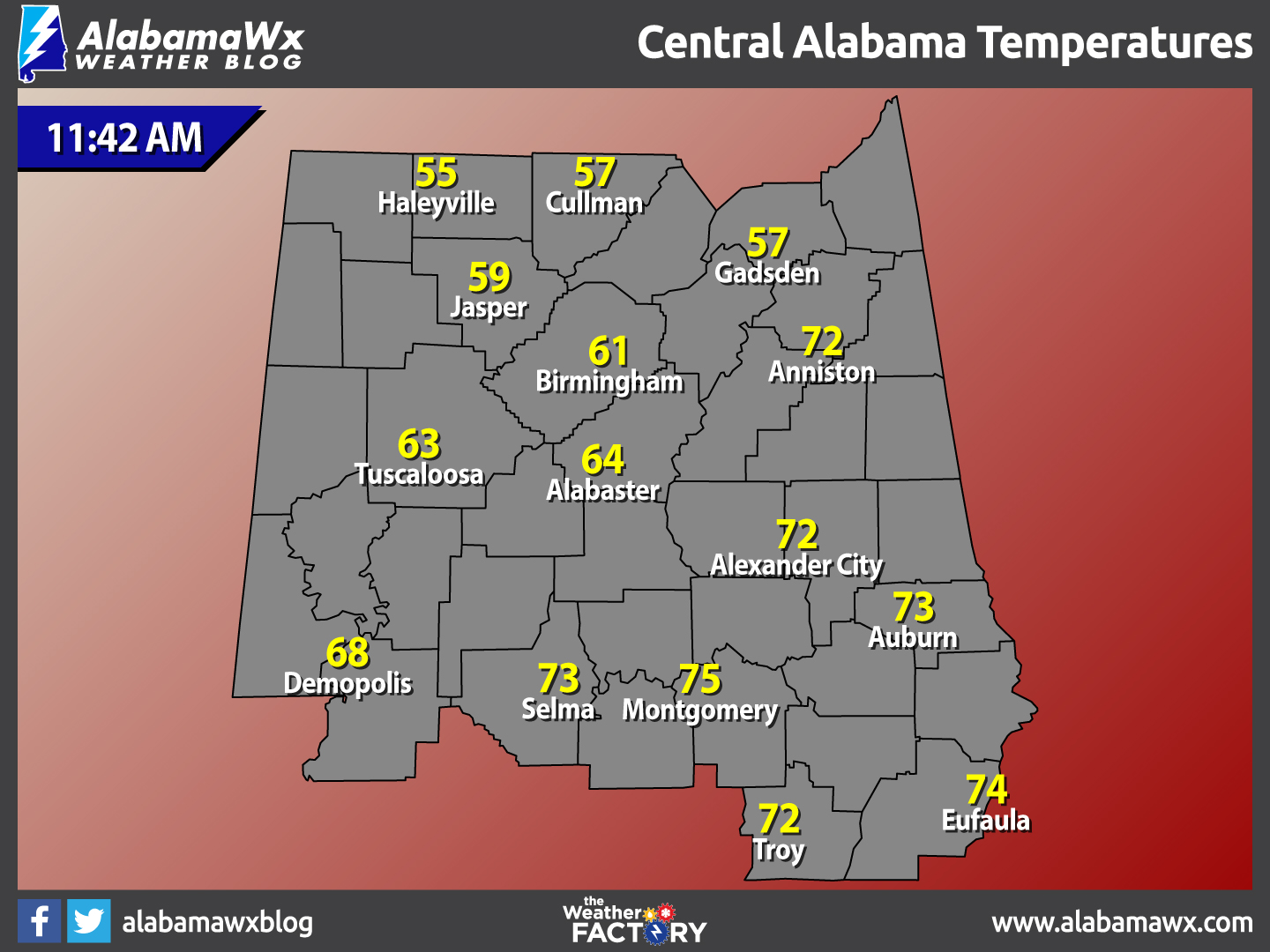
Temperatures Across Central Alabama
At 1:28 PM, temperatures are ranging from the mid 50s in the northern parts of the area, to the mid 70s in the southern parts of the area. The warm spot is currently Montgomery at 75 degrees. The cool spot is Haleyville at 55 degrees.
Birmingham’s Climatology And Records
The normal high for January 18th is 52, while the normal low is 32. The record high for today was set back in 1929 at 76 degrees. The record low was set back in 1977 at 6 degrees.
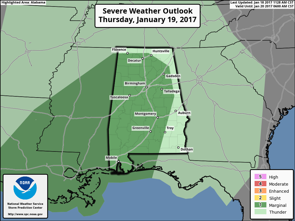
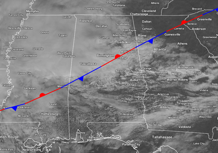
An Active Thursday Possible
The Storm Prediction Center has a “marginal” risk of severe storms for a decent part of Alabama tomorrow afternoon and into the early, pre-dawn hours on Friday. An upper trough will approach from the west tomorrow while the current surface front over Central Alabama lifts northward during the day, putting the state in an unstable airmass.
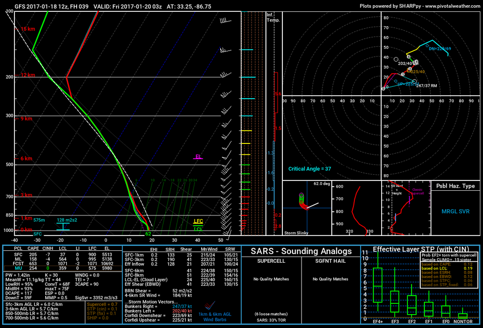
Fortunately, forecast soundings are fairly saturated. You usually need dry air in the mid levels for a big severe weather threat (the best convective instability occurs when dry mid-level air advects over warm and moist air in the lower troposphere).
The main window for strong to severe storms will come from about 4:00 PM tomorrow through 2:00 AM Friday, with the main threats including damaging straight line winds and small hail, although an isolated, brief tornado can’t be ruled out. Rain amounts of around one inch are likely. There could be some minor flooding issues, but major flash flooding is not expected. As always, be sure you have a way of getting severe weather warnings in the event they are needed tomorrow night.
For Those Who Are Beach Bound
Partly sunny days with mostly cloudy nights throughout the week, with a slight chance of rain each day through Wednesday, and increasing for the end of the week and weekend. Highs will be in the 70s, with lows in the 60s. Click here to see the Beach Forecast Center page.
National High & Low Temperature
The warmest high temperature for the United States on Tuesday was 87 degrees, recorded at McAllen, Texas). The coldest low temperature for the United States on Tuesday night into early this morning was -16 degrees, recorded at Big Piney, Wyoming.
On This Day In Weather History: 1988
A storm in the southwestern U.S. produced a 15 to 20 foot surf along the southern coast of California resulting in more than fifty million dollars damage. A small tornado in Orange County CA lifted a baseball dugout fifteen feet into the air and deposited it in the street, 150 yards away. The same storm also produced 26 inches of snow at Duck Creek UT.
Central Alabama Chapter Of The NWA
The Central Alabama Chapter of the National Weather Association will be hosting famed engineer and storm chaser Tim Marshall. He will speak at Vulcan Museum starting at 6:00 PM on the evening of Tuesday, January 24th. This is an event you won’t want to miss. Look for details on the chapter’s website.
Follow The Blog On Social Media
Remember that we are also on Facebook and on Twitter.
WeatherBrains
This is the weekly netcast that’s all about weather featuring many familiar voices, including our meteorologists at ABC 33/40. You can listen anytime on the web, or on iTunes. You can find it here.
Forecaster: Scott Martin (Twitter: @scottmartinwx)
Category: Alabama's Weather
About the Author (Author Profile)
Scott Martin is an operational meteorologist, professional graphic artist, musician, husband, and father. Not only is Scott a member of the National Weather Association, but he is also the Central Alabama Chapter of the NWA president. Scott is also the co-founder of Racecast Weather, which provides forecasts for many racing series across the USA. He also supplies forecasts for the BassMaster Elite Series events including the BassMaster Classic.Subscribe
If you enjoyed this article, subscribe to receive more just like it.


