

A Midday Update On Central Alabama’s Weather
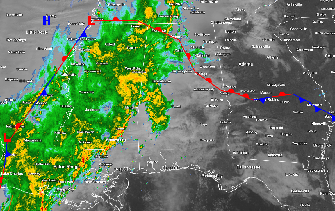
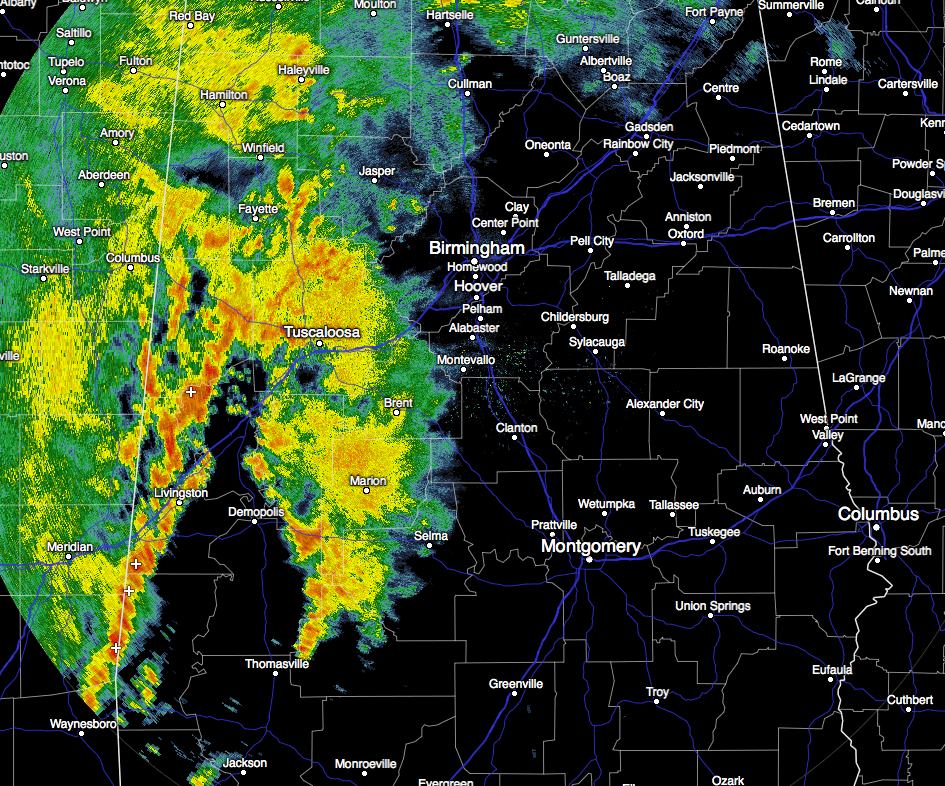
Currently at the midday hour, rain and a few embedded thunderstorms have pushed their way into the western parts of Central Alabama. Most of the rain activity at this point is west of a line from Jasper to Brent to Selma. Currently there are no severe watches and warnings in effect for the southeastern states. Hardly any lightning showing up with this rain shield as well. For those not receiving any rainfall at the moment, you have cloudy skies overhead.
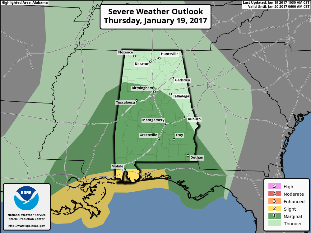
Even though the SPC has much of the southern 2/3rds of the state in a “Marginal Risk” for severe weather today, I do believe that this will mainly be a heavy rain event for Central Alabama. The forecast soundings still look to be too saturated for a big severe weather event, and poor lapse rates and unidirectional wind flow (shear) are limiting factors as well. A few storms could reach severe limits with gusty winds and small hail, and the chance of a small tornado is not out of the question, even though the likely hood is very low. The main window for any stronger storms will be from now until midnight. Rain totals by the end of the day could be as high as 2 to 3 inches, so we could very well have some localized flash flooding events. Highs will be in the mid 60s to the upper 70s across Central Alabama, with overnight lows in the mid 50s to low 60s.
Temperatures Across Central Alabama
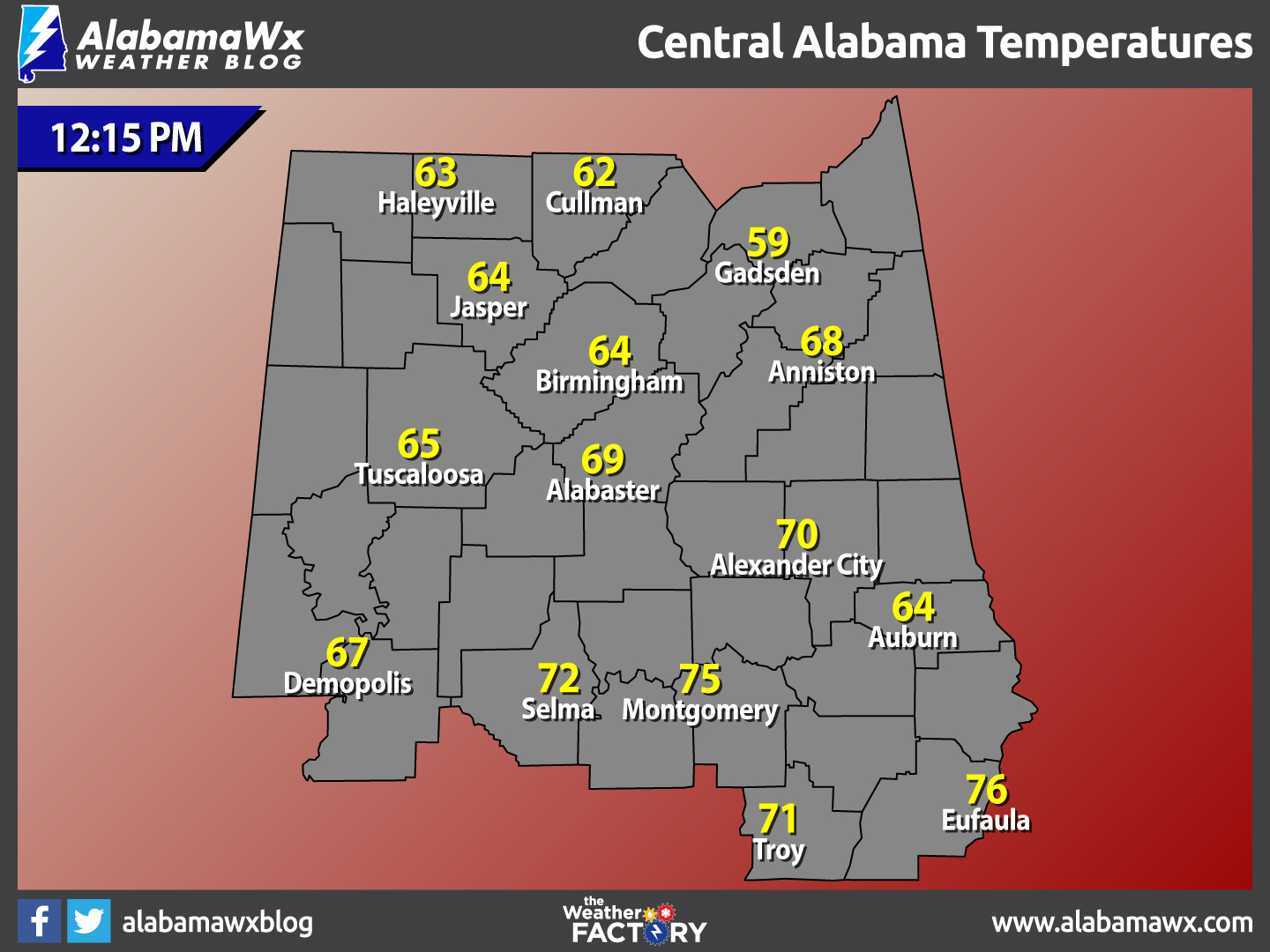
At 12:15 PM, temperatures are ranging from the upper 50s to the mid 70s across the area. The warm spot is currently Eufaula at 76 degrees. The cool spot is Gadsden at 59 degrees.
Birmingham’s Climatology And Records
The normal high for January 19th is 53, while the normal low is 32. The record high for today was set back in 1982 at 76 degrees. The record low was set back in 1940 at 2 degrees.
An Active Friday Night Possible
A complex weather pattern is setting up for Central Alabama with multiple rounds of rain and storms moving through the area for tomorrow through the weekend. A deep upper trough with strong wind fields will be approaching the area, and with steep lapse rates, high instability values, and deep layer shear, we will need to be weather aware through Sunday morning.
During the day, it will be mostly dry across the area, but a few isolated showers could pop up during the day. These will be small and nature and not long lasting. The main action will be during the late night and into the morning on Saturday. Highs will be in the 70s.
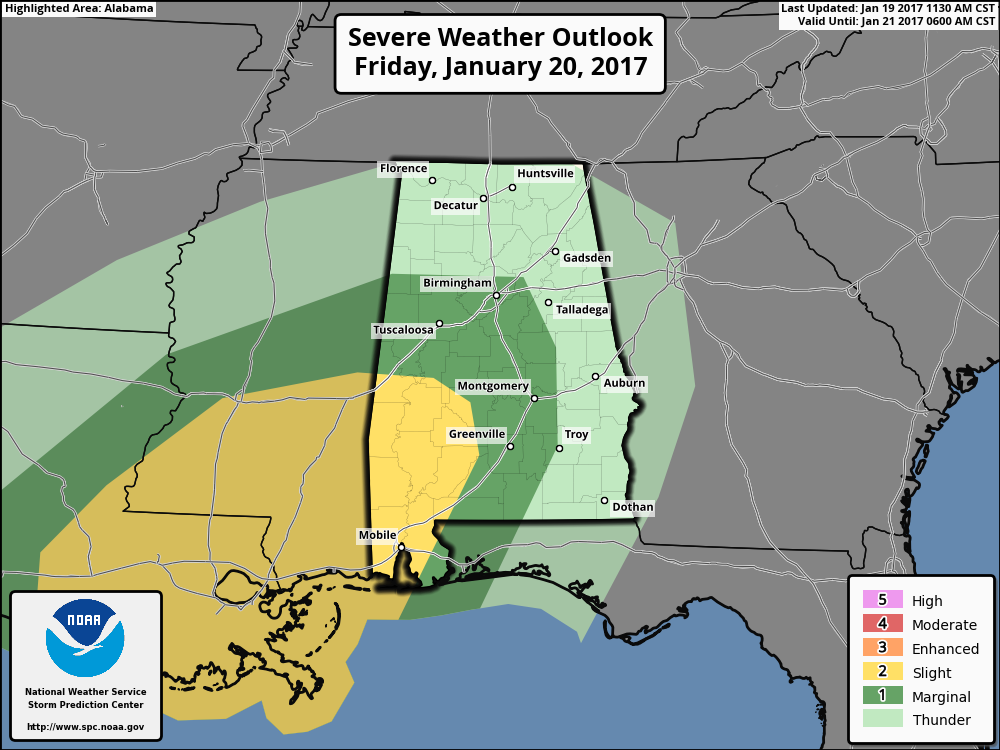
The SPC has the much of the south and western parts of the state in a “Marginal Risk” for severe storms, with the southwest corner in a “slight risk” for severe storms. We really need to get through today’s round of storms before we can really get a good idea on timing and magnitude of tomorrow’s threat. As of now, all modes of severe weather look to be possible, including damaging straight line winds, hail, and tornadoes. Timing as of now appears to be from 9:00 PM on Friday night through 9:00 AM on Saturday morning.
For Those Who Are Beach Bound
Thunderstorms will be likely from now until the end of the weekend, but sunshine returns for the beginning of the week. Highs will be in the 70s through the weekend, then dropping back into the 60s for the start of the week. Click here to see the Beach Forecast Center page.
On This Day In Weather History: 1988
A powerful storm hit the central U.S. producing blizzard conditions in the Central High Plains, and severe thunderstorms in the Lower Mississippi Valley. Snowfall totals ranged up to 36 inches at Wolf Creek Pass CO, with 31 inches at Elsmere NE. Tornadoes claimed five lives in Tennessee, and a tornado at Cullman AL injured 35 persons.
Central Alabama Chapter Of The NWA
The Central Alabama Chapter of the National Weather Association will be hosting famed engineer and storm chaser Tim Marshall. He will speak at Vulcan Museum starting at 6:00 PM on the evening of Tuesday, January 24th. This is an event you won’t want to miss. Look for details on the chapter’s website.
Follow The Blog On Social Media
Remember that we are also on Facebook and on Twitter.
WeatherBrains
This is the weekly netcast that’s all about weather featuring many familiar voices, including our meteorologists at ABC 33/40. You can listen anytime on the web, or on iTunes. You can find it here.
Forecaster: Scott Martin (Twitter: @scottmartinwx)
Category: Alabama's Weather, Severe Weather
About the Author (Author Profile)
Scott Martin is an operational meteorologist, professional graphic artist, musician, husband, and father. Not only is Scott a member of the National Weather Association, but he is also the Central Alabama Chapter of the NWA president. Scott is also the co-founder of Racecast Weather, which provides forecasts for many racing series across the USA. He also supplies forecasts for the BassMaster Elite Series events including the BassMaster Classic.Subscribe
If you enjoyed this article, subscribe to receive more just like it.


