

Rain Moving Out; Several Rounds of Severe Weather Possible Over the Weekend
The line of thunderstorms is now into Georgia above Randolph County. South of there, they curve back to the east of Wedowee, Alexander City and Wetumpka.
The storms are at the vanguard of an area of moderate to occasionally heavy rain that is about 35 miles wide.
An areal flood advisory was just issued for Autauga and Almore Counties.
The rain has now ended in the Birmingham area, but to the northwest, showers continue across the northwestern part of the state. Everything is lifting to the northeast at about 30 mph.
The rain will be out of the area after midnight and lows will drop into the middle and upper 50s.
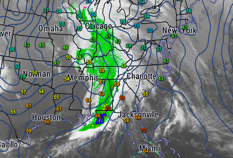
Current satellite/radar with isobars and temperatures.
Tomorrow will be a pretty nice day: partially sunny with mild temperatures in the middle 70s and a balmy southerly wind. The day should be dry.
An areas of showers and storms will overspread the state after midnight Friday night, affecting much of the area Saturday morning. Severe weather is a threat with this system, especially with a strengthening low level jet and strong winds aloft. The threat should be south of I-20, and more significant the further south that you go.
There could be additional development during the afternoon on Saturday, which could also be severe, but this is a little more doubtful because of the morning convection. But the environment will be set for severe storms through the later afternoon and into the overnight as we find ourselves in the warm sector of a developing low that will track near Memphis.
The storms will continue into Sunday morning. More storms may develop ahead of the eventual cold front on Sunday afternoon, with some threat for additional severe weather.
All modes of severe weather will be possible with this slow moving system. Please pay close attention to the latest updates and forecasts throughout the weekend, starting tomorrow.
Category: Alabama's Weather
About the Author (Author Profile)
Bill Murray is the President of The Weather Factory. He is the site's official weather historian and a weekend forecaster. He also anchors the site's severe weather coverage. Bill Murray is the proud holder of National Weather Association Digital Seal #0001 @wxhistorianSubscribe
If you enjoyed this article, subscribe to receive more just like it.


