

Heads Up Lowndes & Dallas Counties
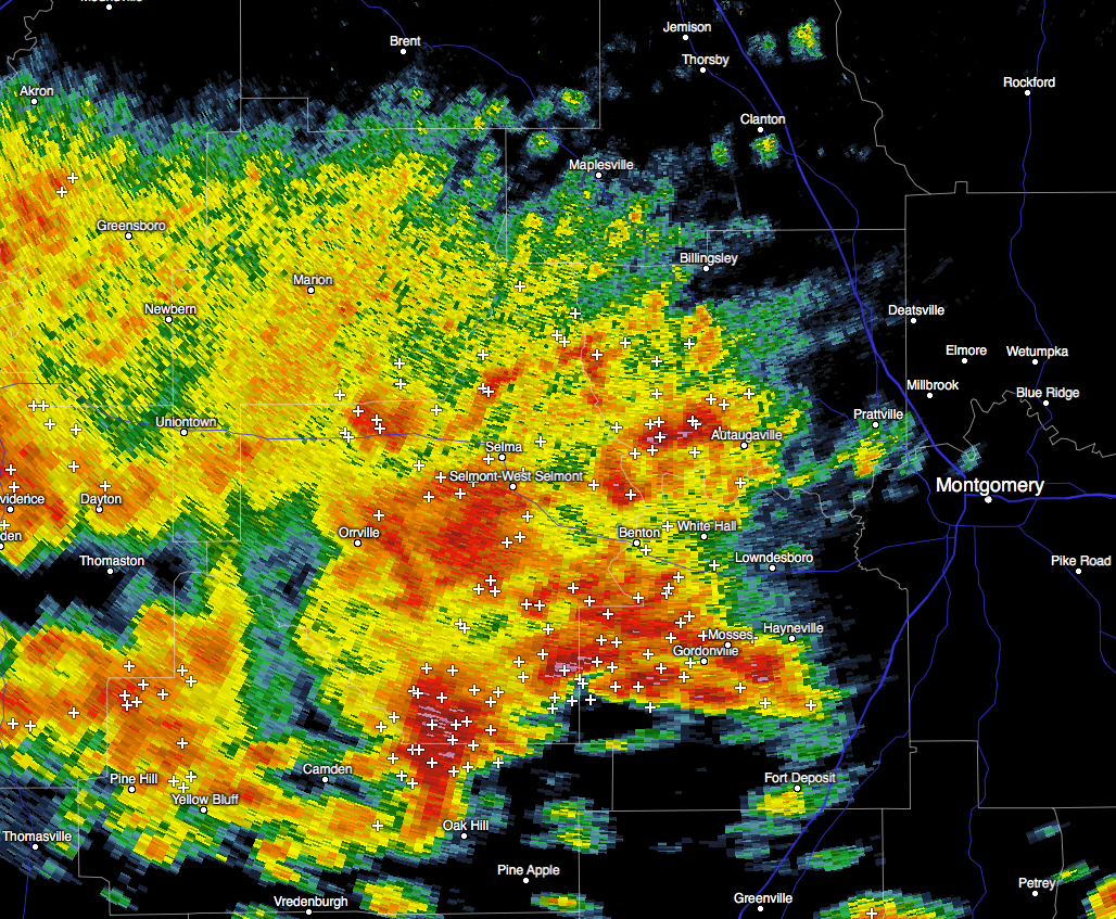 A significant Weather Advisory has been issued until 4:30 AM CST for Lowndes and Dallas counties.
At 352 AM CST, Doppler radar was tracking a strong thunderstorm near Belknap, or 16 miles west of Mosses, moving northeast at 30 mph. Nickel size hail and winds in excess of 40 mph will be possible with this storm. Locations impacted include…
Selma, Valley Grande, Mosses, Hayneville, Selmont-West Selmont, White Hall, Gordonville, Orrville, Lowndesboro, Benton, Bogue Chitto, Memorial Stadium, Burnsville, Marion Junction, Paul M Grist State Park, Dallas County Horse Arena, Dallas Lake, Old Cahaba Park, Dannelly Reservoir and Gardner Island.
Torrential rainfall is also occurring with this storm, and may lead to localized flooding. Do not drive your vehicle through flooded roadways. Frequent cloud to ground lightning is occurring with this storm. Lightning can strike 10 miles away from a thunderstorm. Seek a safe shelter inside a building or vehicle.
Category: Alabama's Weather, Current Warnings
About the Author (Author Profile)
Scott Martin is an operational meteorologist, professional graphic artist, musician, husband, and father. Not only is Scott a member of the National Weather Association, but he is also the Central Alabama Chapter of the NWA president. Scott is also the co-founder of Racecast Weather, which provides forecasts for many racing series across the USA. He also supplies forecasts for the BassMaster Elite Series events including the BassMaster Classic.Subscribe
If you enjoyed this article, subscribe to receive more just like it.


