

Severe T-Storm Warning for Central Lowndes County Has Been Cancelled
The storm which prompted the warning has weakened below severe
limits, and has exited the warned area. Therefore, the warning has
been cancelled.
________________________________________________________
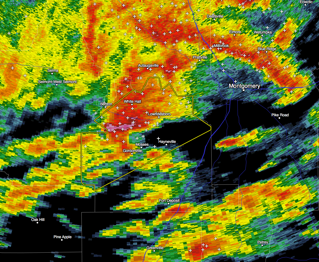
At 435 AM CST, a severe thunderstorm was located near Mosses, moving
northeast at 40 mph.
HAZARD…Golf ball size hail and 60 mph wind gusts.
SOURCE…Radar indicated.
IMPACT…People and animals outdoors will be injured. Expect hail
damage to roofs, siding, windows, and vehicles. Expect wind
damage to roofs, siding, and trees.
Locations impacted include…
Mosses, Hayneville, White Hall, Gordonville, Lowndesboro, Beechwood
and Manack.
PRECAUTIONARY/PREPAREDNESS ACTIONS…
For your protection move to an interior room on the lowest floor of a
building.
________________________________________________________
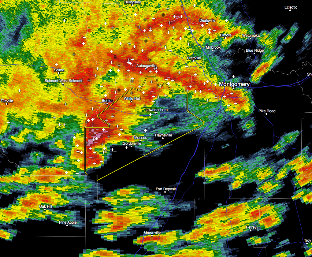
The National Weather Service in Birmingham has issued a
* Severe Thunderstorm Warning for…
Central Lowndes County in south central Alabama…
* Until 515 AM CST
* At 419 AM CST, a severe thunderstorm was located 8 miles west of
Gordonville, or 12 miles west of Mosses, moving northeast at 40
mph.
HAZARD…60 mph wind gusts and quarter size hail.
SOURCE…Radar indicated.
IMPACT…Hail damage to vehicles is expected. Expect wind damage
to roofs, siding, and trees.
* Locations impacted include…
Mosses, Hayneville, White Hall, Gordonville, Lowndesboro,
Beechwood, Manack, Collirene, Fostoria and Farmersville.
PRECAUTIONARY/PREPAREDNESS ACTIONS…
For your protection move to an interior room on the lowest floor of a
building.
Category: Alabama's Weather, Current Warnings, Severe Weather
About the Author (Author Profile)
Scott Martin is an operational meteorologist, professional graphic artist, musician, husband, and father. Not only is Scott a member of the National Weather Association, but he is also the Central Alabama Chapter of the NWA president. Scott is also the co-founder of Racecast Weather, which provides forecasts for many racing series across the USA. He also supplies forecasts for the BassMaster Elite Series events including the BassMaster Classic.Subscribe
If you enjoyed this article, subscribe to receive more just like it.


