

Tornado Warning Has Expired For Parts of Autauga County
Storm has weakened considerably and warning was allowed to expire.
__________________________________________________________________
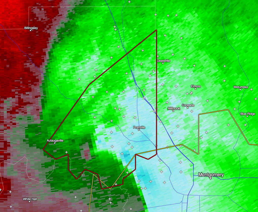
…A TORNADO WARNING REMAINS IN EFFECT UNTIL 745 AM CST FOR
SOUTHEASTERN AUTAUGA COUNTY…
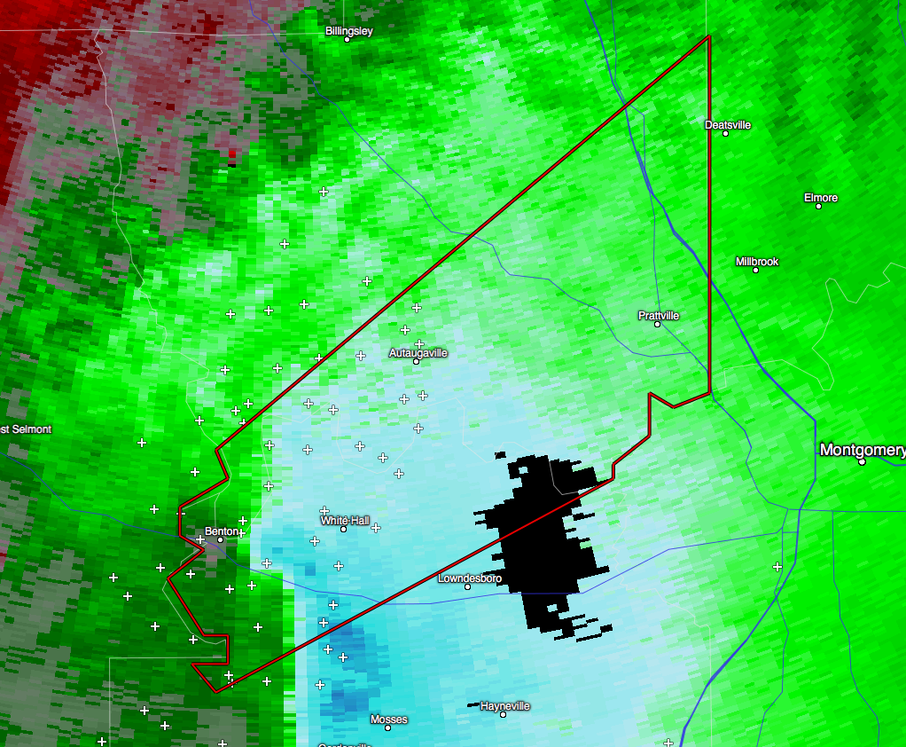
At 726 AM CST, a severe thunderstorm capable of producing a tornado
was located over Autauga County Airport, or near Prattville, moving
northeast at 45 mph.
HAZARD…Tornado.
SOURCE…Radar indicated rotation.
IMPACT…Flying debris will be dangerous to those caught without
shelter. Mobile homes will be damaged or destroyed. Damage
to roofs, windows, and vehicles will occur. Tree damage is
likely.
Locations impacted include…
Prattville, Millbrook, Deatsville, Autaugaville, Booth and Autauga
County Airport.
…THE TORNADO WARNING FOR NORTH CENTRAL LOWNDES COUNTY IS
CANCELLED…
The tornadic thunderstorm which prompted the warning has moved out
of the warned area. Therefore, the warning has been cancelled.
A tornado watch remains in effect until 1100 AM CST for south
central, east central Alabama.
__________________________________________________________________
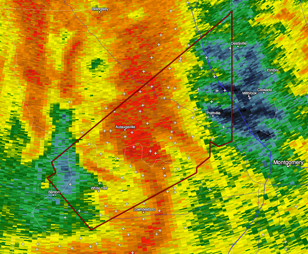
…A TORNADO WARNING REMAINS IN EFFECT UNTIL 745 AM CST FOR NORTH
CENTRAL LOWNDES AND SOUTHEASTERN AUTAUGA COUNTIES…
At 717 AM CST, a severe thunderstorm capable of producing a tornado
was located near Autaugaville, or 10 miles southwest of Prattville,
moving northeast at 60 mph.
HAZARD…Tornado.
SOURCE…Radar indicated rotation.
IMPACT…Flying debris will be dangerous to those caught without
shelter. Mobile homes will be damaged or destroyed. Damage
to roofs, windows, and vehicles will occur. Tree damage is
likely.
Locations impacted include…
Prattville, Millbrook, Deatsville, Autaugaville, Booth and Autauga
County Airport.
__________________________________________________________________
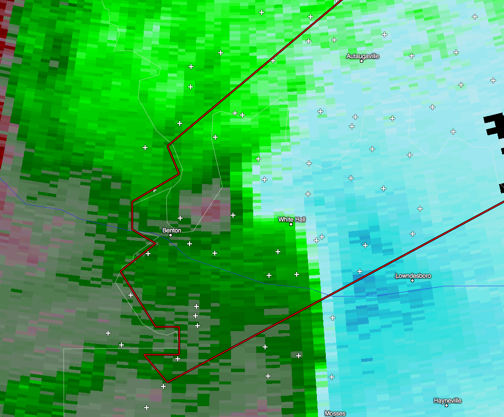
…A TORNADO WARNING REMAINS IN EFFECT UNTIL 745 AM CST FOR
NORTHWESTERN LOWNDES AND SOUTHEASTERN AUTAUGA COUNTIES…
At 710 AM CST, a severe thunderstorm capable of producing a tornado
was located over White Hall, or 11 miles north of Mosses, moving
northeast at 50 mph.
HAZARD…Tornado.
SOURCE…Radar indicated rotation.
IMPACT…Flying debris will be dangerous to those caught without
shelter. Mobile homes will be damaged or destroyed. Damage
to roofs, windows, and vehicles will occur. Tree damage is
likely.
Locations impacted include…
Prattville, Millbrook, Deatsville, Autaugaville, White Hall, Autauga
County Airport, Booth and Robert F. Henry Lock And Dam.
__________________________________________________________________
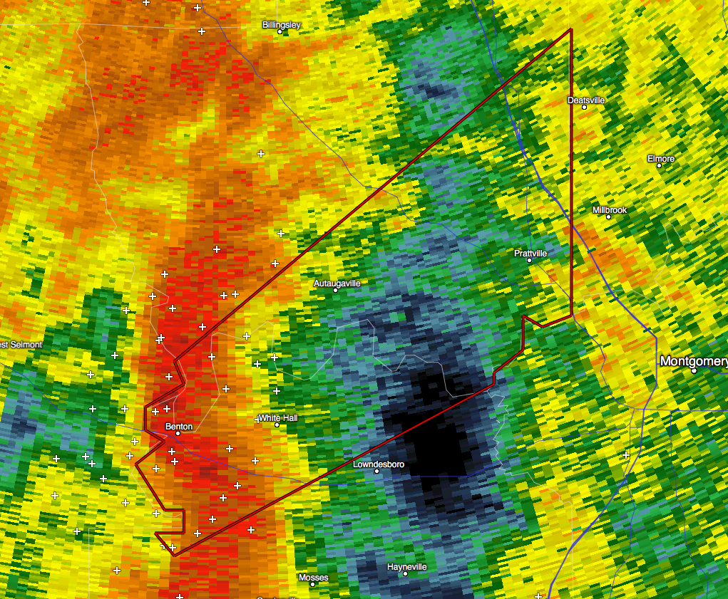
The National Weather Service in Birmingham has issued a
* Tornado Warning for…
Northwestern Lowndes County in south central Alabama…
Southeastern Autauga County in Alabama…
* Until 745 AM CST
* At 701 AM CST, a severe thunderstorm capable of producing a tornado
was located over Benton, or 11 miles northwest of Mosses, moving
northeast at 60 mph.
HAZARD…Tornado.
SOURCE…Radar indicated rotation.
IMPACT…Flying debris will be dangerous to those caught without
shelter. Mobile homes will be damaged or destroyed.
Damage to roofs, windows, and vehicles will occur. Tree
damage is likely.
* Locations impacted include…
Prattville, Millbrook, Deatsville, Autaugaville, White Hall,
Benton, Autauga County Airport, Booth and Robert F. Henry Lock And
Dam.
Category: Alabama's Weather, Current Warnings, Severe Weather
About the Author (Author Profile)
Scott Martin is an operational meteorologist, professional graphic artist, musician, husband, and father. Not only is Scott a member of the National Weather Association, but he is also the Central Alabama Chapter of the NWA president. Scott is also the co-founder of Racecast Weather, which provides forecasts for many racing series across the USA. He also supplies forecasts for the BassMaster Elite Series events including the BassMaster Classic.Subscribe
If you enjoyed this article, subscribe to receive more just like it.


