

Severe Thunderstorm Warning Continues for Parts of Montgomery County Until 8:15 AM CST
…A SEVERE THUNDERSTORM WARNING REMAINS IN EFFECT UNTIL 815 AM CST
FOR MONTGOMERY COUNTY…
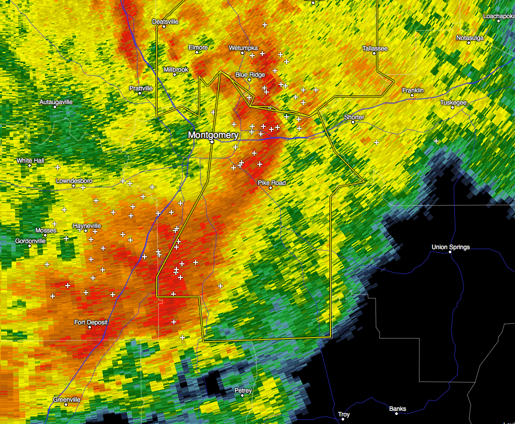
At 746 AM CST, severe thunderstorms were located along a line
extending from near Blue Ridge to Montgomery to near Naftel, moving
east at 55 mph.
HAZARD…60 mph wind gusts.
SOURCE…Radar indicated.
IMPACT…Expect damage to roofs, siding, and trees.
Locations impacted include…
Montgomery, Meadville, Pike Road, Mount Meigs, Auburn University In
Montgomery, Waugh, Gunter Air Force Base, Ramer, Snowdoun, Lagoon
Park, Davenport, Eastdale Mall, Dublin, Sellers, Grady, Pinedale,
Naftel, Strata, Sprague and Pine Level.
…THE SEVERE THUNDERSTORM WARNING FOR SOUTHEASTERN LOWNDES COUNTY IS
CANCELLED…
The storms which prompted the warning have moved out of the warned
area. Therefore, the warning has been cancelled.
_____________________________________________________________________________
…A SEVERE THUNDERSTORM WARNING REMAINS IN EFFECT UNTIL 815 AM CST
FOR SOUTHEASTERN LOWNDES AND MONTGOMERY COUNTIES…
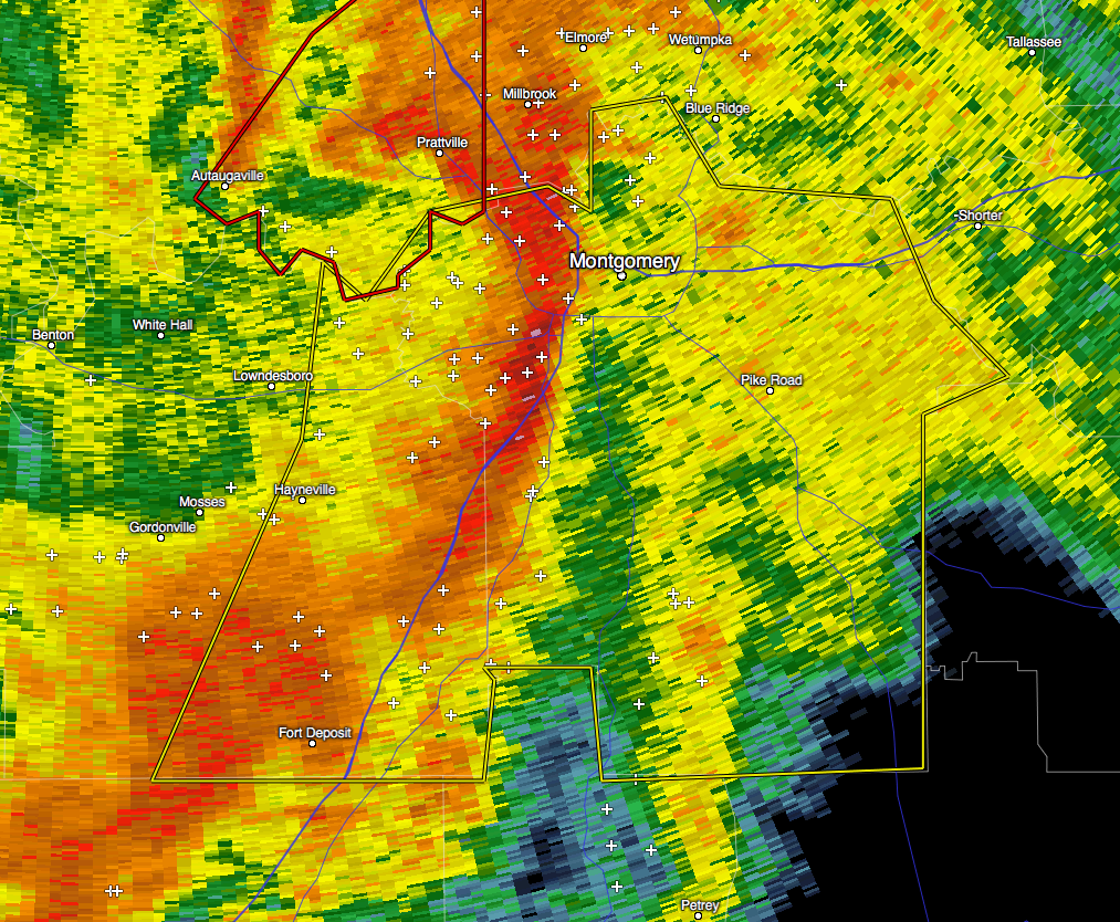
At 733 AM CST, severe thunderstorms were located along a line
extending from Hunter to Hope Hull to near Lowndes County Airport,
moving east at 55 mph.
HAZARD…60 mph wind gusts.
SOURCE…Radar indicated.
IMPACT…Expect damage to roofs, siding, and trees.
Locations impacted include…
Montgomery, Fort Deposit, Meadville, Pike Road, Coosada, Mount Meigs,
Dannelly Field, Auburn University In Montgomery, Logan, Boylston,
Waugh, Alabama State University, Woodcrest, Bob Woodruff Lake, Gunter
Air Force Base, Ramer, Snowdoun, Pintlala, Lagoon Park and Lowndes
County Airport.
_____________________________________________________________________________
The National Weather Service in Birmingham has issued a
* Severe Thunderstorm Warning for…
Eastern Lowndes County in south central Alabama…
Montgomery County in south central Alabama…
* Until 815 AM CST
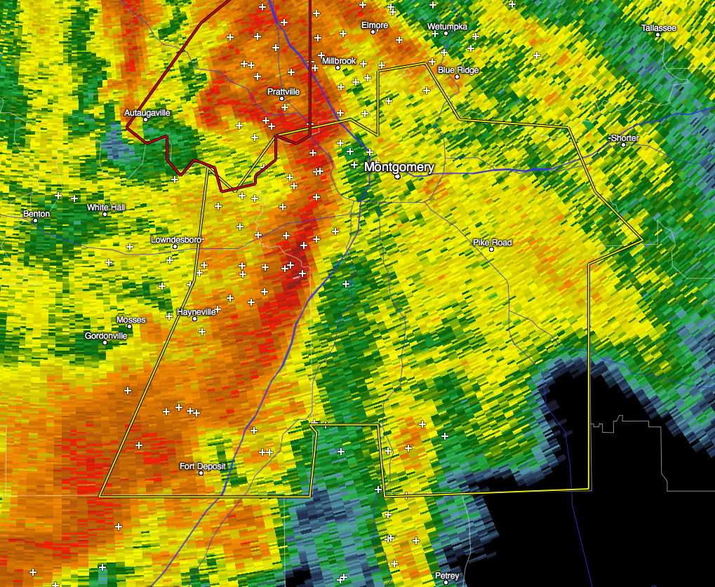
* At 724 AM CST, severe thunderstorms were located along a line
extending from near Cantelous to 6 miles northeast of Hayneville to
near Lowndes County Airport, moving east at 55 mph.
HAZARD…60 mph wind gusts.
SOURCE…Radar indicated.
IMPACT…Expect damage to roofs, siding, and trees.
* Locations impacted include…
Montgomery, Fort Deposit, Hayneville, Meadville, Pike Road,
Coosada, Boylston, Waugh, Alabama State University, Woodcrest,
Ramer, Snowdoun, Lagoon Park, Lowndes County Airport, Dublin,
Sellers, Montgomery Riverwalk Stadium, Grady, Montgomery Zoo and
Strata.
Category: Alabama's Weather, Current Warnings, Severe Weather
About the Author (Author Profile)
Scott Martin is an operational meteorologist, professional graphic artist, musician, husband, and father. Not only is Scott a member of the National Weather Association, but he is also the Central Alabama Chapter of the NWA president. Scott is also the co-founder of Racecast Weather, which provides forecasts for many racing series across the USA. He also supplies forecasts for the BassMaster Elite Series events including the BassMaster Classic.Subscribe
If you enjoyed this article, subscribe to receive more just like it.


