

Significant Severe Weather Threat Possible for Portions of Alabama Tonight
Later tonight, we are going to see another strong upper-level jet streak round the base of the trough, and this will cause a shortwave to eject out of the upper-level low over the Southern Plains. This is going to allow numerous storms to develop to our west and move towards Alabama late tonight. We should see two areas of convection develop, the first being the activity to the west, while another round of storms develops along the Gulf Coast, much like we saw earlier this morning. All modes of severe weather are going to be possible and that includes large hail, damaging winds, and tornadoes, some of which could be large, violent tornadoes.
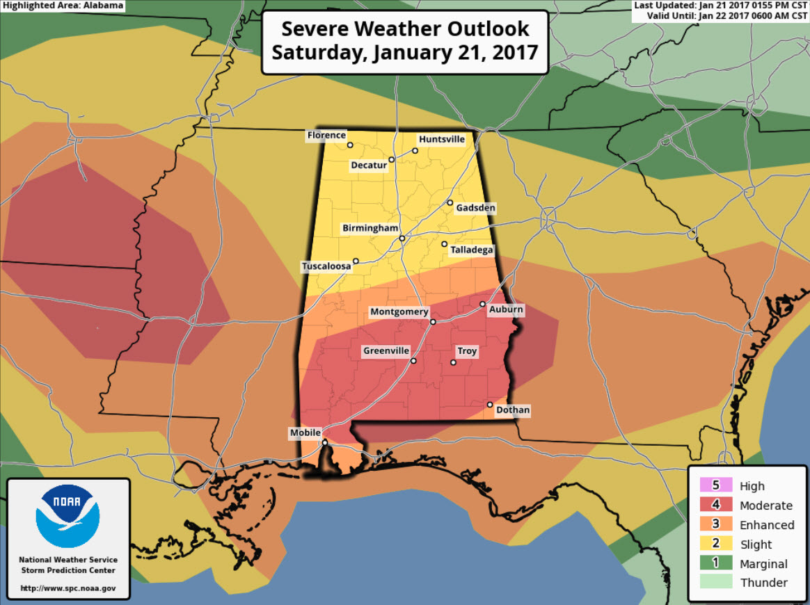
PLACEMENT: In the latest day one outlook, the SPC has upgraded to a “moderate risk” (level 4 out of 5) across much of South Alabama, roughly along and south of the U.S. Highway 80 and Interstate 85 corridors. Cities included are Montgomery, Auburn, Troy, Selma, Greenville, Monroeville, Evergreen, Opp, and all locations in between. An “enhanced risk” covers the rest of the southern half of Alabama, while the northern half of Alabama is in the standard “slight risk”.
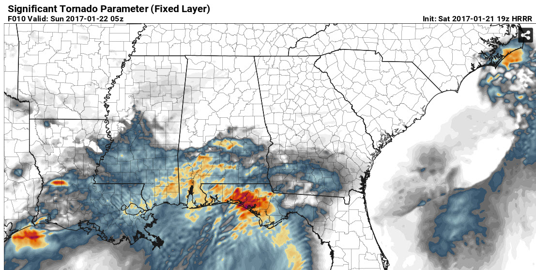
Overnight, strong low-level shear will promote rotation, and there is a threat for tornadoes across the entire state, however, the highest tornado threat seems to be over the southern half of the state within the “moderate risk” area. STP (Significant Tornado Parameter) values are highest there, and is where we are going to see the best combination of instability and shear. Below is the projected STP values for 11PM tonight.
The main window for strong to severe storms will come from roughly 8PM tonight through 6AM tomorrow morning. This system has the POTENTIAL to be a high impact event for the state. We have already seen significant damage from the first round of storms this morning across South Alabama and South Mississippi. Please remain weather aware as we head into the overnight hours.
Along with threat of storms, we have to mention the threat for some flooding issues across the state as an additional 1-3 inches rain is possible.
Make sure you have multiple reliable sources to receive severe weather notifications in the event a warning is issued for your location. With some of the severe weather occurring during the overnight hours, it extremely important that you are able to receive the alerts. Continue to check the blog frequently for severe weather updates.
Category: Alabama's Weather, Severe Weather
About the Author (Author Profile)
Macon, Georgia Television Chief Meteorologist, Birmingham native, and long time Contributor on AlabamaWX. Stormchaser. I did not choose Weather, it chose Me. College Football Fanatic. @Ryan_StinnetSubscribe
If you enjoyed this article, subscribe to receive more just like it.


