

New Tornado Watch for Much of Mississippi; A Few Thoughts on Rounds 3 and 4
A new tornado watch has been issued that will cover much of their forecast area, which covers most of northern Mississippi.
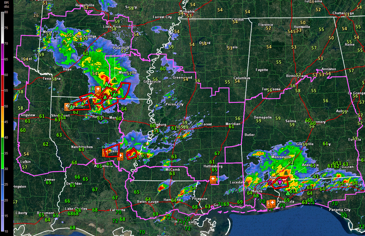
The temperatures shown are dewpoint temperatures.
Storms are firing now in Central Louisiana that will enter Mississippi near Vicksburg in the next couple of hours. Additionally, storms over northern Louisiana and southern Arkansas will move into the Mississippi River Delta of West Central Mississippi in three hours or so as well.
All of this activity will affect Central Alabama later tonight.
We are now about to enter Round Two of this severe weather event. It will last through 3-4 a.m. tomorrow morning when most of the second round of activity will be out of Alabama.
The third round of weather will come into West Central and Southwest Alabama by 9-10 a.m. and will quickly overspread the area from the southwest through early afternoon. Heavy rain, gusty winds and lightning will be the main threats. The best threat of severe weather in round three
Then, as the upper low rotates into Alabama late tomorrow night, additional showers and storms will form under the cold air aloft. Hail will be a threat.
The activity should be gone by Monday. Expect colder air for the end of the week into the weekend.
Category: Alabama's Weather
About the Author (Author Profile)
Bill Murray is the President of The Weather Factory. He is the site's official weather historian and a weekend forecaster. He also anchors the site's severe weather coverage. Bill Murray is the proud holder of National Weather Association Digital Seal #0001 @wxhistorianSubscribe
If you enjoyed this article, subscribe to receive more just like it.


