

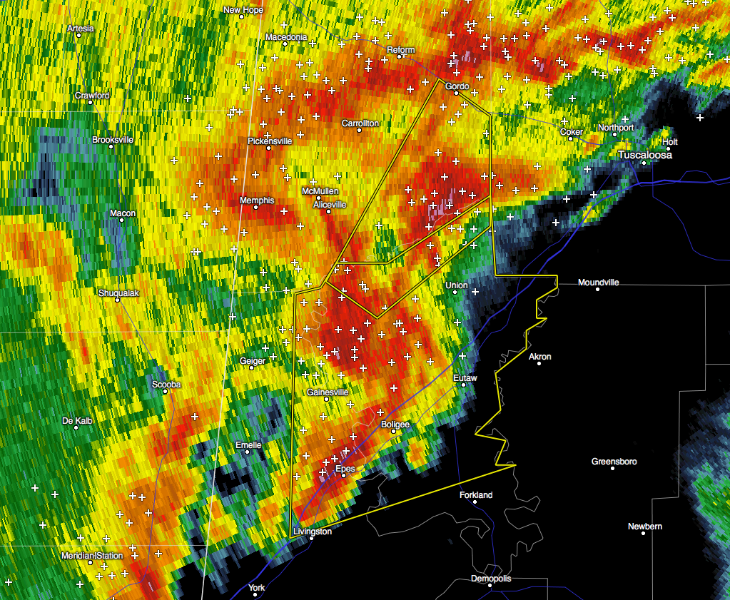
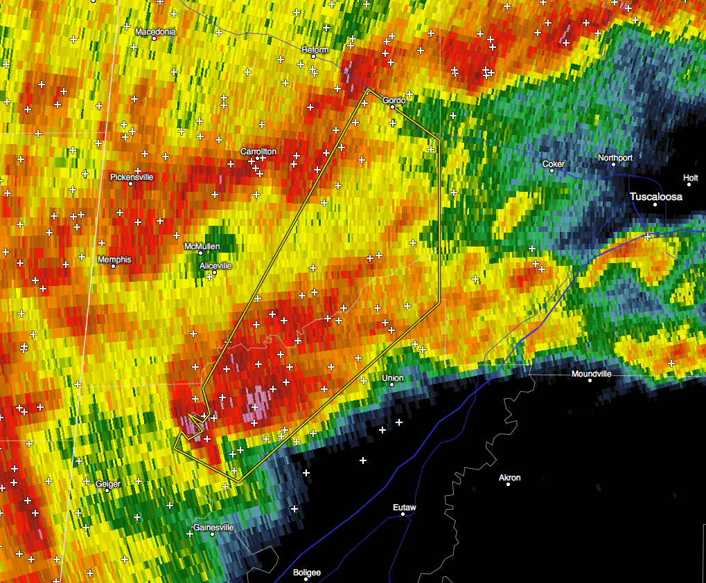
Severe Thunderstorm Warning Continues for Parts of Pickens & Greene Counties Until 11:45 PM
At 1132 PM CST, a severe thunderstorm was located over Benevola, or
12 miles east of Aliceville, moving northeast at 40 mph.
HAZARD…60 mph wind gusts and quarter size hail.
SOURCE…Radar indicated.
IMPACT…Hail damage to vehicles is expected. Expect wind damage to
roofs, siding, and trees.
Locations impacted include…
Gordo, Mantua, Jena, Johnston Lake, Benevola, Pioneer and Kirk.
_________________________________________________________________
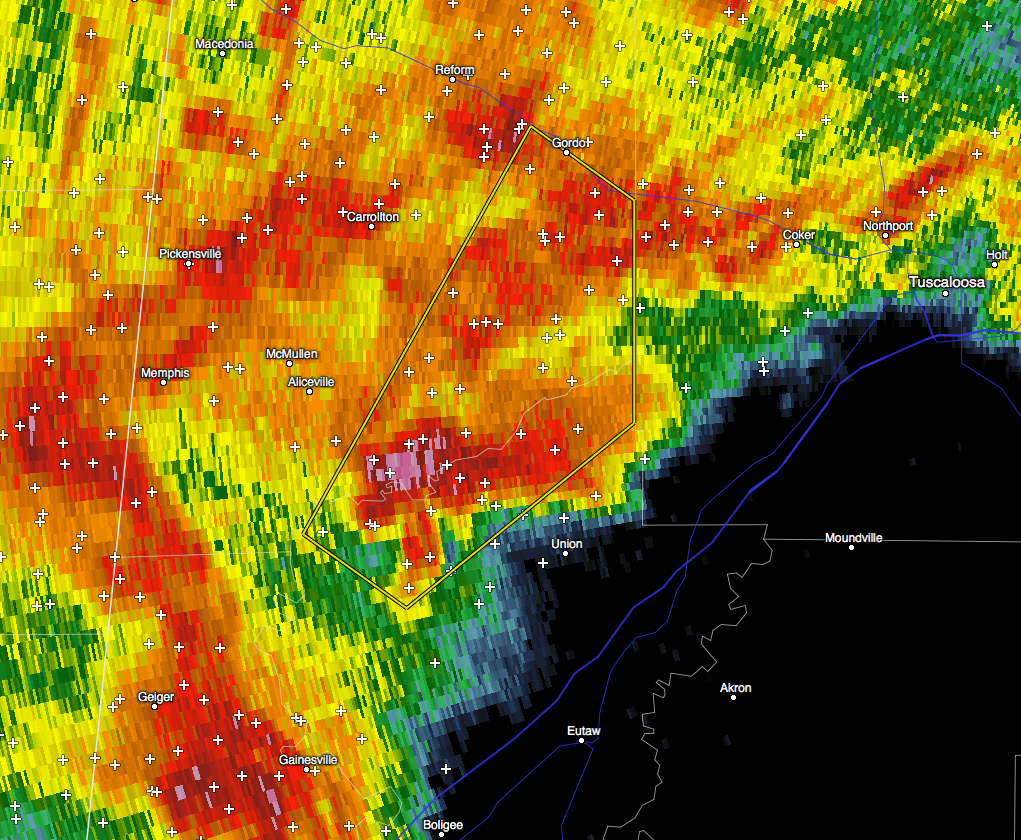
…A SEVERE THUNDERSTORM WARNING REMAINS IN EFFECT UNTIL 1145 PM CST
FOR SOUTHEASTERN PICKENS AND NORTHWESTERN GREENE COUNTIES…
At 1116 PM CST, a severe thunderstorm was located near West Greene,
or 8 miles southeast of Aliceville, moving northeast at 35 mph.
HAZARD…60 mph wind gusts and quarter size hail.
SOURCE…Radar indicated.
IMPACT…Hail damage to vehicles is expected. Expect wind damage to
roofs, siding, and trees.
Locations impacted include…
Gordo, Mantua, Jena, Johnston Lake, Benevola, Lewiston, Pleasant
Ridge, Pioneer and Kirk.
_________________________________________________________________
The National Weather Service in Birmingham has issued a
* Severe Thunderstorm Warning for…
Southeastern Pickens County in west central Alabama…
Northwestern Greene County in west central Alabama…
* Until 1145 PM CST
* At 1105 PM CST, a severe thunderstorm was located over New West
Greene, or 12 miles south of Aliceville, moving northeast at 35
mph.
HAZARD…60 mph wind gusts and quarter size hail.
SOURCE…Radar indicated.
IMPACT…Hail damage to vehicles is expected. Expect wind damage
to roofs, siding, and trees.
* Locations impacted include…
Gordo, New West Greene, Mantua, Jena, Johnston Lake, West Greene,
Benevola, Lewiston, Pleasant Ridge, Pioneer and Kirk.
Category: Alabama's Weather, Current Warnings, Severe Weather
About the Author (Author Profile)
Scott Martin is an operational meteorologist, professional graphic artist, musician, husband, and father. Not only is Scott a member of the National Weather Association, but he is also the Central Alabama Chapter of the NWA president. Scott is also the co-founder of Racecast Weather, which provides forecasts for many racing series across the USA. He also supplies forecasts for the BassMaster Elite Series events including the BassMaster Classic.Subscribe
If you enjoyed this article, subscribe to receive more just like it.


