

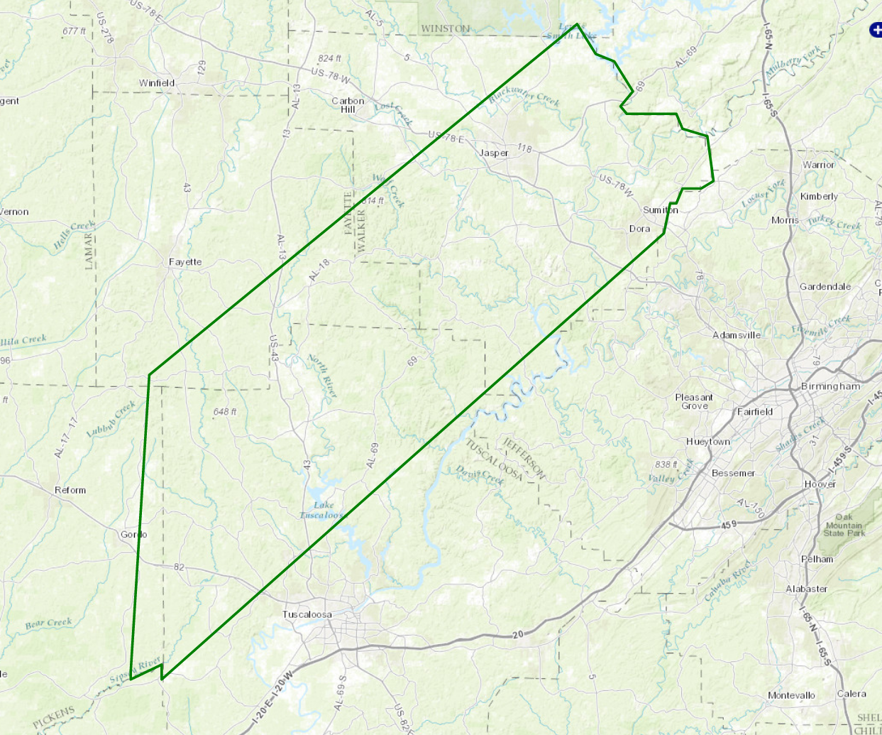
New Areal Flood Advisory for Parts of Pickens, Fayette, Tuscaloosa, & Walker Counties Until 3:45 AM
The National Weather Service in Birmingham has issued a
* Urban and Small Stream Flood Advisory for…
Northeastern Pickens County in west central Alabama…
Southeastern Fayette County in west central Alabama…
Northwestern Tuscaloosa County in west central Alabama…
Walker County in Alabama…
* Until 345 AM CST
* At 1240 AM CST, Doppler radar indicated heavy rain due to
thunderstorms. This will cause urban and small stream flooding in
the advisory area. Up to two inches of rain have already fallen.
* Some locations that will experience flooding include…
Jasper, Sumiton, Cordova, Dora, Berry, Parrish, Coker, Oakman,
Sipsey, Gorgas, Boley Springs, Curry, Binion Creek Landing, Rocky
Hollow, Burnwell, Lake Lurleen State Park, Samantha, Gorgas Steam
Plant, Smith Dam and Beloit.
Category: Alabama's Weather, Current Warnings, Severe Weather
About the Author (Author Profile)
Scott Martin is an operational meteorologist, professional graphic artist, musician, husband, and father. Not only is Scott a member of the National Weather Association, but he is also the Central Alabama Chapter of the NWA president. Scott is also the co-founder of Racecast Weather, which provides forecasts for many racing series across the USA. He also supplies forecasts for the BassMaster Elite Series events including the BassMaster Classic.Subscribe
If you enjoyed this article, subscribe to receive more just like it.


