

An Update To The Central Alabama Weather Situation At 2:55 AM
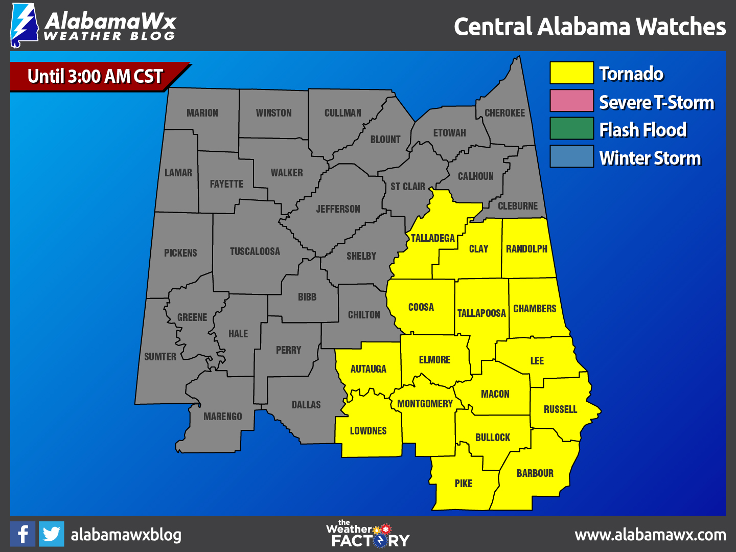
For most of Central Alabama, the threat for severe weather has diminished at this point. As a matter of fact, Chilton and Shelby counties have been removed from the Tornado Watch. The counties remaining in the watch until 3:00 AM are Talladega, Clay, Randolph, Coosa, Tallapoosa, Chambers, Autauga, Elmore, Lee, Lowndes, Montgomery, Macon, Russell, Bullock, Pike, and Barbour.
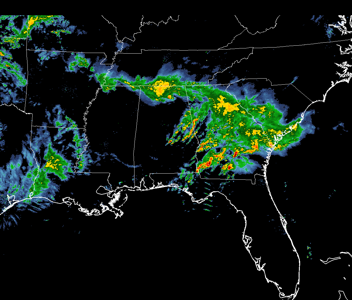
Most of the thunderstorm activity has pushed off out of the area, with only the extreme eastern and southeastern parts of the area still dealing with storms. Fortunately, these are just good rain producers with some thunder. No severe warnings are in effect for anyone in Central Alabama at this moment.
Now we do have a few damage reports coming in from the severe thunderstorms that pushed through Jefferson and Blount counties earlier…
••• Trees and power lines are down in the Pleasant Grove area on 8th Place.
••• Trees are down in the Birmingport area on Buddy Vines Camp Road.
••• Power lines are down in the Midfield area at 67th Street and Pineview Road.
••• Trees are down in the Tarrant area near McDonald Street.
••• Trees are down in Vestavia Hills near Rocky Ridge, and at US-31 and Kentucky Avenue.
••• Trees are down in Homewood near Vulcan Park.
••• Tree down on a home in Locust Fork, in Susan Moore, and on 3rd Street in Hayden.
••• Trees are down on I-65 at mile marker 289.
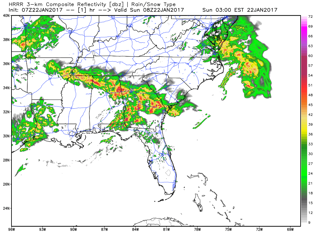
The next round of storms should arrive in the area around 9-10 AM later this morning. For locations north of a line from Tuscaloosa to Alabaster to Talladega, it will probably be just a good shot of rain and thunderstorms with the possibility of a few strong storms.
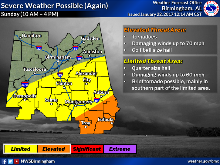
The main threat areas will be south of that line, and highest for those south and east of Auburn and Montgomery. In those areas, damaging winds, along with hail and a few tornadoes are possible. The severe threat should be over by 5PM today.
If anything changes between now and 9AM, we’ll have updates for you.
Category: Alabama's Weather, Current Warnings, Severe Weather
About the Author (Author Profile)
Scott Martin is an operational meteorologist, professional graphic artist, musician, husband, and father. Not only is Scott a member of the National Weather Association, but he is also the Central Alabama Chapter of the NWA president. Scott is also the co-founder of Racecast Weather, which provides forecasts for many racing series across the USA. He also supplies forecasts for the BassMaster Elite Series events including the BassMaster Classic.Subscribe
If you enjoyed this article, subscribe to receive more just like it.


