

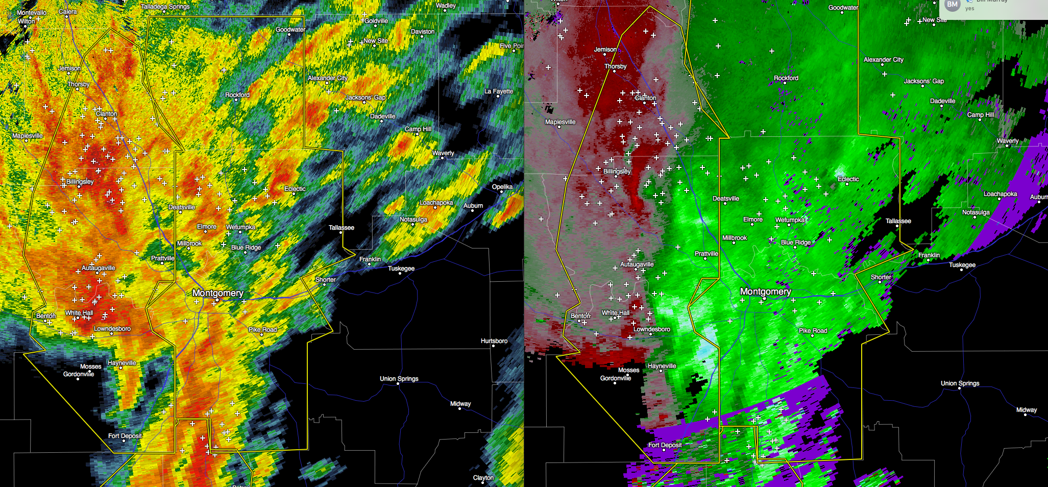
Severe Thunderstorm Warning Issued For Parts Of Coosa, Elmore, And Montgomery Counties

Please seek shelter if you are in the path of this storm. Wind gusts up to 60 MPH, along with quater size hail and dangerous lightning can be expected with this severe storm.
The National Weather Service in Birmingham has issued a
* Severe Thunderstorm Warning for…
Elmore County in east central Alabama…
Montgomery County in south central Alabama…
Coosa County in east central Alabama…
* Until 130 PM CST
* At 1231 PM CST, severe thunderstorms were located along a line
extending from near Clanton to 6 miles west of Petrey, moving
northeast at 60 mph.
HAZARD…60 mph wind gusts and quarter size hail.
SOURCE…Radar indicated.
IMPACT…Hail damage to vehicles is expected. Expect wind damage
to roofs, siding, and trees.
* Locations impacted include…
Montgomery, Prattville, Millbrook, Wetumpka, Tallassee, Goodwater,
Rockford, Kellyton, Stewartville, Equality, Meadville, Weogufka,
Pike Road, Elmore, Coosada, Deatsville, Eclectic, Emerald Mountain,
Jordan Lake and Lagoon Park.
Category: Alabama's Weather, Current Warnings, Severe Weather
About the Author (Author Profile)
Subscribe
If you enjoyed this article, subscribe to receive more just like it.


