

Severe Thunderstorm Warning Continues For Parts Of Chambers, Lee, And Randolph Counties Until 245 PM CST
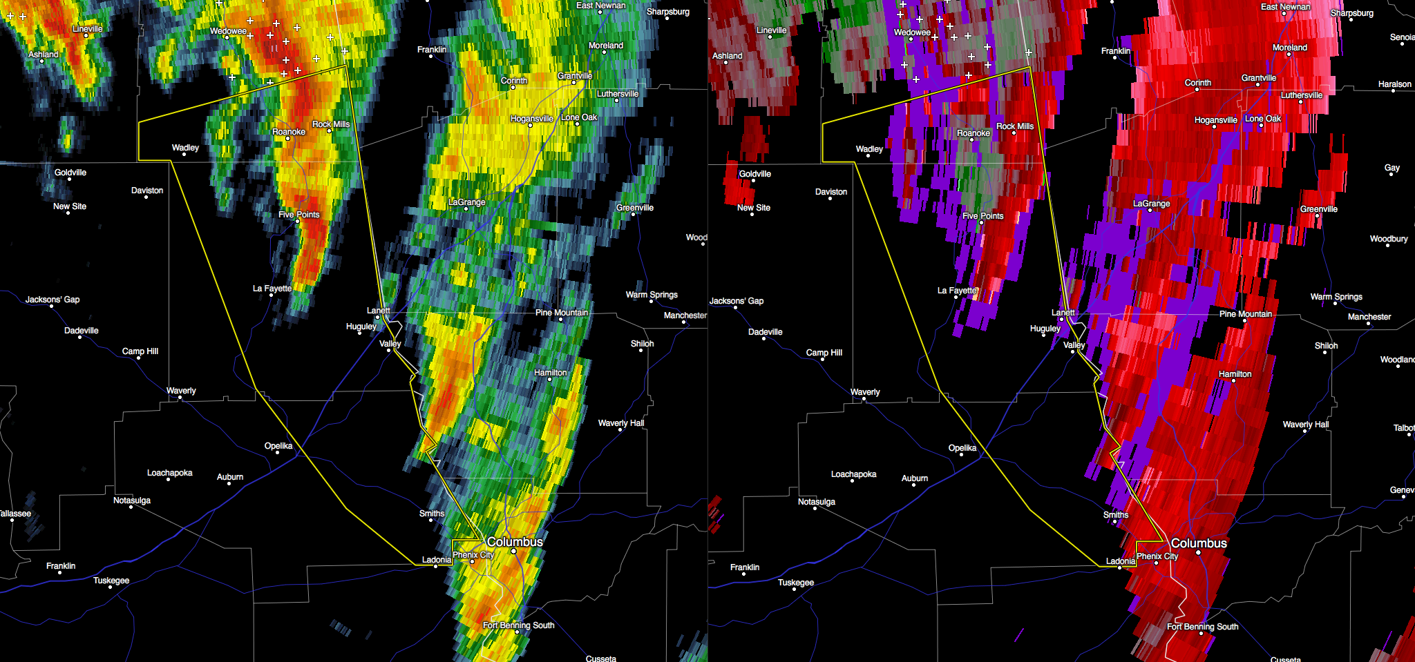

At 228 PM CST, severe thunderstorms were located along a line
extending from 7 miles southwest of Franklin to near Hamilton to near
Upatoi, moving east at 65 mph.
HAZARD…60 mph wind gusts and quarter size hail.
SOURCE…Radar indicated.
IMPACT…Hail damage to vehicles is expected. Expect wind damage to
roofs, siding, and trees.
Locations impacted include…
Opelika, Valley, Lanett, Roanoke, Lafayette, Smiths, Stroud, Smiths
Station, La Fayette, Wadley, Red Level, Lakeview, Cusseta, Beans
Mill, Welch, Crystal Lake, Penton, Huguley, Fairfax and Chambers
County Lake.
Severe Thunderstorm Warning Canceled For Parts Of Tallapoosa County
Jan 22nd @ 1:42 pm
…THE SEVERE THUNDERSTORM WARNING FOR TALLAPOOSA COUNTY IS CANCELLED…
The storms which prompted the warning have moved out of the warned
area. Therefore, the warning has been cancelled. A severe
thunderstorm warning remains in effect for southern portions of
Randolph County and eastern portions of Chamber County.
A tornado watch remains in effect until 700 PM CST for southeastern
and east central Alabama.
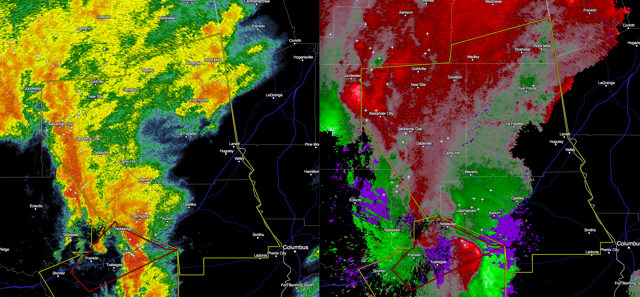
Severe Thunderstorm Warning Issued For Parts Of Chambers, Lee, Randolph, And Tallapoosa Counties
Jan 22nd @ 1:42 pm

Seek shelter if you are in the path of this storm. Damaging wind gusts up to 60 MPH, along with dangerous lightning and quarter size hail can be expected with this severe storm.
The National Weather Service in Birmingham has issued a
* Severe Thunderstorm Warning for…
Southern Randolph County in east central Alabama…
Lee County in east central Alabama…
Chambers County in east central Alabama…
Tallapoosa County in east central Alabama…
* Until 245 PM CST
* At 140 PM CST, severe thunderstorms were located along a line
extending from near Kellyton to near Notasulga to near Tuskegee
National Forest, moving east at 65 mph.
HAZARD…60 mph wind gusts and quarter size hail.
SOURCE…Radar indicated.
IMPACT…Hail damage to vehicles is expected. Expect wind damage
to roofs, siding, and trees.
* Locations impacted include…
Auburn, Opelika, Alexander City, Valley, Lanett, Roanoke,
Dadeville, Camp Hill, Notasulga, Lafayette, Smiths, Stroud, Smiths
Station, La Fayette, Jacksons’ Gap, New Site, Wadley, Red Level,
Waverly and Lakeview.
Category: Alabama's Weather, Current Warnings, Severe Weather
About the Author (Author Profile)
Subscribe
If you enjoyed this article, subscribe to receive more just like it.


