

Tornado Warning Continues For Lee County Until 215 PM CST
…A TORNADO WARNING REMAINS IN EFFECT UNTIL 215 PM CST FOR
NORTHWESTERN LEE COUNTY…
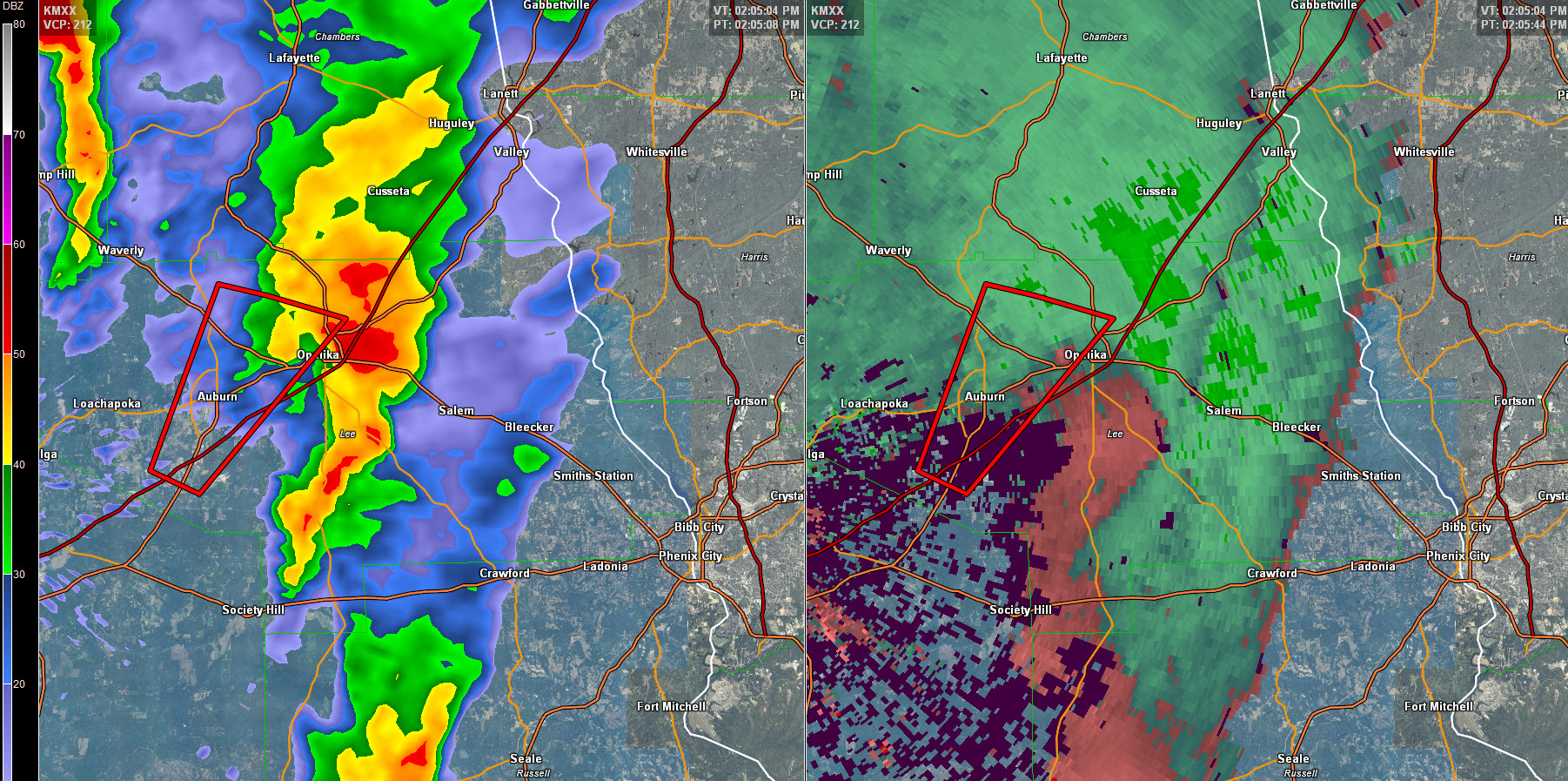
At 154 PM CST, a severe thunderstorm capable of producing a tornado
was located over Auburn, moving northeast at 25 mph.
HAZARD…Tornado.
SOURCE…Radar indicated rotation.
IMPACT…Flying debris will be dangerous to those caught without
shelter. Mobile homes will be damaged or destroyed. Damage
to roofs, windows, and vehicles will occur. Tree damage is
likely.
Locations impacted include…
Auburn, Opelika, Auburn University, Robert G. Pitts Airport and
Chewacla State Park.
This warning includes Auburn and the campus of Auburn University. Take cover now!
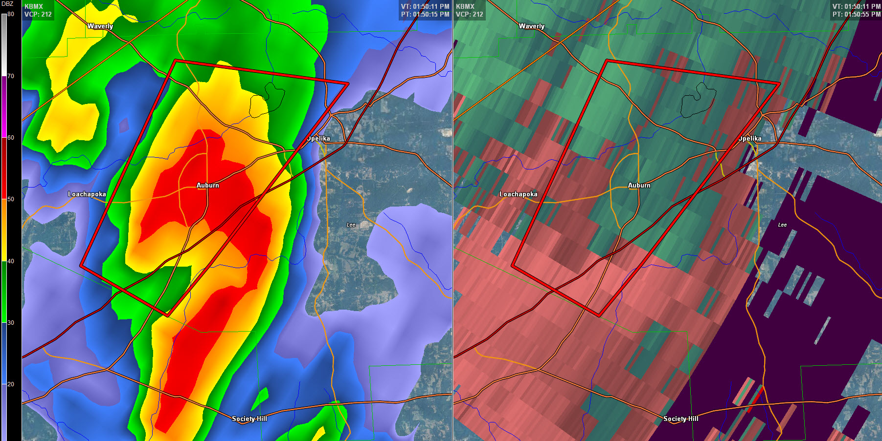
The National Weather Service in Birmingham has issued a
* Tornado Warning for…
Northwestern Lee County in east central Alabama…
* Until 215 PM CST
* At 148 PM CST, a severe thunderstorm capable of producing a tornado
was located near Tuskegee National Forest, or near Auburn, moving
northeast at 30 mph.
HAZARD…Tornado.
SOURCE…Radar indicated rotation.
IMPACT…Flying debris will be dangerous to those caught without
shelter. Mobile homes will be damaged or destroyed.
Damage to roofs, windows, and vehicles will occur. Tree
damage is likely.
* Locations impacted include…
Auburn, Opelika, Auburn University and Robert G. Pitts Airport.
Category: Current Warnings
About the Author (Author Profile)
Bill Murray is the President of The Weather Factory. He is the site's official weather historian and a weekend forecaster. He also anchors the site's severe weather coverage. Bill Murray is the proud holder of National Weather Association Digital Seal #0001 @wxhistorianSubscribe
If you enjoyed this article, subscribe to receive more just like it.


