

Update On Central Alabama’s Weather Situation At 2:20 PM.
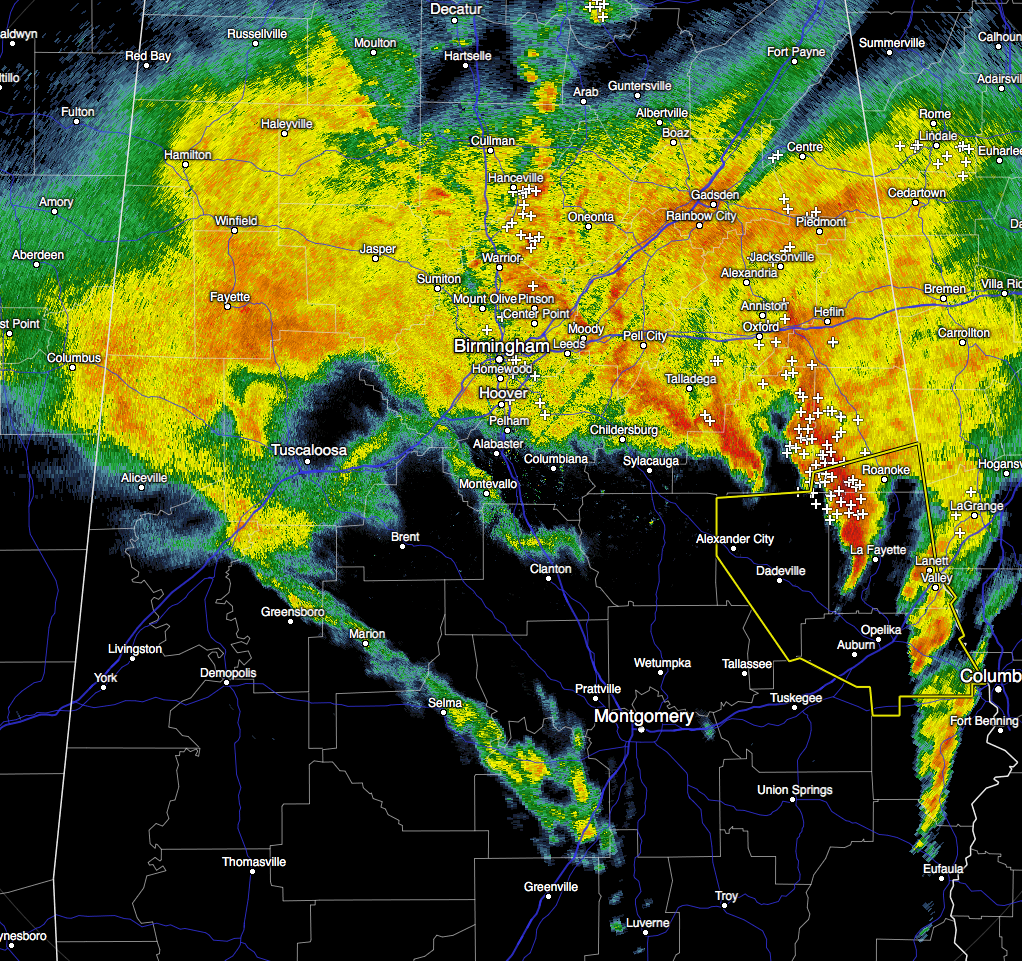
The severe threat is starting to come to an end for most of Central Alabama at this time. The main focus for the next hour will be on the southeastern counties of the area, especially Lee, Tallapoosa, and Chambers counties. A Severe Thunderstorm Warning remains in effect for those counties until 2:45 PM.
Damage reports are coming in from Opelika, with significant damage apparently in Pepperell Village (confirmed by Opelika Police and public safety officials).
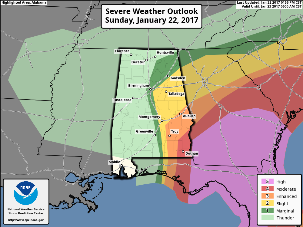
The latest update from the SPC is showing a marginal risk for severe storms for the eastern half of the state, with a slight risk for locations south of a line from roughly Birmingham to Gadsden, and east of the I-65 corridor. The enhanced and moderate risks remain confined to the extreme southeastern corner of the area, but I believe the threat will be coming to an end within an hour or so.
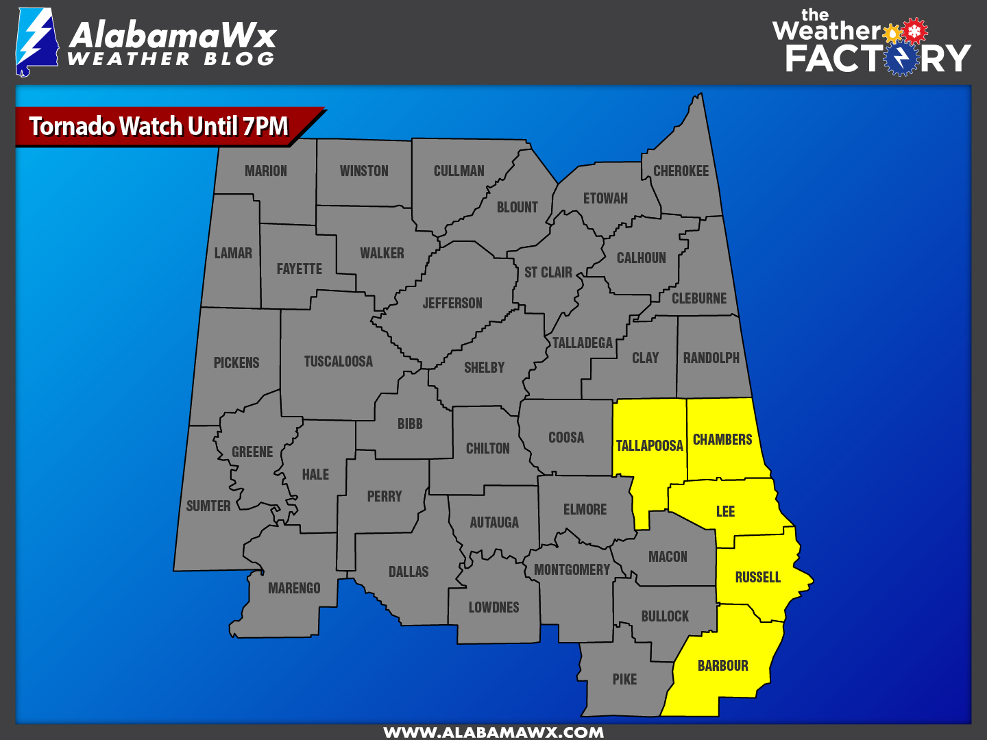
More counties are being removed from the PDS Tornado Watch. Bullock, Coosa, and Macon counties were the recent removees, leaving just Barbour, Chambers, Lee, Russell, and Tallapoosa counties in the watch.
For the locations north of I-20 and I-20/59, the risk for severe storms is rather low, and for locations west of I-65, the threat is over. Just a good steady rain for a few hours more.
Category: Alabama's Weather, Current Warnings, Severe Weather
About the Author (Author Profile)
Scott Martin is an operational meteorologist, professional graphic artist, musician, husband, and father. Not only is Scott a member of the National Weather Association, but he is also the Central Alabama Chapter of the NWA president. Scott is also the co-founder of Racecast Weather, which provides forecasts for many racing series across the USA. He also supplies forecasts for the BassMaster Elite Series events including the BassMaster Classic.Subscribe
If you enjoyed this article, subscribe to receive more just like it.


