

Severe Weather Threat Over For Alabama; Wind and Showers Now the Story
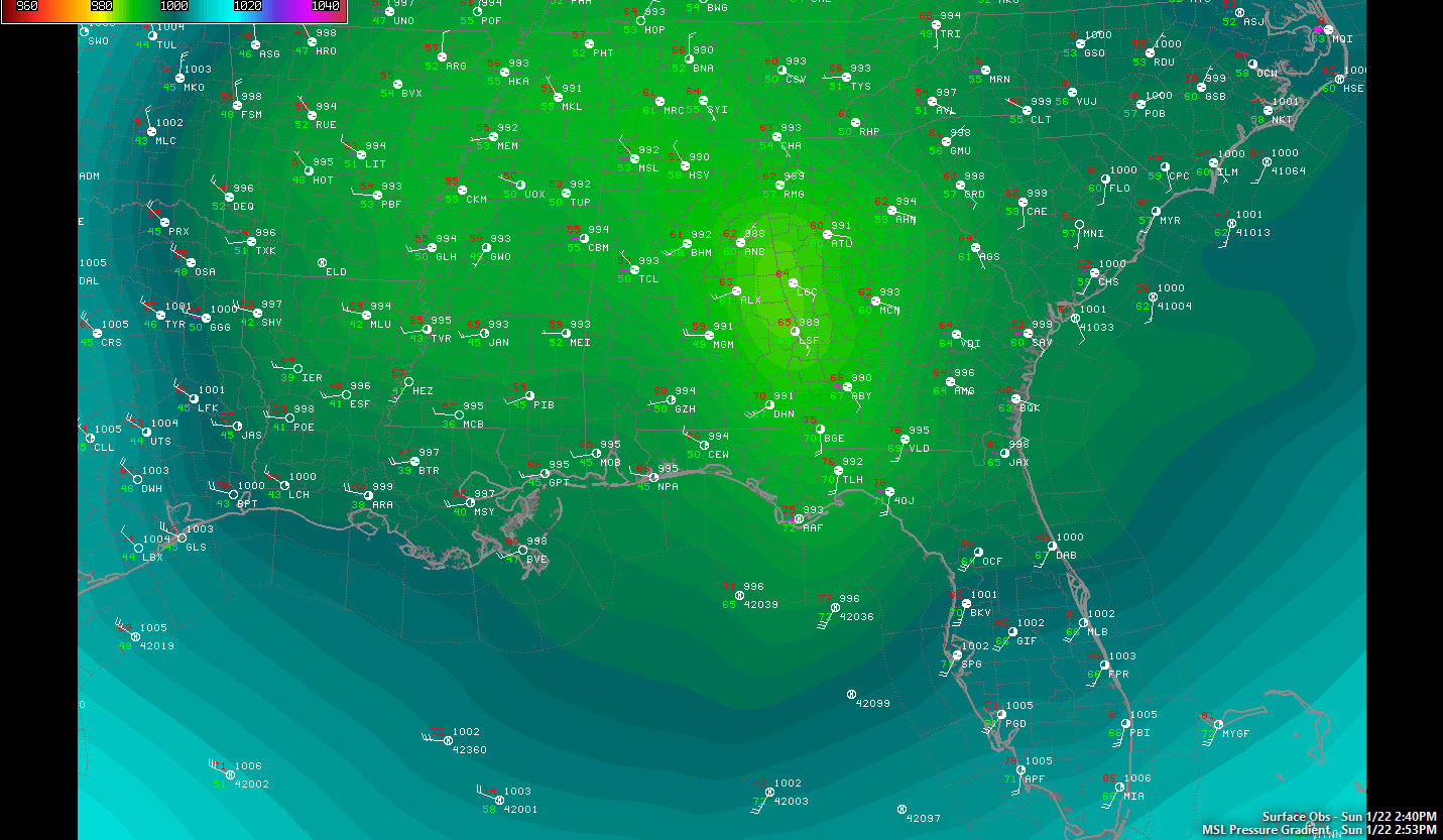
Barometers are on the rise and dewpoints are plummeting across Alabama as a compact and powerful low pressure moves northeast out of East Central Alabama. The barometer at the center of the low is measuring an eye-popping 29.12 inches or so. The barometer at Birmingham dropped to a near record 29.25 inches.
The rain shield has lifted north of I-20 now and rain has ended over the southern half of the Birmingham Metro area. It may build back south a bit over the next few hours as the upper low slides to the southeast.
Winds are still strong over East Alabama, averaging 15-25 mph and gusting to 30-35 mph. They have calmed a bit to the west, but are averaging 10-15 mph out of the west. Winds will remain brisk through Monday as the low lifts out to the northeast. A wind advisory is in effect for all of Central Alabama starting at midnight tonight
Showers will accompany the upper low as it moves across the area tonight as well.
BIG TORNADO IN GEORGIA
A large tornado struck Albany GA this afternoon. There is considerable damage.
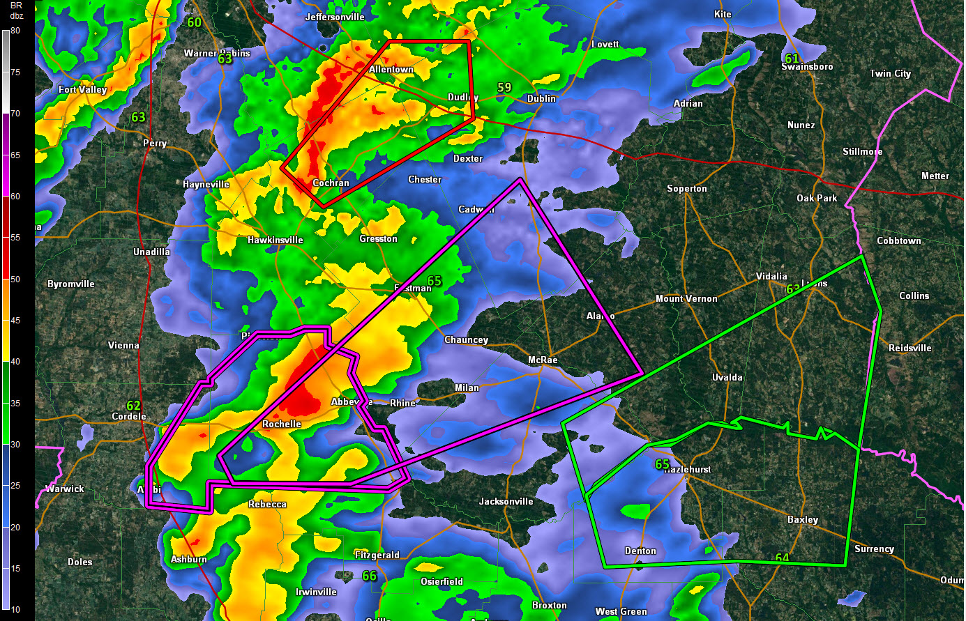
This tornado is now on the ground near Abbeville.
Category: Alabama's Weather, Severe Weather
About the Author (Author Profile)
Bill Murray is the President of The Weather Factory. He is the site's official weather historian and a weekend forecaster. He also anchors the site's severe weather coverage. Bill Murray is the proud holder of National Weather Association Digital Seal #0001 @wxhistorianSubscribe
If you enjoyed this article, subscribe to receive more just like it.


