

Showers Tonight; Colder Tomorrow
RADAR CHECK: On this mild January afternoon we have some light rain falling over Northwest Alabama…
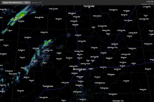
The showers are ahead of a cold front approaching Alabama from the northwest; showers are likely at times through midnight, with the possibility of a little thunder in a few spots. Moisture is limited, so rain amounts should be pretty light, generally under 1/4″ for most communities. The rain will sweep out of the state after midnight.
COLDER DAYS: We project dry, cool weather tomorrow through the weekend. Partly to mostly sunny days, fair nights. Highs in the 49-53 degree range, with lows between 29 and 33. We should drop below freezing early Friday morning for the first time since January 9. These temperatures are at or slightly below average values in Alabama for late January.
NEXT WEEK: Not much change; dry and cool weather continues for the first half of the week with highs in the 50s and lows in the 30s. And, we should mention that we have no sign of any high impact weather event (severe storms, winter mischief, etc) for the next 10 days across Alabama and the Deep South. Quite frankly, we could use a break since this month we have dealt with single digit cold, snow, sleet, freezing rain, severe thunderstorms, flooding, record warmth, and 18 tornadoes in our state. The action has been pretty much non-stop.

DROUGHT UPDATE: The new drought monitor will be released tomorrow, we expect great improvement over North Alabama thanks to the recent rains. Here is an update from the Birmingham Water Works:
“After receiving more than six-inches of rain since January 1, 2017, and three inches of rain in December 2016, the Birmingham Water Works (BWW) is announcing the return to the Stage-2 “Drought Watch Advisory” phase of its Drought Management Plan (DMP). The lack of rain in the state over the last five months of 2016 forced the BWW to move into higher levels of water restrictions for customers in order for the utility to effectively manage their water resources. Stage-3 “Drought Warning” was announced on October 19th, and Stage-4 “Extreme Drought Emergency” was announced on November 4th. These advanced stages typically include surcharges for excessive water use after 30 days of announcement of the appropriate drought stage of the DMP. The current drought was so significant that the BWW had to move to the next higher stage of the DMP before surcharges were enforced from the previous stage. The December rains came at the best possible time and resulted in the BWW not collecting any surcharge fees for excessive water use.”
As always, watch me for the full weather story on ABC 33/40 News this evening at 4, 5, 6, and 10:00!
WEATHER BRAINS: Don’t forget you can listen to our weekly 90 minute netcast anytime on the web, or on iTunes. This is the show all about weather featuring many familiar voices, including our meteorologists here at ABC 33/40.
CONNECT: You can find me on all of the major social networks…
Facebook
Twitter
Google Plus
Instagram
Snapchat: spannwx
I had a great time today visiting with the students at Oscar Adams Elementary in Gadsden… be looking for them on the Pepsi KIDCAM today at 5:00 on ABC 33/40 News! The next Weather Xtreme video will be posted early tomorrow morning by 7:00….
Category: Alabama's Weather
About the Author (Author Profile)
James Spann is one of the most recognized and trusted television meteorologists in the industry. He holds the AMS CCM designation and television seals from the AMS and NWA. He is a past winner of the Broadcast Meteorologist of the Year from both professional organizations.Subscribe
If you enjoyed this article, subscribe to receive more just like it.


