

Sunny but Cool
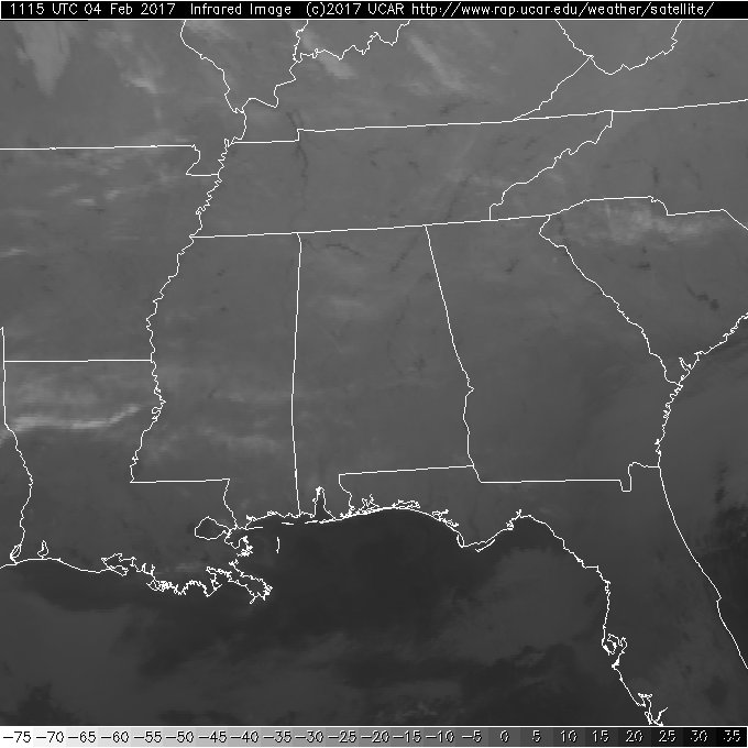
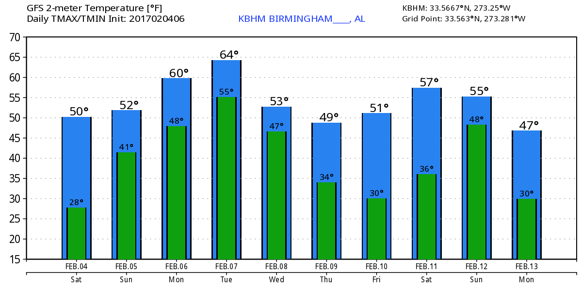
Satellite image this morning showed clear skies with just some streaks of passing cirrus clouds. Temperatures had really dropped off, and the Skywatcher at Black Creek in Etowah County reported a low of 18 degrees. With plenty of sunshine beating down on the landscape, highs should climb well into the lower 50s, just a few degrees below our typical highs for early February.
For those heading to the beach, a mix of sun and clouds can be expected from today through Thursday with chances of rain on Tuesday and Wednesday. Highs will be in the 60s to lower 70s with the exception of Thursday, when highs drop back into the 50s. Click here to see the Beach Forecast Center page.
Unfortunately our surface flow goes around to the south on Sunday as moisture increases. This means clouds will increase with an isolated shower or two possible for Sunday and the 2017 celebration of National Weatherperson’s Day! Temperatures once again stay cool and will be in the lower to middle 50s. Not much changes in the pattern for Monday as we watch the developments well to our northwest over the Northwest US. Continued southerly flow will keep moisture up and also provide some warming so that highs climb into the lower 60s.
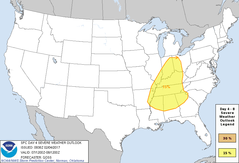
Tuesday and into Wednesday will see the action. The upper trough over the Northwest US shoots out across the northern tier of the US while a surface low moves from near Denver to Chicago on Tuesday. The surface low will drag a cold front across the Lower Mississippi River Valley during the latter half of Tuesday setting the stage for the potential for a round of severe weather. CAPE values are projected into the 1000-1500 g/kg range especially just west of Alabama. Shear values are also fairly good with Energy Helicity Index (EHI) running in the range of 1 to 2. While much of the upper air dynamics are further north, conditions are sufficient for the SPC forecasters to include a 15 percent area on the Day 4 outlook. The GFS and the ECMWF are in pretty good agreement on the surface features, so this system is going to bear continued scrutiny in future model runs.
By Wednesday the front has moved southeastward into North Florida. The surface high to our northwest will bring us back under northerly flow and drop high temperatures back into the 50s. Morning lows will dip back into the 30s once again on Thursday and Friday. The upper air pattern changes very rapidly on Friday and Saturday as an upper ridge builds into the East Coast area. But that feature does not last long as the GFS plunges another deep upper trough into the East Coast. This is verging on voodoo country, but this pattern is definitely cold and will remind us that winter is not over. Right now this pattern develops so rapidly that there is a distinct lack of moisture, so there does not appear to be a threat of wintery precipitation.
Looking out into voodoo country, the GFS is definitely highlighting a cold pattern with a deep trough over the East Coast through Thursday, February 16th. We do warm up a bit as an upper ridge replaces that trough by Saturday the 18th. But our attention will be focused on the very strong closed low and deep trough coming into the Central US by the 19th. Definitely looks like some active weather for us to deal for the middle of February.
I’m going to be heading down to Tuscaloosa this morning to do a presentation on severe weather safety at the Tuscaloosa Home Show being held at the Bryant Conference Center on the campus of UA. If you will attending, be sure to say hello. I expect to have the next Weather Xtreme Video posted here by 7:30 or so on Sunday morning. Enjoy the sunshine today and Godspeed.
-Brian-
Category: Alabama's Weather
About the Author (Author Profile)
Brian Peters is one of the television meteorologists at ABC3340 in Birmingham and a retired NWS Warning Coordination Meteorologist. He handles the weekend Weather Xtreme Videos and forecast discussion and is the Webmaster for the popular WeatherBrains podcast.Subscribe
If you enjoyed this article, subscribe to receive more just like it.


