

Focusing on This Week’s Severe Weather Threat
We continue to monitor the threat of severe weather for Tuesday and Wednesday here in our Alabama.
There are mixed signals about whether this will be a significant event or not.
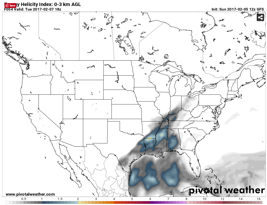
Energy Helicity Index for Noon Tuesday showing areas favorable for supercells and possibly tornadoes if storms are able to break the cap and form. Blue/green to yellow indicates values of 1-2 which is conducive for development.
Showers and storms that form Monday night to the west of us will be edging toward Alabama Tuesday morning, reaching the northwest corner of the state by mid-morning. We should see mostly cloudy skies Tuesday with a few breaks allowing the mercury to rise to near 70F or just above. That sunshine could be a big factor. Instability values will climb into the 500-1,000 joules/kg range, which is decent for thunderstorms.
There will be a weak cap in place, with warm temperatures aloft perhaps stifling thunderstorm development during the and part of the afternoon. That is a good thing short term, but may lead to a stronger release of energy in the form of strong storms later in the afternoon.
There will be good speed shear in the atmosphere, which means storms that do form will be organized. The upper trough will be taking on more of a negative tilt, or a northwesterly to southeasterly orientation, which can mean a greater transfer of energy. There will be drier air moving in aloft, which can enhance severe thunderstorm chances.
But several ingredients may be less than optimal for severe weather. There will be warmer temperatures aloft putting a lid, or cap on the atmosphere. There will not be a strong upper level jet stream near the area. The surface low will be far to the north and surface winds will not be out of the more favorable southeasterly direction. The low level jet will be displaced to the northwest as well. So, we are not certain that the parameters will overlap to produce significant severe weather, yet. We will be watching.
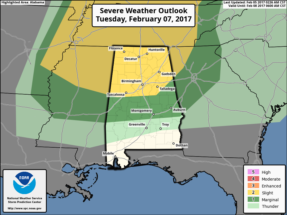
SLIGHT RISK: Tuesday, the SPC has their standard “slight risk” of severe weather for areas generally along and north of a line from Aliceville to Moundville to Calera to Heflin. A “slight risk” means that scattered severe storms are expected, or in other words, a good chance of severe weather. A “marginal Risk”, meaning isolated severe storms expected, extends down to south of Montgomery and Auburn. The fact that the SPC has the risk delineated on their Day 3 Outlook does portend a higher level of confidence that severe weather is likely. No question, the threat is greater to the north, but it is one we will have to take very seriously.
HOW DOES IT EVOLVE? It is just too early to tell. Those showers and storm will be approaching northwest Alabama Tuesday morning and will skirt across the Tennessee Valley. Will more showers and storms develop further south with the cap in place and the warmer temperatures aloft? Will the upper support lift out to the north, leaving us high and dry. These are the questions that will come into clearer focus over the next 24 hours.
MORE ACTION WEDNESDAY: The airmass won’t really change Tuesday and we will be waiting for the main cold front to arrive Wednesday. Showers and storms could form late Wednesday afternoon and evening across the state. Storms could be strong to severe, especially is areas from Chilton and Coosa counties southeast into Montgomery, Auburn and Eufaula.
ACTION STEPS: Just keep the severe weather threat in mind and check the latest forecast information. We will have an update this evening and frequent updates on Monday and through the event.
Category: Severe Weather
About the Author (Author Profile)
Bill Murray is the President of The Weather Factory. He is the site's official weather historian and a weekend forecaster. He also anchors the site's severe weather coverage. Bill Murray is the proud holder of National Weather Association Digital Seal #0001 @wxhistorianSubscribe
If you enjoyed this article, subscribe to receive more just like it.


