

Wet Beginning for Your Weekend
Cloudy along with a bit of a wet start to your morning as an upper level low over Missouri traverses the Southeast US today. You can expect to see clouds for much of the day while the threat of rain will be diminishing during the late morning and afternoon. Temperatures will warm a little in spite of the clouds with highs today around 60.
For those headed to the beach, showers and thunderstorms possible today before becoming partly cloudy late in the day. Sunday and Monday will see mostly sunny weather. Rain returns Monday night through Wednesday. Highs will mainly be in the lower 70s. Click here to see the Beach Forecast Center page.
Click here to see the Beach Forecast Center page. Save Up To 25% on Spring Break Beach Vacations on the Alabama Gulf Coast with Brett/Robinson! The Beach Forecast is partially underwritten by the support of Brett/Robinson Vacation Rentals in Gulf Shores and Orange Beach. Click here to see Brett/Robinson’s best beach offers now!.
There is little in the way of severe weather expected today with enough instability for some thunder across the Southeast US and into the Florida Peninsula.
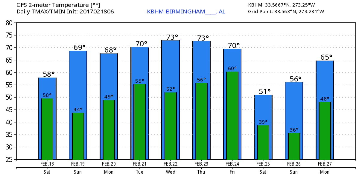
The upper low over Missouri this morning will move quickly off the Southeast US Coast by midday on Sunday as a sharp ridge develops over the Lower Mississippi River Valley in response to a trough digging into northern Mexico. Look for mostly sunny skies along with a bump up in temperatures as highs climb into the lower 70s. While the lower 70s sounds pretty warm the actual high temperature record for Sunday stands at 77 set in 1982.
The ridge moves slowly eastward on Monday giving us another warm February day with highs moving slightly upward into the middle 70s. But the good weather comes to an end late Monday and Tuesday as the trough moves out of Texas bringing a cold front across the area. The trough is expected to shear out as the portion across the Great Lakes moves faster than the portion over the western Gulf of Mexico. This means that rain is mostly likely to occur both north and south of us. Without a strong surge from the north we will see temperatures drop only a little with highs Wednesday in the 60s. Highs this time of year are typically in the upper 50s.
Wednesday and Thursday will once again see nice weather for us with an upper ridge becoming the prevailing feature in the weather pattern for us. Temperatures will remain warm on Thursday with highs around 70.
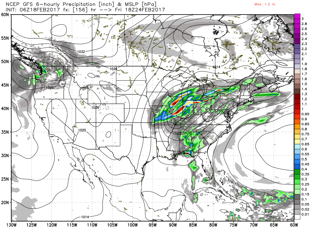
A fast moving upper trough comes out of the Central Rockies Thursday into Friday as a surface low moves eastward just south of the Great Lakes. A front will trail from the surface low south of Chicago into the Lower Mississippi River Valley providing us with a wet Friday. This system will need to be watched for the potential for severe weather, but right now there are too many differences in the ensembles to generate a specific risk. Ahead of the front temperatures will stay in the lower 70s. Rainfall amounts through Thursday morning are expected to be between a half inch and one inch with the higher amounts most likely across Southwest Alabama.
The upper trough moves by late Friday and early Saturday and the cold front moves off the Southeast US coast, so we should dry out and the sky should clear for next Saturday as a nice northerly flow drops temperatures back a good 10 degrees with highs in the lower 60s.
Looking out into voodoo country, a fast moving trough across the Great Lakes on Monday, February 27th, will drag another front across the Southeast US. After a couple of days of nice weather, another trough coming out of the southern Rockies will provide us with the potential for thunderstorms around the March 2nd/3rd time frame. After that system, the GFS digs a trough into Baja California area, so we should see some pretty warm weather by March 5th.
Off to get pancakes at the Helena Kiwanis Club’s annual Pancake Breakfast this morning. Just $5 for all you can eat, so be sure to stop by Helena Elementary School as the event runs through noon. I expect to have the next Weather Xtreme Video posted here first thing on Sunday morning. Enjoy the day, stay dry this morning, and Godspeed.
-Brian-
Category: Alabama's Weather
About the Author (Author Profile)
Brian Peters is one of the television meteorologists at ABC3340 in Birmingham and a retired NWS Warning Coordination Meteorologist. He handles the weekend Weather Xtreme Videos and forecast discussion and is the Webmaster for the popular WeatherBrains podcast.Subscribe
If you enjoyed this article, subscribe to receive more just like it.


