

Clouds Are Hanging Tough At Midday Across Central Alabama
At this “later than midday hour” across Central Alabama, rainfall has pretty much come to an end for most of the area. The only exceptions would be for a few showers over parts of our east and southeastern counties. Otherwise, the rest of the area is generally cloudy, but there are some breaks in those clouds that are letting some sun peek through at times.
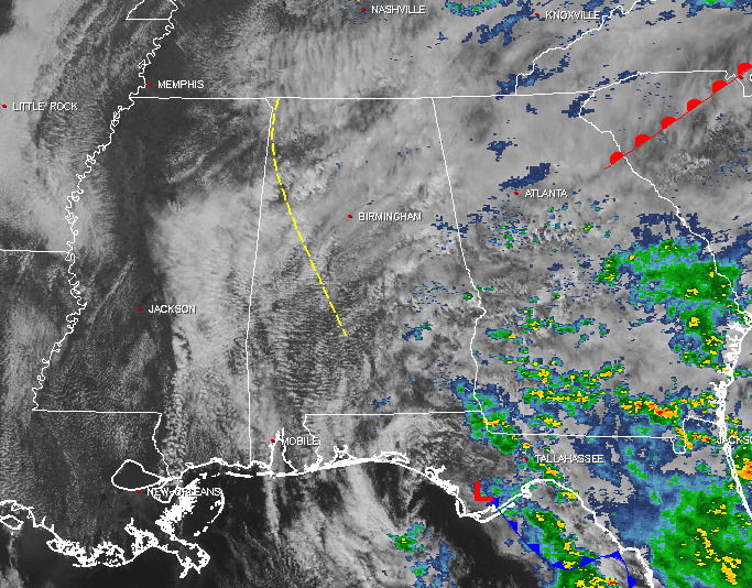
Pretty much all of the southeastern US is blanketed with cloud cover, with showers and storms falling mainly over the southern parts of Georgia and down into the peninsula of Florida.
For the remainder of today, skies will stay mostly cloudy and whatever shower activity is left should move out of the state later today. Afternoon highs will be in the lower to mid 70s throughout the area, with overnight lows in the mid to upper 50s. There could be some fog developing for the overnight hours, so be careful if you have to be out and about tonight.
Temperatures Across Central Alabama
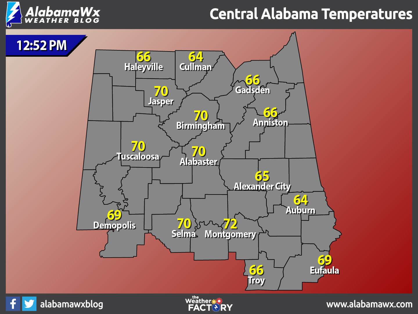
At 12:52 PM, temperatures are ranging from the mid 60s to the lower 70s across the area. The warm spot is currently Montgomery at 72ºF. The cool spots are Cullman and Auburn, both at 64ºF.
Birmingham’s Climatology And Records
The normal high for February 22nd is 60ºF, while the normal low is 37ºF. The record high for today was set back in 1897 at 81ºF. The record low was set back in 1963 at 9ºF.
Some Clouds Will Hang Around, But Thursday Will Be Nice
The clouds will thin out a little for the day on Thursday, but skies will generally be partly cloudy. It will be another warm day with well above average temperatures. Afternoon highs will be in the mid to upper 70s across the area, 15 to 18 degrees above normal for most spots. Skies will clear out a little more for the evening and overnight hours, making them generally mostly clear. Overnight lows will be in the mid to upper 50s.
The Beach Forecast
After partly to mostly cloudy skies today, sunshine makes a triumphant return for the beaches of the Alabama and Florida Gulf Coasts. Highs will generally be in the 70s throughout the weekend and into early next week, with a slight cool down into the 60s on Sunday. Click here to see the Beach Forecast Center page.
Save Up To 25% on Spring Break Beach Vacations on the Alabama Gulf Coast with Brett/Robinson! The Beach Forecast is partially underwritten by the support of Brett/Robinson Vacation Rentals in Gulf Shores and Orange Beach. Click here to see Brett/Robinson’s best beach offers now!.
On This Day In Weather History: 1990
Thunderstorms developing along and ahead of a cold front produced severe weather from southern Mississippi to North Carolina. One thunderstorm spawned a tornado just prior to dawn which touched down near Opp AL injuring ten persons and causing half a million dollars damage. Thunderstorm winds injured four persons south of Troy AL, and five people at Columbus GA. Thunderstorm winds gusted to 76 mph at Dothan AL.
Follow The Blog On Social Media
Remember that we are also on Facebook and on Twitter.
WeatherBrains
To hear the latest of the weekly netcast that’s all about weather featuring many familiar voices, including our meteorologists at ABC 33/40, you can listen anytime on the web at Weatherbrains.com, or on iTunes.
Forecaster: Scott Martin (Twitter: @scottmartinwx)
Category: Alabama's Weather
About the Author (Author Profile)
Scott Martin is an operational meteorologist, professional graphic artist, musician, husband, and father. Not only is Scott a member of the National Weather Association, but he is also the Central Alabama Chapter of the NWA president. Scott is also the co-founder of Racecast Weather, which provides forecasts for many racing series across the USA. He also supplies forecasts for the BassMaster Elite Series events including the BassMaster Classic.Subscribe
If you enjoyed this article, subscribe to receive more just like it.


