

Record Book Rewritten! Storms Tonight, a Few Could Be Strong
The record book has been rewritten at all our first order reporting station this afternoon.
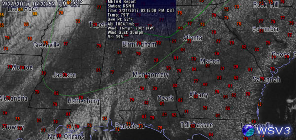
New record highs have been established at the following:
Muscle Shoals 81F (old record 78F)
Huntsville 80F (old record 77F)
Anniston 79F (old record 78F)
Birmingham 79F (old record 78F)
Tuscaloosa 81F (old record 78F)
Montgomery 81F (old record 80F)
Temperatures could rise even higher and we will have final results when the official highs are released later today.
Winds have become quite gusty across the northern half of the state today, averaging 15-25 out of the south and southwest, gusting to over 30 mph at times.
SEVERE WEATHER THREAT TONIGHT
An approaching cold front will trigger a line of thunderstorms tonight that will move across Alabama. Conditions are not very favorable for severe weather, but there is enough wind shear for organized thunderstorm updrafts so we will have to monitor. There is a small threat of damaging winds and small hail.
I have overlain the SPC outlook on the graphic, with the thunderstorm forecast extending down nearly to Montgomery and a Marginal Risk over Northeast Alabama.
Category: Severe Weather
About the Author (Author Profile)
Bill Murray is the President of The Weather Factory. He is the site's official weather historian and a weekend forecaster. He also anchors the site's severe weather coverage. Bill Murray is the proud holder of National Weather Association Digital Seal #0001 @wxhistorianSubscribe
If you enjoyed this article, subscribe to receive more just like it.


