

Much Cooler After Record Warmth
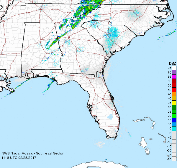
After a Friday that saw record worth including a number of new records, the weekend will be much colder with highs mainly in the upper 50s. New record highs for February 24th were set for Birmingham (81), Montgomery (83), Muscle Shoals (81), and Huntsville (81). It is also interesting to note that the coolest place in the state yesterday was Mobile with a high of only 77. As for rainfall, the showers associated with the passing front have not produced much in the way of rain with amounts generally less than a tenth of an inch.
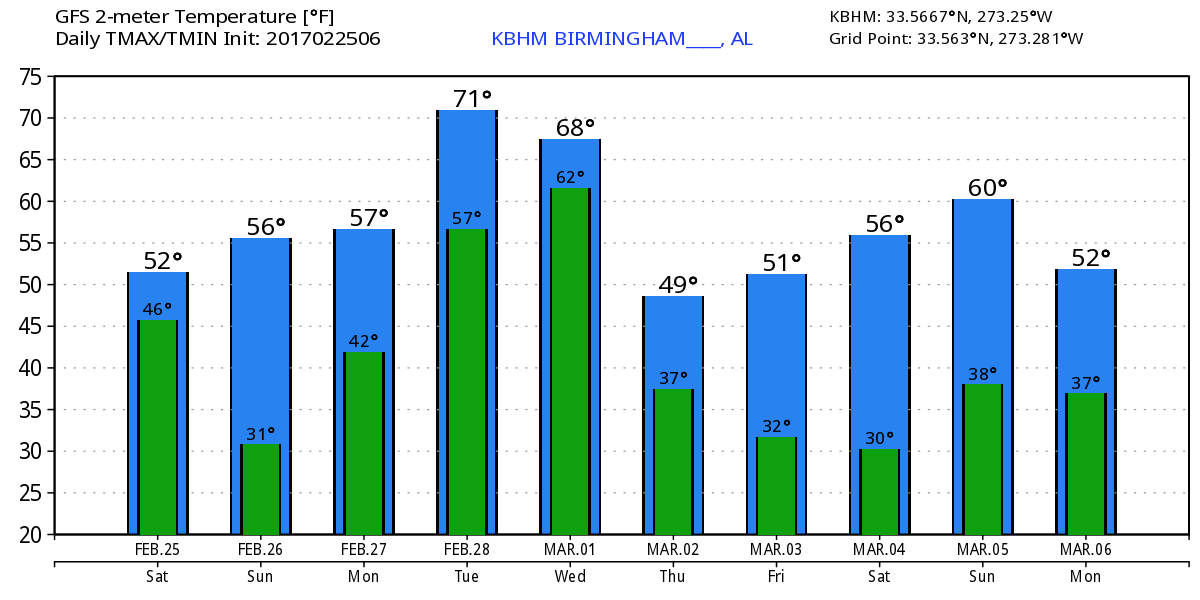
The cold front was located early this morning in East Central Alabama and will move briskly eastward clearing the state by late morning. Satellite imagery showed rapid clearing behind the cold front, so sunshine will return even though our highs today will be about 20 degrees colder than yesterdays record warmth. We’ll also see breezy conditions with a northwesterly wind at 15 to 20 mph with gusts to 20 to 25 mph. A high of 58 at the Birmingham today would be about 3 degrees below the 30 year average high for late February, but 23 degrees lower than the record high of 81 yesterday. With the surface high settling into the Southeast Sunday morning, look for the morning lows to be quite chilly compared with recent days with readings around daybreak Sunday around 30 degrees, mid and upper 20s in those typically colder locations.
Things will turn cooler today across the beaches of Alabama and Northwest Florida with highs in the 60s. Rain and storms return on Monday and continue through Wednesday. Highs will be mild with readings in the 70s Monday through Wednesday, falling back into the 60s for the end of the week. Click here to see the Beach Forecast Center page. Save Up To 25% on Spring Break Beach Vacations on the Alabama Gulf Coast with Brett/Robinson! The Beach Forecast is partially underwritten by the support of Brett/Robinson Vacation Rentals in Gulf Shores and Orange Beach. Click here to see Brett/Robinson’s best beach offers now!.
The weather will be calm for us Sunday and early Monday as weak riding occurs aloft as the surface high pressure center migrates from near Dallas-Fort Worth today to near Augusta Sunday and off into the Atlantic on Monday. Sunday will be cool, too, with highs around 60. Monday a weak upper short wave trough moves by just to our north ramping up the chances for rain for Monday night and Tuesday. The upper flow goes southwesterly adding Pacific moisture to the mix for us and much of the Southeast US. The southwesterly flow should help along with a good southerly flow to bring highs back up nicely by Tuesday with highs once again into the 70s.
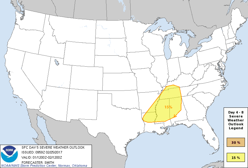
Unfortunately, all of this sets the stage for the potential for severe storms on Wednesday. SPC has outlined a 15 percent area for severe weather that includes a fairly sizable chunk of Alabama for Day 5, Wednesday. A strong trough is forecast to come across the Central Mississippi River Valley Wednesday with a surface front near Chicago at midday with a cold front trailing southwestward into Southeast Texas. CAPE values peak Wednesday afternoon in the 1000-1500 j/kg range while helicity values reach near 300. Add to these features the fact that the front is forecast to move into Alabama close to maximum heating time, and we have the ingredients for a severe weather episode. We are still several days away from this event, so I’m sure future model runs will be scrutinized closely to see if the threat of severe weather rises or falls.
The upper trough moves by Thursday, and the GFS sets up a trough generally along the Eastern Seaboard of the US from much of the latter part of the week and into the start of the weekend. This should keep us dry with temperatures generally below seasonal averages. This means lows in the 30s and highs in the 50s.
Looking out into voodoo country, the GFS maintains the idea of this eastern US trough through about the 6th of March. A moderate short wave trough comes into the Lower Mississippi River Valley around the 9th. This pattern suggests the potential for severe storms once again followed by some winter mischief for parts of the Southeast US. Much too early to start forecasting show or ice amounts since we all know this pattern could change drastically in the next model run. But worthy to note the potential and to carefully watch future model runs for consistency of this pattern. By March 12th, we come back under a ridge suggesting warm weather as we get into the middle of March, but the GFS also showing potent troughs coming across the northern Rockies. In other words, an active weather pattern to keep us busy!
Looking forward to filling in for Meaghan Thomas on the 10 o’clock news this evening. I plan to have the next Weather Xtreme Video posted here by 7:30 or so on Sunday morning. Enjoy the sunshine today, but stay warm. Godspeed.
-Brian-
Category: Alabama's Weather
About the Author (Author Profile)
Brian Peters is one of the television meteorologists at ABC3340 in Birmingham and a retired NWS Warning Coordination Meteorologist. He handles the weekend Weather Xtreme Videos and forecast discussion and is the Webmaster for the popular WeatherBrains podcast.Subscribe
If you enjoyed this article, subscribe to receive more just like it.


