

An Update on the Severe Weather Situation for Alabama at 4 p.m.
The SPC expanded its slight risk severe weather outlook to include all of the Tennessee Valley of North Alabama. The marginal risk is still in effect for areas generally north of I-20.
Storms that have fired over southern Missouri today ahead of a sharpening upper level trough over Kansas will sweep southeastward tonight. Severe thunderstorm watches and warnings are in effect for that area.
They should reach the Memphis area around 10:30 p.m. Some storms could break out ahead of the main line before midnight, but the line of storms should reach the Northwest Corner of the state around midnight.
Approximate time line:
…Hamilton by 1:30 a.m.
…Jasper/Cullman/Gadsden by 2 a.m.
…Birmingham/Anniston by 3 a.m.
…Tuscaloosa by 3:30 a.m.
(your mileage may vary)
They should start weakening by then as they cruise into South Central Alabama.
Here is the HRRR model simulated radar for the evening and overnight showing the line of storms:
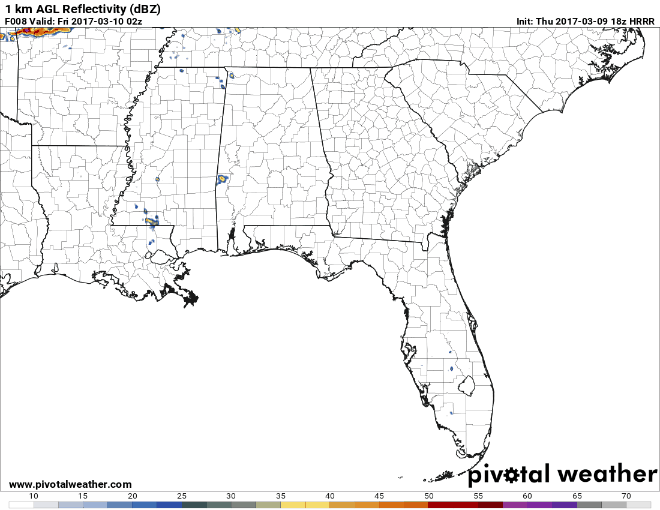
An area of strong winds at about 5,000 feet is a concern as those winds could be translated easily to the surface by organized storms. In fact, a mesoscale convective system, or organized cluster of storms could form. So damaging winds will be the main threat. There is a small tornado risk down into the Northwest Corner of the state, but the better threat for tornadoes is over SE Kansas, southern Missouri, NE Oklahoma and northern Arkansas. The SPC has posted a 30% damaging wind threat for SE Missouri, NE Arkansas and western Tennessee. That means there is a 30% chance of damaging winds (58 mph or greater) within 25 miles of points in those areas and translates into an enhanced risk area. The 15% damaging winds threat extends through the slight risk area of North Alabama. It diminishes the further south you go.
Scott Martin and I will be monitoring the threat throughout the night. Stay right here for the very latest information on a minute by minute basis, including warnings within 3 seconds of their issuance from the National Weather Service. Updates to the warnings post in real time to the original warning posts. We will be adding commentary in real time as well.
Expect another severe weather update by 6 p.m.
– Bill Murray
Category: ALL POSTS, Severe Weather
About the Author (Author Profile)
Bill Murray is the President of The Weather Factory. He is the site's official weather historian and a weekend forecaster. He also anchors the site's severe weather coverage. Bill Murray is the proud holder of National Weather Association Digital Seal #0001 @wxhistorianSubscribe
If you enjoyed this article, subscribe to receive more just like it.


