

Winter Weather Advisory for Northeast Alabama from 6PM Tonight Through 7AM Sunday
The National Weather Service in Huntsville has issued a Winter Weather Advisory for northeast Alabama, which is in effect from 6PM CST this evening to 7AM CDT Sunday.
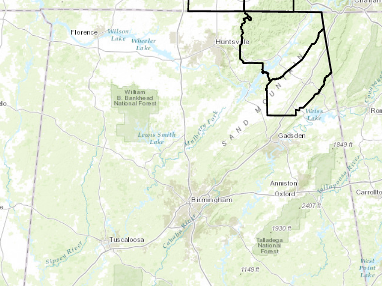
TIMING AND AREAS AFFECTED…Jackson and Dekalb counties in Alabama from 6 PM tonight through 7 AM Sunday.
ACCUMULATIONS…Half an inch to 1 inch of snow are possible in the higher elevations with less than a half an inch in the valley locations.
IMPACTS…Light snow accumulations will cause roads to be slick and make travel dangerous.
A Winter Weather Advisory for snow means that periods of snow will cause primarily travel difficulties. Be prepared for snow
covered roads and limited visibilities…and use caution while driving.
Two precipitation axes will be be affecting northern Alabama tonight. One will be across central MS/AL where there is good convergence between the low and the incoming shortwave and the other would be associated with the incoming shortwave with the focus of precipitation along the TN/AL border. The questions for tonight will be just when the precipitation changes from
rain to winter precipitation and amounts. Soundings are all suggesting that parcels from the surface up through 10,000 ft could be a mix of liquid and frozen. Looks like lift will be very weak at best, but the best lift however, occurs above 18,000 ft as the shortwave approaches the area, but arrives slightly later then the highest precipitation chances.
With weak lift, limited “ice” particles, and temps remaining in the mid 30s until after midnight we may be hard pressed to see a complete changeover to all snow until after midnight. The timing of the coldest temps and precipitation will allow the
best chances for snowfall to occur in the higher elevations of Jackson and DeKalb counties. But as mentioned above, temps aloft might allow for a bit of a mix of rain, snow, and sleet tonight. This could limit snowfall accumulations for much of
the area to only a trace. The higher elevations in northeast Alabama and could see around an inch. So, with that in mind, Jackson and DeKalb counties are under a Winter Weather Advisory for tonight but this would really only be for the higher elevations in those counties. The valley locations will see less than 0.5 inch. Snow amounts will be very limited south of the
Tennessee border and higher along and north of the border. Huntsville should see a quarter or less.
Category: ALL POSTS, Winter Weather
About the Author (Author Profile)
Scott Martin is an operational meteorologist, professional graphic artist, musician, husband, and father. Not only is Scott a member of the National Weather Association, but he is also the Central Alabama Chapter of the NWA president. Scott is also the co-founder of Racecast Weather, which provides forecasts for many racing series across the USA. He also supplies forecasts for the BassMaster Elite Series events including the BassMaster Classic.Subscribe
If you enjoyed this article, subscribe to receive more just like it.


