

Few Snowfall Observations
The NWS in Huntsville compiled a list of snow observations from across North Alabama and southern Middle Tennessee. Here is the report:
Public Information Statement
National Weather Service Huntsville AL
1204 PM CDT Sun Mar 12 2017

...Snowfall Reports...

Location                     Amount    Time/Date
Fayetteville                 2.0 in    0100 AM 03/12
6 WSW Estill Springs         1.5 in    0700 AM 03/12
1 NNW Lynchburg              1.3 in    0700 AM 03/12
1 WSW Cowan                  1.3 in    0700 AM 03/12
Sewanee                      1.0 in    0700 AM 03/12
1 NNW Florence               0.9 in    0700 AM 03/12
3 NNE Harvest                0.8 in    0318 AM 03/12
1 NNE Rogersville            0.4 in    0700 AM 03/12
2 NNE Ider                   0.2 in    0700 AM 03/12

Observations are collected from a variety of sources with varying
equipment and exposures. Not all data listed are considered official.

$$
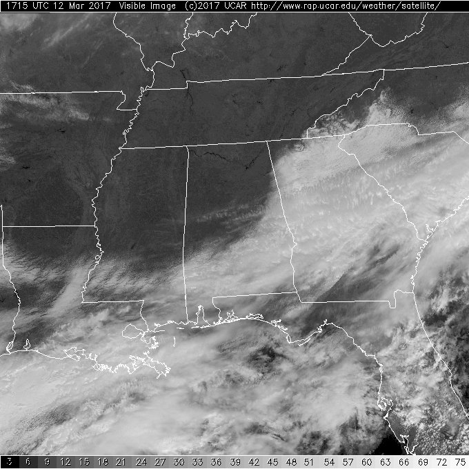
The sky cleared this morning, so with the help of some direct sunlight, the snow disappeared. Sometimes after a snow when the sky clears you can see it showing up on the satellite image, but that is not the case at this hour since the snow disappeared so quickly.
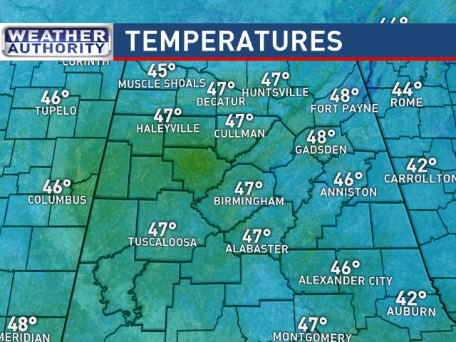
Nearly all of Central and North Alabama will enjoy sunshine this afternoon with temperatures at noon in the upper 40s. Most sites will climb into the 50s for the afternoon highs. Those values are about 7 to 10 degrees below our seasonal averages for the first portion of March.
I hope with the warm weather we’ve had that you didn’t pack away the winter clothing just yet. A fast moving cold front should blast through Central Alabama Monday night and early Tuesday. This will result in a somewhat bitter day with a stiff northwest wind at 10 to 20 mph with some higher gusts and temperatures probably holding in the 40s. Tuesday is likely to be one of those days when the high for the day does not occur in the middle of the afternoon and the low won’t occur around sunrise. Morning lows are still expected to drop into the 20s for Wednesday and Thursday mornings, and a freeze warning is likely to be issued by NWS offices serving Alabama.
-Brian-
Category: Alabama's Weather, ALL POSTS
About the Author (Author Profile)
Brian Peters is one of the television meteorologists at ABC3340 in Birmingham and a retired NWS Warning Coordination Meteorologist. He handles the weekend Weather Xtreme Videos and forecast discussion and is the Webmaster for the popular WeatherBrains podcast.Subscribe
If you enjoyed this article, subscribe to receive more just like it.


