

Severe Thunderstorm Watch Canceled for all Alabama Counties
UPDATE 8:25 PM
The severe thunderstorm watch has been canceled now for all Alabama counties.
Additional showers and storms may develop to the northwest later tonight but they should weaken as they move into North Alabama during the early morning hours.
Severe Thunderstorm Watch #0076 is Currently:
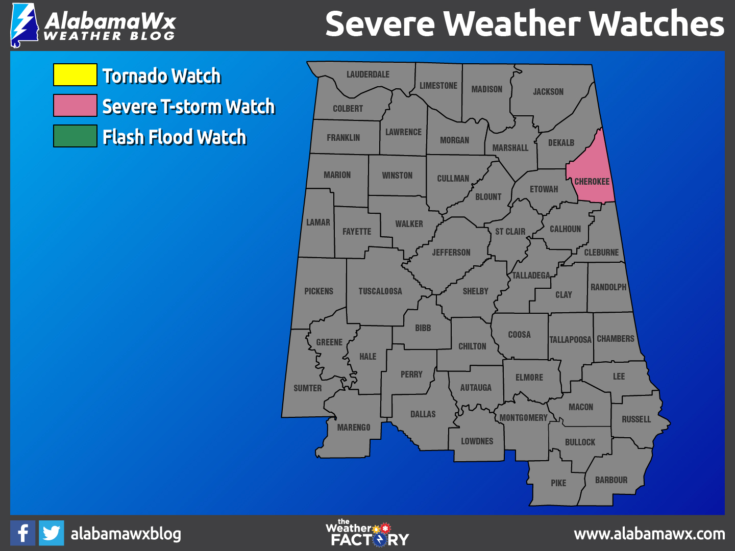
In Effect until 10:00 pm for Cherokee county
It has been Canceled for the following counties: DeKalb, Franklin (TN), Jackson, Lauderdale, Limestone, Lincoln (TN), Madison, Marshall, Moore (TN)
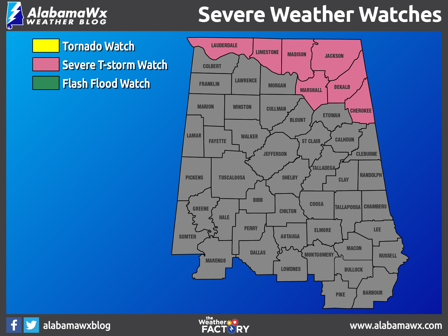
UPDATE: A Severe Thunderstorm Watch has been issued for DeKalb, Jackson, Lauderdale, Limestone, Madison, Marshall counties until 10PM tonight.
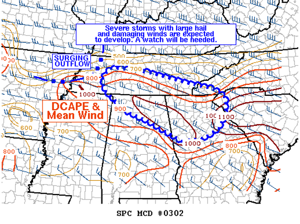
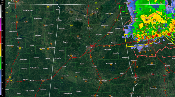
Large hail and damaging winds will be possible with a rapidly evolving MCS that will be moving across parts of North Alabama later this afternoon and into the evening hours. A few scattered showers and thunderstorms could develop out ahead of the MCS, and with impressive mid-level lapse rates in excess of 8 C/km and large downdraft CAPE values, large hail of 1-2 inches in diameter along with damaging straight-line winds will be possible.
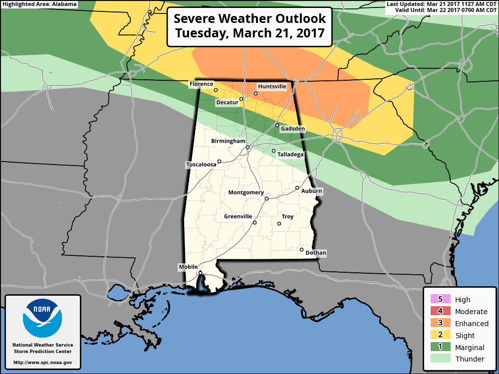
The SPC continues having the northeastern part of Alabama in an “Enhanced Risk” for severe storms through tonight for this incoming system, with a small sliver just to the south of that in the standard “Slight Risk.” The good news is that the tornado threat still is almost zero, but of course with severe thunderstorms you can expect the unexpected. With that being said, straight-line thunderstorm winds can still cause damage that can be just as bad or worse than a small tornado.
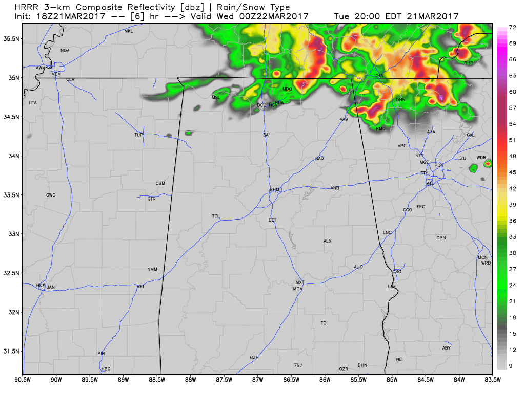
HRRR Simulated Radar at 7PM tonight.
A Severe Thunderstorm Watch will likely be issued within the next hour or so. Main window for strong to severe storms will be from 4PM to 9PM.
Category: Alabama's Weather, ALL POSTS
About the Author (Author Profile)
Scott Martin is an operational meteorologist, professional graphic artist, musician, husband, and father. Not only is Scott a member of the National Weather Association, but he is also the Central Alabama Chapter of the NWA president. Scott is also the co-founder of Racecast Weather, which provides forecasts for many racing series across the USA. He also supplies forecasts for the BassMaster Elite Series events including the BassMaster Classic.Subscribe
If you enjoyed this article, subscribe to receive more just like it.


