

Strong Storms Approaching Limestone, Madison, Marshall, Morgan, Jackson & Dekalb Counties
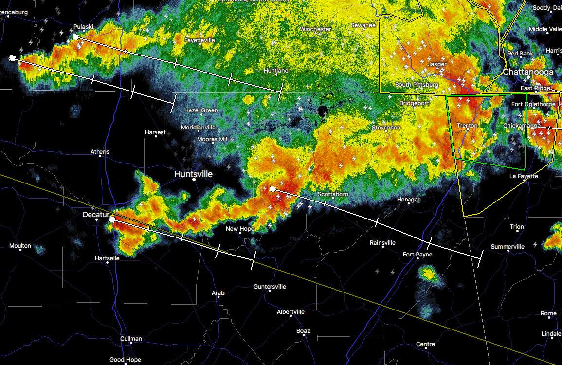
Two separate Significant Weather Advisories have been issued for counties in the northeast part of the state. One is for SE Limestone and S Morgan counties until 6:30PM for a strong thunderstorm over Priceville, or near Decatur, moving east at 40 mph. Nickel size hail and winds in excess of 40 mph will be possible with this storm. Locations in the path are Southern Huntsville, Decatur, Hartselle, Arab, Redstone Arsenal, Priceville, Owens Cross Roads, Triana, Morgan City and Huntsville International Airport.
The other is for SW Jackson, NE Marshall and C Jackson counties until 6:30PM for a strong thunderstorm near Woodville, or 11 miles west of Scottsboro, moving southeast at 55 mph. Penny size hail and wind gusts up to 50 mph will be possible with
this storm. Locations in the path are Scottsboro, Fort Payne, Rainsville, Sylvania, Fyffe, Powell, Grant, Section, Woodville and Pleasant Groves.
Strong gusty winds will be capable of knocking down small tree limbs along with other small unsecured items. Seek safe shelter until this storm has passed. This storm may intensify, so be certain to monitor local radio stations and available television stations for additional information and possible warnings from the National Weather Service.
About the Author (Author Profile)
Scott Martin is an operational meteorologist, professional graphic artist, musician, husband, and father. Not only is Scott a member of the National Weather Association, but he is also the Central Alabama Chapter of the NWA president. Scott is also the co-founder of Racecast Weather, which provides forecasts for many racing series across the USA. He also supplies forecasts for the BassMaster Elite Series events including the BassMaster Classic.Subscribe
If you enjoyed this article, subscribe to receive more just like it.


