

Severe Storms Possible Across Alabama Tomorrow
NICE SPRING AFTERNOON: With a mix of sun and clouds, temperatures are in the 70s across Alabama this afternoon; no rain on radar. Clouds will increase tonight ahead of a storm system to the west that will bring severe storms to the ArkLaTex region in coming hours.
STORMY SATURDAY: Roughly the western half of Alabama is in the standard “slight risk” of severe weather for tomorrow, with a “marginal risk” for the eastern counties…

A surface low will be over Missouri, and a moist, unstable airmass will be over Alabama with surface based CAPE values to near 1,500 j/kg by afternoon. New model guidance shows a little better alignment with the highest shear and instability values over the western third of the state.
TIMING: While a few morning showers are possible, the primary risk of strong to severe storms will come from 12:00 noon until 9:00 p.m. Understand it won’t rain all nine hours, but during that time strong to severe storms are very possible.
THREATS: The main risk with the storms will come from strong, potentially damaging straight line winds. Hail is also possible, and based on the new model guidance we could very well see an isolated tornado or two, especially over the western counties.
RAIN: Rain amounts of 1/2 to 1 inch are expected with no flooding issues.
Be sure you are in a position to hear severe watches and warnings tomorrow afternoon and evening if they are needed.
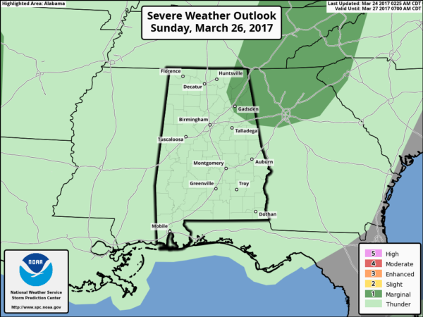
SUNDAY: While a decent part of the day will be dry, the air remains unstable, and it looks like scattered showers and storms will form during the afternoon and evening hours. Where the storms do form, they could be strong, and we have a “marginal risk” of severe weather Sunday over Northeast Alabama… hail is the threat.
NEXT WEEK: A very active pattern will continue for the foreseeable future as the spring wave train is rolling. Another upper trough will bring the risk of strong to severe storms to the state Monday, and yet another severe weather threat is likely toward the end of the week most likely Thursday night or Friday. We will focus on Monday’s threat once we get past the stormy day tomorrow. See the Weather Xtreme video for maps, graphics, and more details.
Click here to see the Beach Forecast Center page. Save Up To 25% on Spring Break Beach Vacations on the Alabama Gulf Coast with Brett/Robinson! The Beach Forecast is partially underwritten by the support of Brett/Robinson Vacation Rentals in Gulf Shores and Orange Beach. Click here to see Brett/Robinson’s best beach offers now!.
STORM SPOTTER TRAINING: We will be on the road through early April offering free storm spotter classes. We need more trained spotters in Alabama; by attending you can make the severe weather warning process better. No need to register; just come with a curious mind. And, there is no age limit… kids that love weather will enjoy it. You will never look at a storm the same again. Next week we are at Oxford Tuesday (at the Oxford Civic Center) and Jasper Thursday (at the Jasper Civic Center).
WEATHER BRAINS: Don’t forget you can listen to our weekly 90 minute netcast anytime on the web, or on iTunes. This is the show all about weather featuring many familiar voices, including our meteorologists here at ABC 33/40.
CONNECT: You can find me on all of the major social networks…
Facebook
Twitter
Google Plus
Instagram
Pinterest
Snapchat: spannwx
I had a great time today visiting with the students at Calera Elementary… be looking for them on the Pepsi KIDCAM today at 5:00 on ABC 33/40 News! My next Weather Xtreme video will be posted here by 7:00 a.m. Monday… Brian Peters will have the video updates tomorrow and Sunday. Enjoy the weekend!
Category: Alabama's Weather, ALL POSTS
About the Author (Author Profile)
James Spann is one of the most recognized and trusted television meteorologists in the industry. He holds the AMS CCM designation and television seals from the AMS and NWA. He is a past winner of the Broadcast Meteorologist of the Year from both professional organizations.Subscribe
If you enjoyed this article, subscribe to receive more just like it.


