

A Look At Today’s Severe Weather Potential
RADAR CHECK: A line of storms over Mississippi is moving toward West Alabama early this morning… for now they are under severe limits.
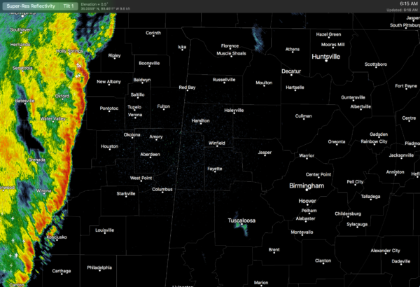
These storms will move into West Alabama in a few hours, and storms will be possible statewide this afternoon and into the evening hours. With the daytime heating process, the air will become unstable, supporting strong to severe storms during the afternoon and evening hours.
SPC maintains the standard “slight risk” of severe storms for roughly the western half of Alabama, with a “marginal risk” for the eastern side of the state.
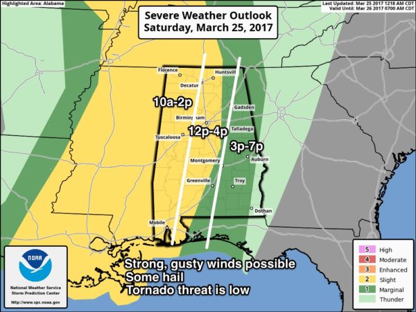
TIMING: While a few isolated showers are possible this morning, the main window for stronger storms will come from 10:00 a.m. until 7:00 p.m.
THREATS: The high resolution HRRR model is showing a mostly unidirectional wind profile this afternoon, meaning the tornado threat will be low. The main issue will come from strong thunderstorm winds. Some small hail is possible as well.
RAIN: Rain amounts of 1/2 to 1 inch are expected; no flooding issues.
Keep an eye on the blog today for frequent updates on the situation…
Category: Alabama's Weather, ALL POSTS
About the Author (Author Profile)
James Spann is one of the most recognized and trusted television meteorologists in the industry. He holds the AMS CCM designation and television seals from the AMS and NWA. He is a past winner of the Broadcast Meteorologist of the Year from both professional organizations.Subscribe
If you enjoyed this article, subscribe to receive more just like it.


