

A Quick Look At Our Weather Situation At 9:20AM
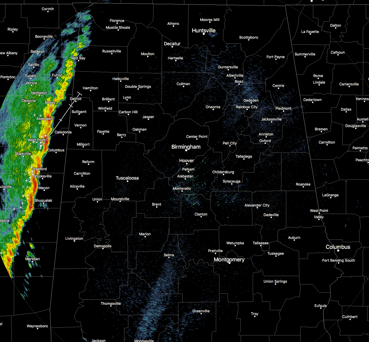
RADAR CHECK
A line of storms are starting to push ever so closer to the state line, and will be crossing over in the extreme northwestern corner of the state by the time you read this post. There are no watches or warnings currently in effect for anyone in the southeast, as the line is below severe limits. Lightning output is not all that high as of now as well. Strongest part of the line right now stretches from Bogue Chitto up to West Point in eastern Mississippi.
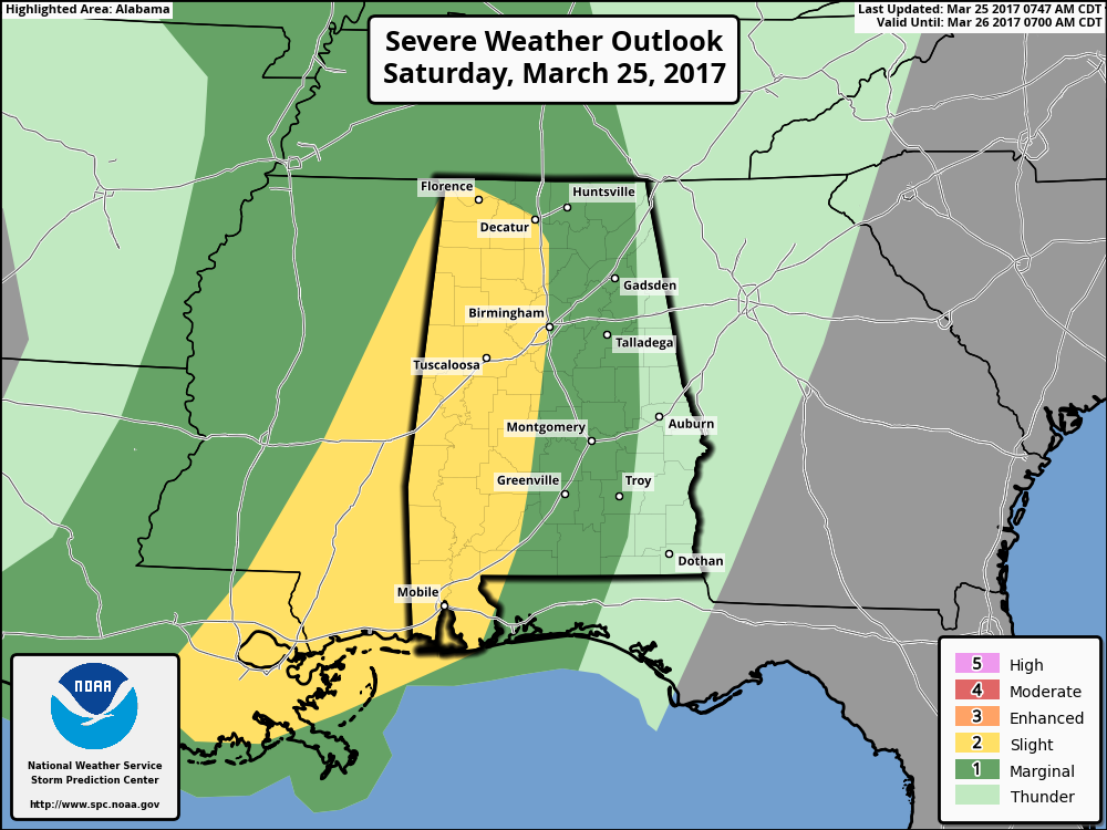
SPC RISKS
As you will notice, the SPC has shrunk the slight risk area down to areas west of I-65, with much of the rest of the state in a marginal risk for severe storms. Main threat will be from damaging straight-line winds, but some small hail will be possible. The threat for any tornadoes will be very low, but not zero.
LATEST THINKING
It looks like the upper level low responsible for this system will actually be moving farther to the north than first modeled, and this will take the better dynamics and upper-level support farther to the north, decreasing the severe potential for tonight. The good news is that with the line moving through eastern Mississippi and soon moving into western Alabama, the atmosphere may not recover enough for instability levels to be sufficient for an organized severe weather threat. There will still be enough forcing for thunderstorm development as the surface front moves closer to the area this afternoon and evening.
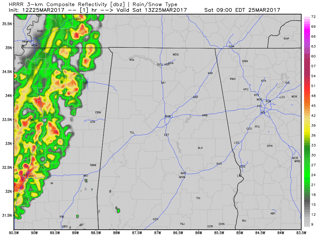
TIMING
The main window for stronger storms will be from 10:00AM to 7:00PM tonight, but a few showers could develop beforehand.
WORD OF ADVICE
Be sure to be in a position to hear severe weather watches and warnings throughout the day if they are needed. Stay tuned to the Alabama Wx Weather Blog throughout the day for regular updates. Have your NOAA Weather Radio handy and your smart phone charged and nearby.
Category: ALL POSTS, Severe Weather
About the Author (Author Profile)
Scott Martin is an operational meteorologist, professional graphic artist, musician, husband, and father. Not only is Scott a member of the National Weather Association, but he is also the Central Alabama Chapter of the NWA president. Scott is also the co-founder of Racecast Weather, which provides forecasts for many racing series across the USA. He also supplies forecasts for the BassMaster Elite Series events including the BassMaster Classic.Subscribe
If you enjoyed this article, subscribe to receive more just like it.


