

A Quick Look At Our Weather Situation At 11:20AM
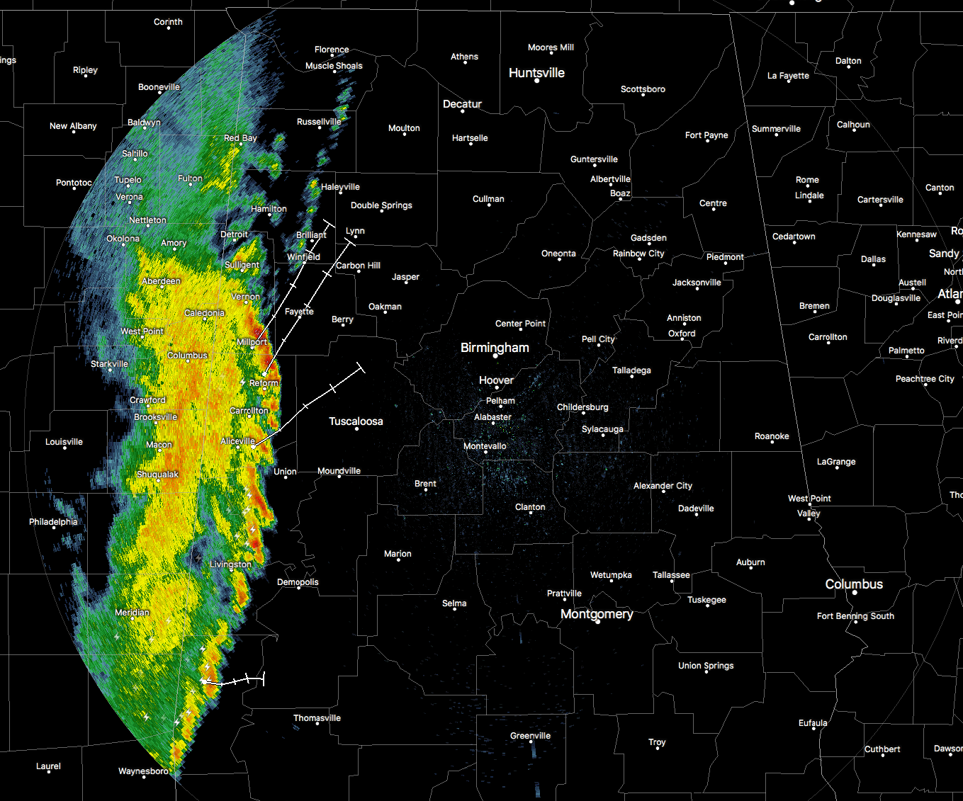
RADAR CHECK
The line of storms have slowly pushed into the western parts of the state, and the intensity has picked up since the last update. The strongest part of the line right now is over parts of Lamar and Pickens counties. Millport and Reform are really having some heavy rainfall at this moment. The line is slowly moving to the east at 20-25 MPH.
LATEST THINKING
It looks like the upper level low responsible for this system will actually be moving farther to the north than first modeled, and this will take the better dynamics and upper-level support farther to the north, decreasing the severe potential for tonight. The atmosphere still looks like it will have a hard time recovering after the line moves through, and instability values should be too low for organized severe weather. There will still be enough forcing for thunderstorm development as the surface front moves closer to the area this afternoon and evening.
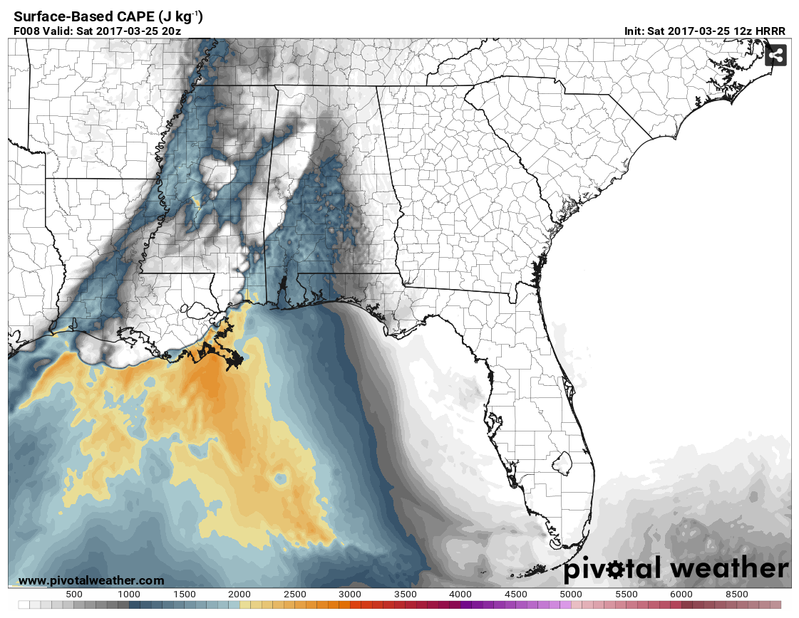
Surface-based CAPE values will be in the 1000-1500 J/kg range just ahead of the line of storms, with the higher values mainly south of the I-20 corridor.
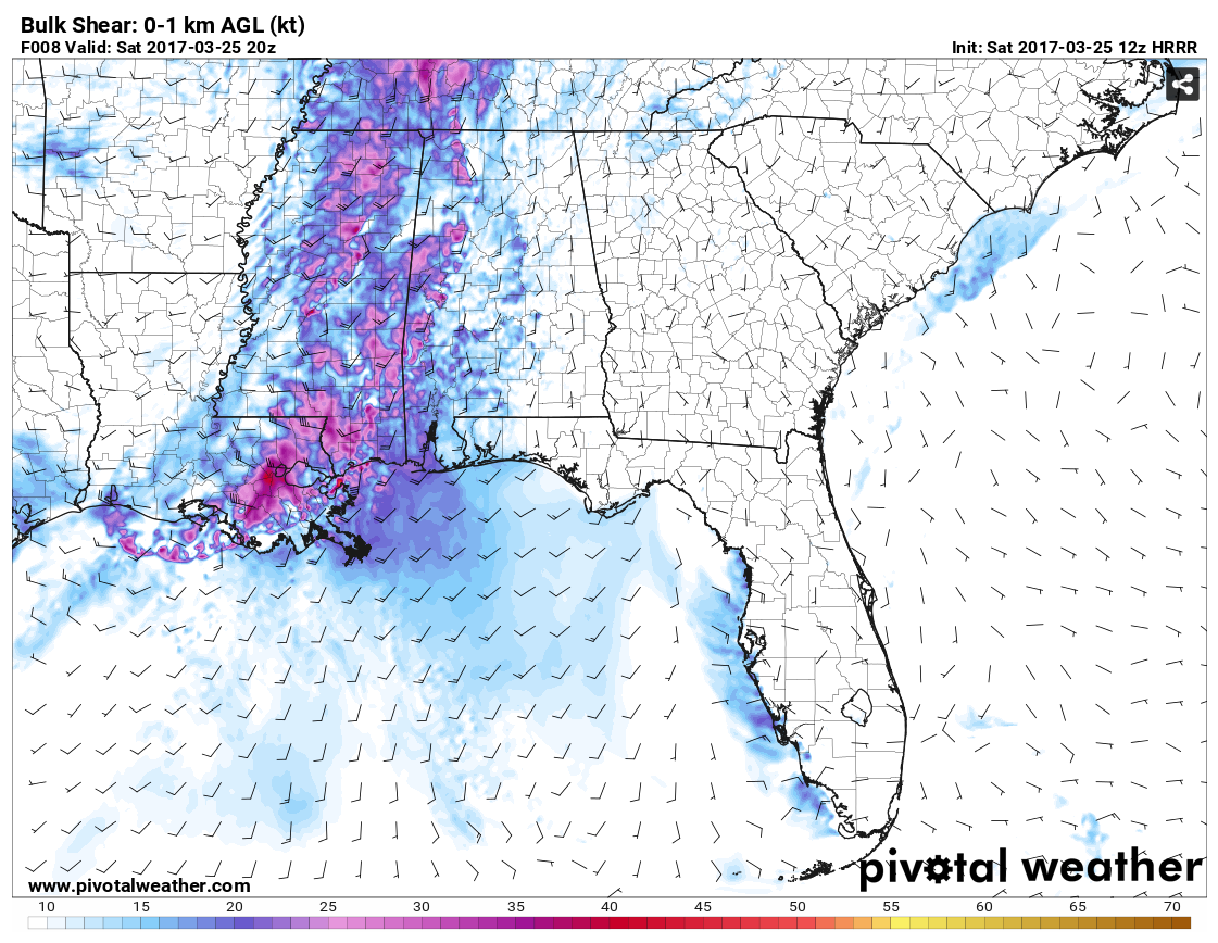

Higher shear values are still somewhat separated from the helicity values, meaning that the threat for tornadoes will be really low, but if any do form, most likely place will be in the southwestern parts of the state.
Significant Tornado Paremeter values are running well below 1, so that agrees with the helicity and shear values.
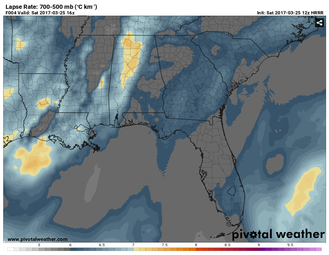
700-500 mb Lapse Rates are running in the 6.4 – 7.4ºC/km-1, and this means that the potential is there for some hail that could reach up to severe parameters.
So with that being said, the main threat for today’s event should be from thunderstorm winds, with a smaller threat coming from some hail. The tornado threat is very, very small, but expect the unexpected when it comes to severe weather in Central Alabama. Go ahead and be prepared just in case a warning is issued for your location.
The main window for stronger storms will be from now through 7:00PM tonight, but a few showers could develop beforehand.
Category: ALL POSTS, Severe Weather
About the Author (Author Profile)
Scott Martin is an operational meteorologist, professional graphic artist, musician, husband, and father. Not only is Scott a member of the National Weather Association, but he is also the Central Alabama Chapter of the NWA president. Scott is also the co-founder of Racecast Weather, which provides forecasts for many racing series across the USA. He also supplies forecasts for the BassMaster Elite Series events including the BassMaster Classic.Subscribe
If you enjoyed this article, subscribe to receive more just like it.


