

Strong Storms Approaching Limestone County
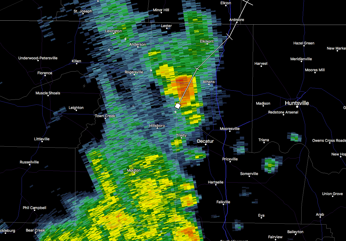
At 1:42 PM, a strong thunderstorm was 7 miles west of Tanner, or 7 miles west of Athens, moving northeast at
45 mph. Pea size hail and wind gusts of 40 to 50 mph will be possible with this storm.
SIGNIFICANT WEATHER ADVISORY
For Limestone County until 2:15 PM.
Locations impacted include… Athens, Ardmore, Elkmont, Cartwright, Coxey, Mt Rozell, Ripley, Cairo, Holland Gin and Leggtown.
Strong gusty winds will be capable of knocking down small tree limbs along with other small unsecured items. Seek safe shelter until this storm has passed.
Category: ALL POSTS, Severe Weather
About the Author (Author Profile)
Scott Martin is an operational meteorologist, professional graphic artist, musician, husband, and father. Not only is Scott a member of the National Weather Association, but he is also the Central Alabama Chapter of the NWA president. Scott is also the co-founder of Racecast Weather, which provides forecasts for many racing series across the USA. He also supplies forecasts for the BassMaster Elite Series events including the BassMaster Classic.Subscribe
If you enjoyed this article, subscribe to receive more just like it.


