

A Quick Check On Our Weather Situation At 3:15PM

RADAR CHECK
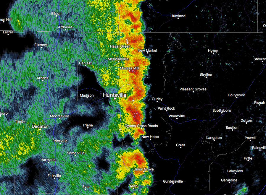
Currently, the line of rain and storms are located from New Hope to Cleveland to Hoover to Maplesville to Selma. The line is well below severe limits at this time as it continues its slow crawl across the state, but we do have a few stronger storms out there…
SIGNIFICANT WEATHER ADVISORY
For Central Madison County until 3:30 PM.
At 3:00 PM CDT, a strong thunderstorm was over southeastern Huntsville, moving northeast at 30 mph. Pea size hail and winds up to 40 to 50 mph will be possible with this storm. Locations impacted include… Huntsville, Moores Mill, Redstone Arsenal, Owens Cross Roads, Gurley, Alabama A And M University, Ryland, Whitesburg, Maysville and Hampton Cove.
MARGINAL RISK
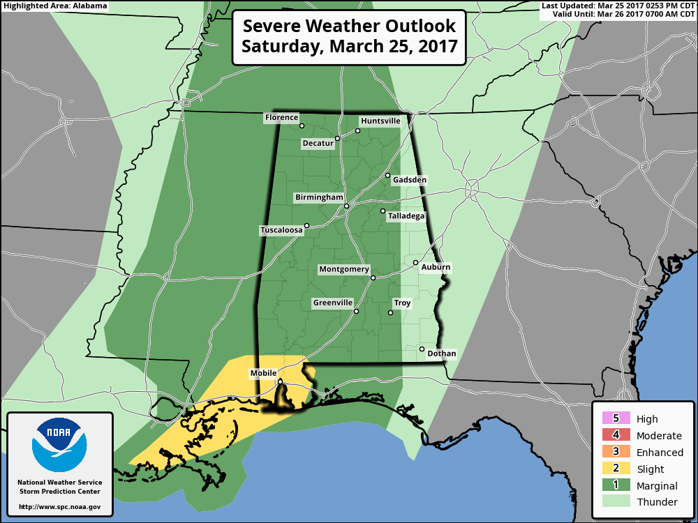
The latest update from the Storm Prediction Center has removed all of the North/Central Alabama from the slight risk for severe storms throughout the remainder of the afternoon and evening. Much of the state remains in a marginal risk, with the extreme southwestern counties of the state in a slight risk.
LATEST THINKING
The upper-level low will end up in the south-central parts of Illinois tonight, and that will greatly lessen our threat for severe weather today. The better dynamics and upper-level support will be well farther to the north than what was modeled 12 hours ago, and with the line moving through now, it is pretty doubtful that the atmosphere will recover enough for any organized severe weather as the front moves closer to the area. We will still have general showers and thunderstorms with some gusty winds possible, but with good cloud cover and weakening convergence, the risk will be limited.
Category: ALL POSTS, Severe Weather
About the Author (Author Profile)
Scott Martin is an operational meteorologist, professional graphic artist, musician, husband, and father. Not only is Scott a member of the National Weather Association, but he is also the Central Alabama Chapter of the NWA president. Scott is also the co-founder of Racecast Weather, which provides forecasts for many racing series across the USA. He also supplies forecasts for the BassMaster Elite Series events including the BassMaster Classic.Subscribe
If you enjoyed this article, subscribe to receive more just like it.


