

A Quick Look At Our Weather Situation At 5:30PM
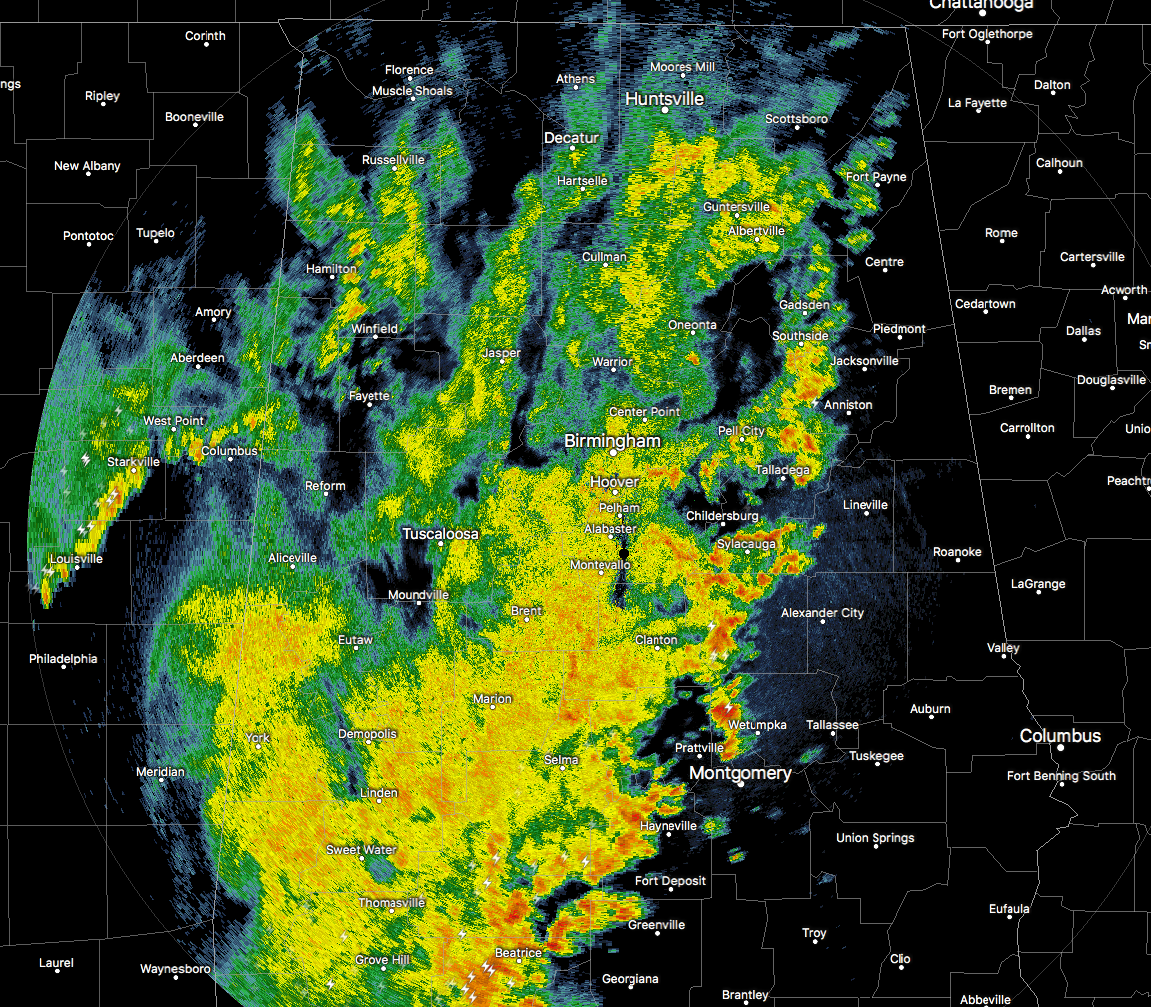
RADAR CHECK
The line of showers and thunderstorms is continuing to slowly make its way across Central Alabama at this time, and so far, we have not had a single warning issued at all. The leading edge of the line has become quite broken as it has moved into a more stable airmass. That leading edge is currently affecting Fort Payne to Talladega to Millbrook to just west of Fort Deposit. Much of the lightning activity at this point is contained over the south-central and southwestern parts of the state.
LATEST THINKING
The latest from the NWS Birmingham is saying that no hazardous weather is expected throughout the remainder of the evening. More showers and storms have developed back to the west in Central Mississippi just ahead of a dryline, but with the atmosphere well worked over, they will weaken as they move into the state and will just be rainmakers with a clap of thunder or two.
THOUGHTS ABOUT SUNDAY
Sunday will start off with a few scattered showers across much of the area, but will dry out for the afternoon and evening hours as much drier mid-level air will move in behind the short wave. Skies may actually clear out some before sunset. Afternoon highs will be in the mid 70s to the lower 80s.
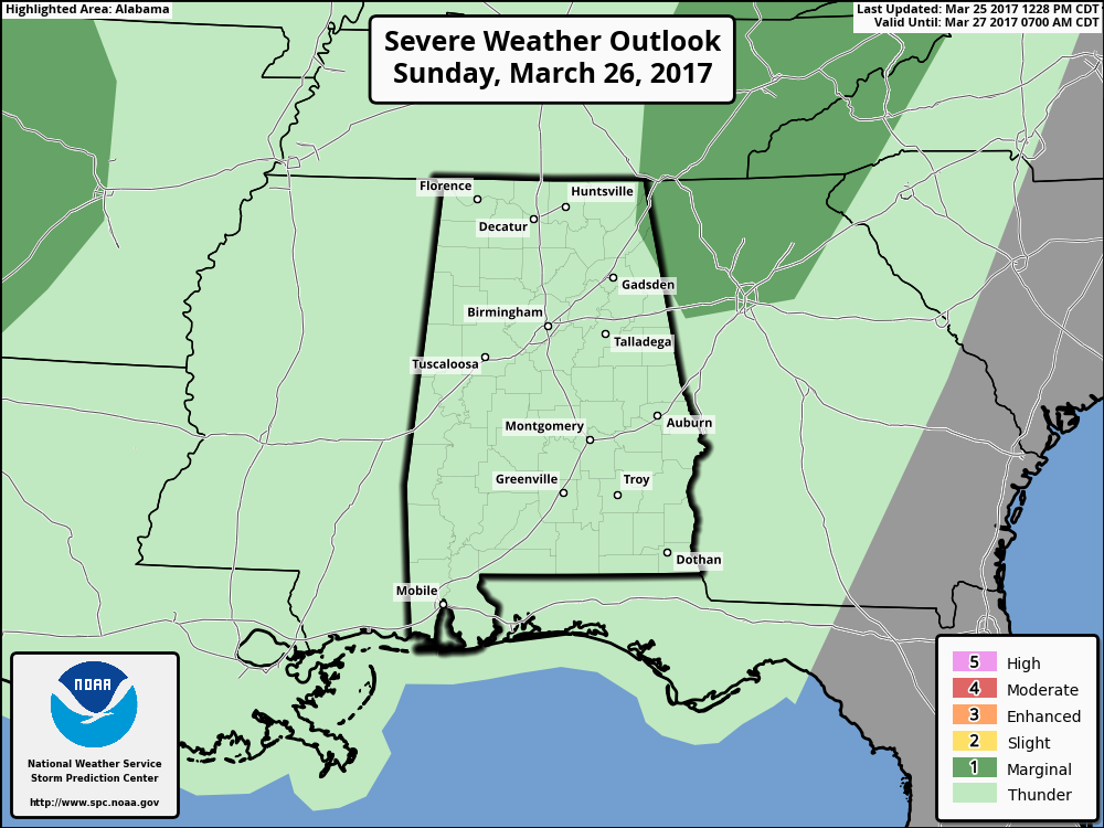
I’ll mention that a few storms in the northeast corner of the state could be strong with small hail being the main threat, and the SPC has a very slim portion of that part of the state defined in a marginal risk for severe storms. All rain activity should be done by 1PM at the latest.
Category: ALL POSTS, Severe Weather
About the Author (Author Profile)
Scott Martin is an operational meteorologist, professional graphic artist, musician, husband, and father. Not only is Scott a member of the National Weather Association, but he is also the Central Alabama Chapter of the NWA president. Scott is also the co-founder of Racecast Weather, which provides forecasts for many racing series across the USA. He also supplies forecasts for the BassMaster Elite Series events including the BassMaster Classic.Subscribe
If you enjoyed this article, subscribe to receive more just like it.


