

At The Midday Hour, Here Is A Quick Look At Our Weather Situation
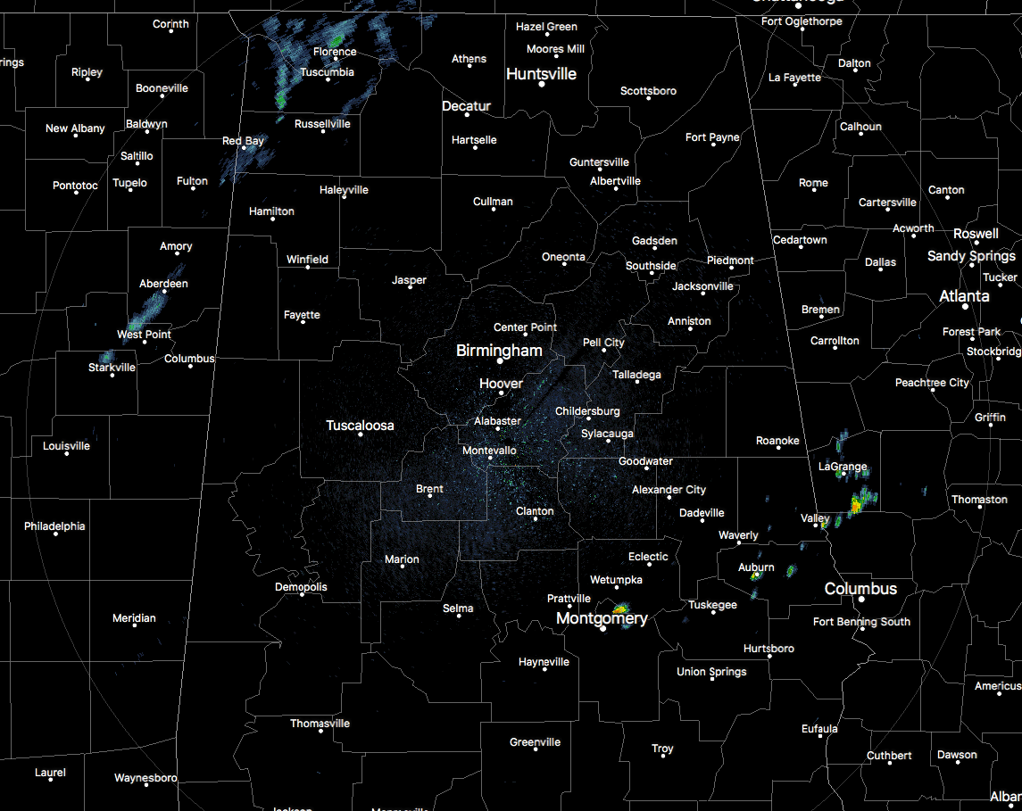
RADAR CHECK
At the 11:00AM hour across North/Central Alabama, all is pretty quiet at the moment. We have mostly cloudy skies across the area, and we do have a few isolated showers in the southeastern parts of Central Alabama near the cities of Montgomery and Wetumpka, and affecting Auburn. There is some shower activity showing up in northwestern Alabama, but looking at different radars, I do not believe these are reaching the ground. Temperatures at this time are in the lower to mid 70s.
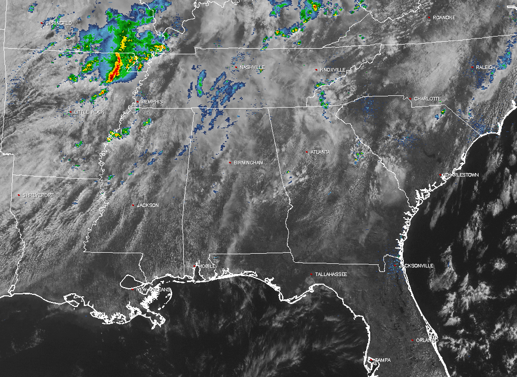
ACROSS THE SOUTHEAST
Skies are mostly cloudy for much of the southeastern U.S., with mostly clear skies down in southern parts of Alabama, Georgia, and across all of Florida. Active showers and storms are affecting the northeastern parts of Arkansas and up into the southeastern parts of Missouri. Another batch of showers and storm are over the east-central parts of Kentucky. Where we need to keep our attention is over the northern half of Mississippi, as this is where our storms will be developing and moving into the state this afternoon. We do see some development already in northwestern Mississippi, which these were not there 30 minutes ago.
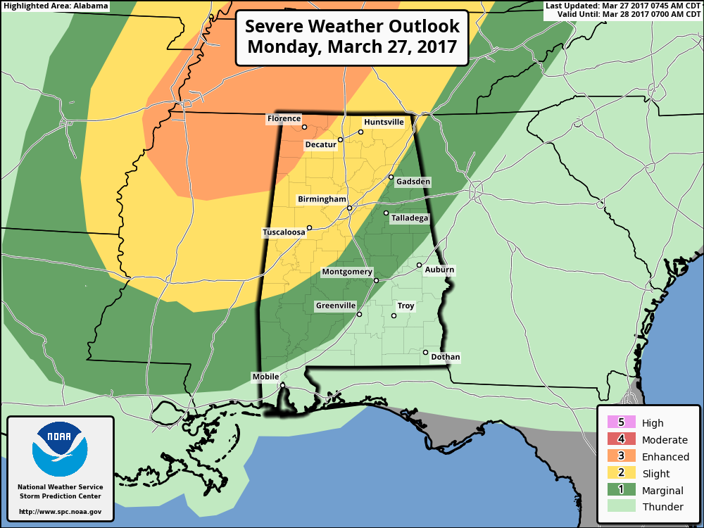
SEVERE OUTLOOK FROM THE STORM PREDICTION CENTER
The last update from the SPC has the northwest corner of the state in an enhanced risk for severe storms throughout the day, with a good portion of the northern half of the state in a slight risk, and a marginal risk stretching all the way out to Mobile and Baldwin counties to Greenville and Montgomery and out to east and northeastern Alabama. The next update will be out by 11:30AM.
LATEST THINKING
A broad upper-level trough is moving eastward and closer to the state, with convective storms expected to develop out ahead of the front during the early afternoon hours. We will have plenty of dry air aloft, along with CAPE values in the 1000-2000 J/kg range and with 0-6 km shear around 35-45 knots. Storms possibly could be in the form of supercells and clusters. Main threats for today will be from damaging winds and large hail. The tornado threat will be very low, and flooding should not be an issue as only 1 inch of rain or less is expected.
TIMING
The main risk for strong to severe storms across the area today will be from roughly 3:00PM until 9:00PM this evening. With the cold front lagging and a low-level jet in place, more showers and storms are possible after that during the late evening and overnight hours, but these will not be severe.
WORD OF ADVICE
Be sure to be in a position to hear severe weather watches and warnings throughout the day if they are needed. Stay tuned to the Alabama Wx Weather Blog throughout the day for regular updates. Have your NOAA Weather Radio handy and your smart phone charged and nearby.
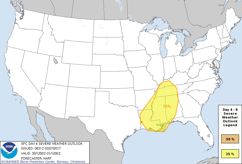
HEADS UP FOR POSSIBLE SEVERE WEATHER ON THURSDAY
Our next system that will move across the area will be on Thursday afternoon and Thursday night, and the SPC already has much of the state defined in a severe weather risk on their “Day 4” outlook. The synoptic pattern looks favorable for strong to severe storms as of now, but we need to get through today’s event before focusing on Thursday.
Category: Alabama's Weather, ALL POSTS
About the Author (Author Profile)
Scott Martin is an operational meteorologist, professional graphic artist, musician, husband, and father. Not only is Scott a member of the National Weather Association, but he is also the Central Alabama Chapter of the NWA president. Scott is also the co-founder of Racecast Weather, which provides forecasts for many racing series across the USA. He also supplies forecasts for the BassMaster Elite Series events including the BassMaster Classic.Subscribe
If you enjoyed this article, subscribe to receive more just like it.


