

Severe Thunderstorm Warning Continues For Parts Of Blount County Until 6:30PM

…A SEVERE THUNDERSTORM WARNING REMAINS IN EFFECT UNTIL 630 PM CDT FOR EAST CENTRAL BLOUNT COUNTY… At 611 PM CDT, a severe thunderstorm was located over Susan Moore, or 7 miles north of Oneonta, moving east at 25 mph.
HAZARD…Quarter size hail.
SOURCE…Radar indicated.
IMPACT…Damage to vehicles is expected. Locations impacted include… Altoona, Snead, Susan Moore, Walnut Grove and Hendrix.
Severe Thunderstorm Warning Continues For Parts Of Blount County Until 6:30PM
Mar 27th @ 5:35 pm

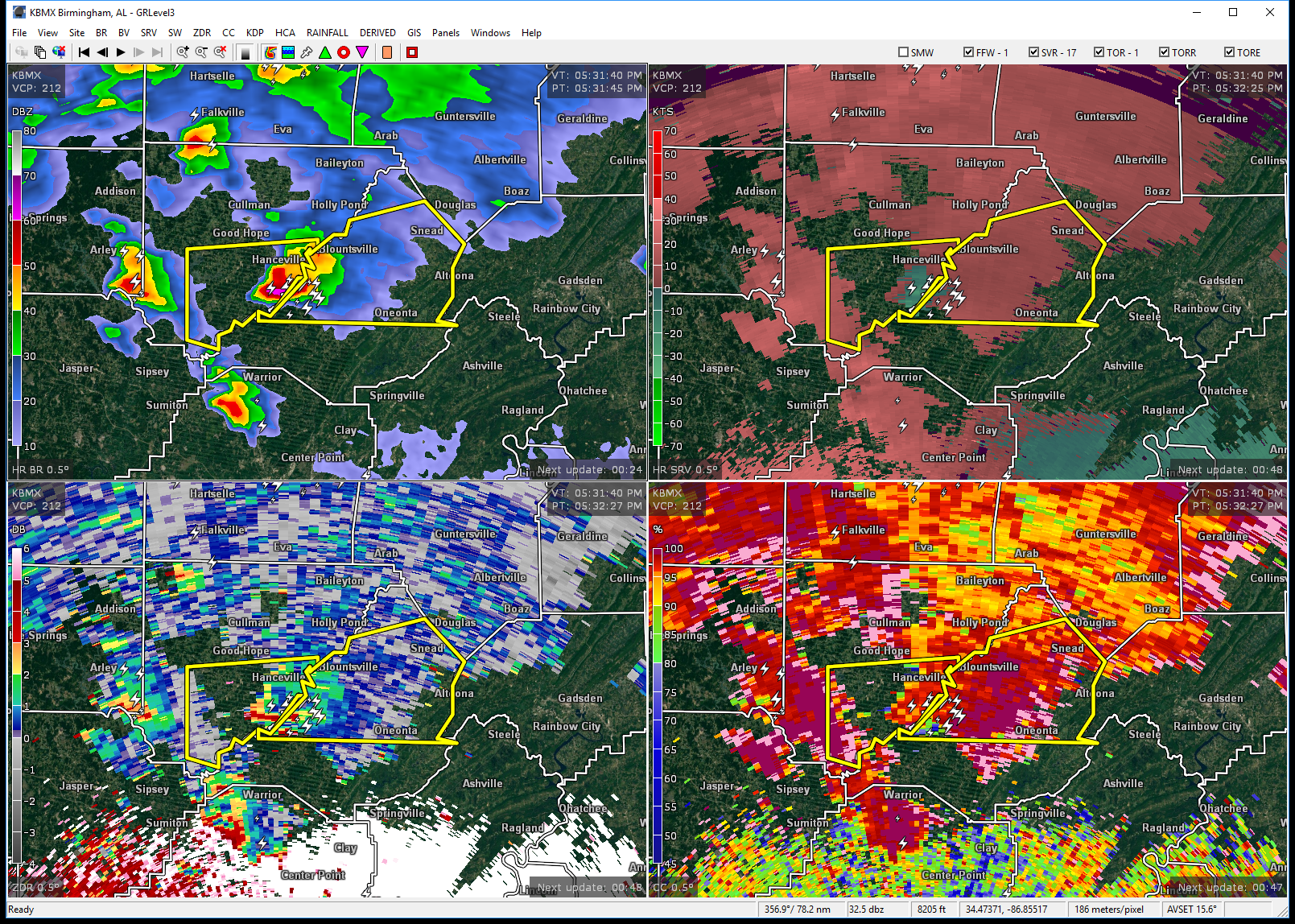
…A SEVERE THUNDERSTORM WARNING REMAINS IN EFFECT UNTIL 630 PM CDT FOR NORTHEASTERN BLOUNT COUNTY… At 557 PM CDT, a severe thunderstorm was located near Cleveland, moving east at 25 mph.
HAZARD…Quarter size hail.
SOURCE…Radar indicated.
IMPACT…Damage to vehicles is expected. Locations impacted include… Blountsville, Cleveland, Altoona, Snead, Susan Moore, Walnut Grove, Rosa, McLarty, Fowler Spring and Hendrix.
Severe Thunderstorm Warning Issued For Parts Of Blount County Until 6:30PM
Mar 27th @ 5:35 pm

The National Weather Service in Birmingham has issued a
* Severe Thunderstorm Warning for…
Northern Blount County in Alabama…
* Until 630 PM CDT
* At 534 PM CDT, a severe thunderstorm was located near Bangor, or 9 miles west of Cleveland, moving east at 25 mph.
HAZARD…60 mph wind gusts and quarter size hail.
SOURCE…Radar indicated.
IMPACT…Hail damage to vehicles is expected. Expect wind damage to roofs, siding, and trees.
* Locations impacted include…
Oneonta, Blountsville, Cleveland, Altoona, Snead, Susan Moore, Walnut Grove, Fairview, Nectar, Rosa, McLarty, Bangor, Easley, Chamblees Mill, Fowler Spring and Hendrix.
Category: ALL POSTS, Archived Warnings
About the Author (Author Profile)
Subscribe
If you enjoyed this article, subscribe to receive more just like it.


