

Severe Thunderstorm Warning Continues For Parts Of Lawrence County Until 7:00PM

…A SEVERE THUNDERSTORM WARNING REMAINS IN EFFECT UNTIL 700 PM CDT FOR SOUTHEASTERN LAWRENCE COUNTY… At 648 PM CDT, a severe thunderstorm was located near Inmanfield, or 13 miles southeast of Moulton, moving east at 40 mph.
HAZARD…60 mph wind gusts and quarter size hail.
SOURCE…Radar indicated.
IMPACT…Hail damage to vehicles is expected. Expect wind damage to roofs, siding, and trees. Locations impacted include… Speake and eastern Bankhead National Forest.
Severe Thunderstorm Warning Issued For Parts Of Lawrence County Until 7:00PM
Mar 27th @ 6:14 pm
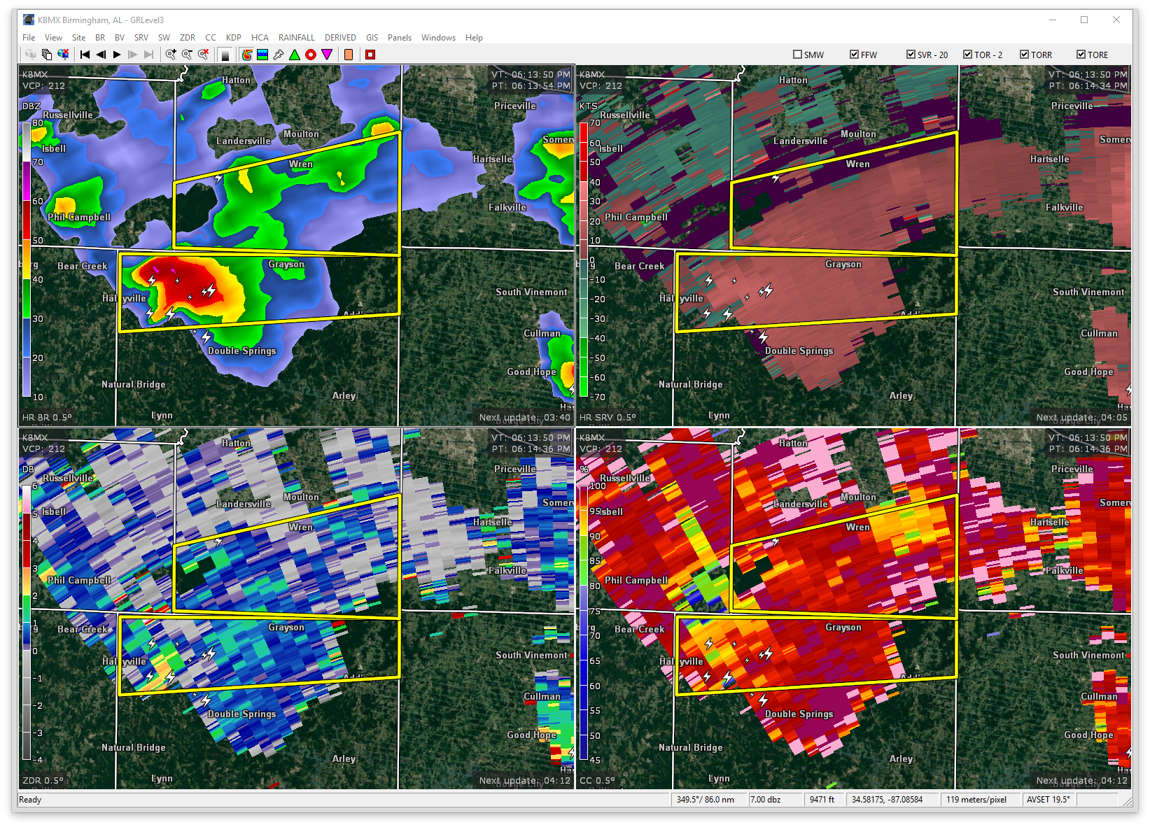

The National Weather Service in Huntsville Alabama has issued a
* Severe Thunderstorm Warning for…
Southern Lawrence County in northwestern Alabama…
* Until 700 PM CDT
* At 613 PM CDT, a severe thunderstorm was located near Needmore, or near Haleyville, moving east at 30 mph.
HAZARD…60 mph wind gusts and quarter size hail.
SOURCE…Radar indicated.
IMPACT…Hail damage to vehicles is expected. Expect wind damage to roofs, siding, and trees.
* Locations impacted include…
Speake, Bankhead National Forest and Wren.
Category: ALL POSTS, Archived Warnings
About the Author (Author Profile)
Subscribe
If you enjoyed this article, subscribe to receive more just like it.


