

Severe Thunderstorm Warning Continues For Parts Of Etowah County Until 7:15PM

…A SEVERE THUNDERSTORM WARNING REMAINS IN EFFECT UNTIL 715 PM CDT FOR ETOWAH COUNTY… At 642 PM CDT, severe thunderstorms were located along a line extending from near Aurora to near Steele to near Reece City, moving east at 35 mph.
HAZARD…Quarter size hail.
SOURCE…Radar indicated.
IMPACT…Damage to vehicles is expected. Locations impacted include… Gadsden, Rainbow City, Boaz, Hokes Bluff, Attalla, Glencoe, Sardis City, Altoona, Walnut Grove, Reece City, Aurora, Gadsden Mall, Noccalula Falls, Neely Henry Lake, Southside, Ridgeville, Gadsden Steam Plant, Mountainboro, Rockledge and Cobb City.
Severe Thunderstorm Warning Issued For Parts Of Etowah County Until 7:15PM
Mar 27th @ 6:19 pm
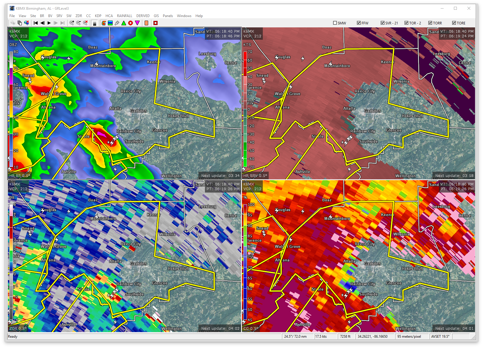

The National Weather Service in Birmingham has issued a
* Severe Thunderstorm Warning for…
Etowah County in northeastern Alabama…
* Until 715 PM CDT
* At 618 PM CDT, severe thunderstorms were located along a line extending from near Susan Moore to near Inland Lake to near Steele, moving east at 35 mph.
HAZARD…Quarter size hail.
SOURCE…Radar indicated.
IMPACT…Damage to vehicles is expected.
* Locations impacted include…
Gadsden, Rainbow City, Boaz, Hokes Bluff, Attalla, Glencoe, Sardis
City, Altoona, Walnut Grove, Reece City, Aurora, Gadsden Mall, Noccalula Falls, Neely Henry Lake, Southside, Ridgeville, Gadsden
Steam Plant, Mountainboro, Rockledge and Cobb City.
Category: ALL POSTS, Archived Warnings
About the Author (Author Profile)
Subscribe
If you enjoyed this article, subscribe to receive more just like it.


