

Strong Storms Approaching Parts Of Calhoun And Etowah Counties
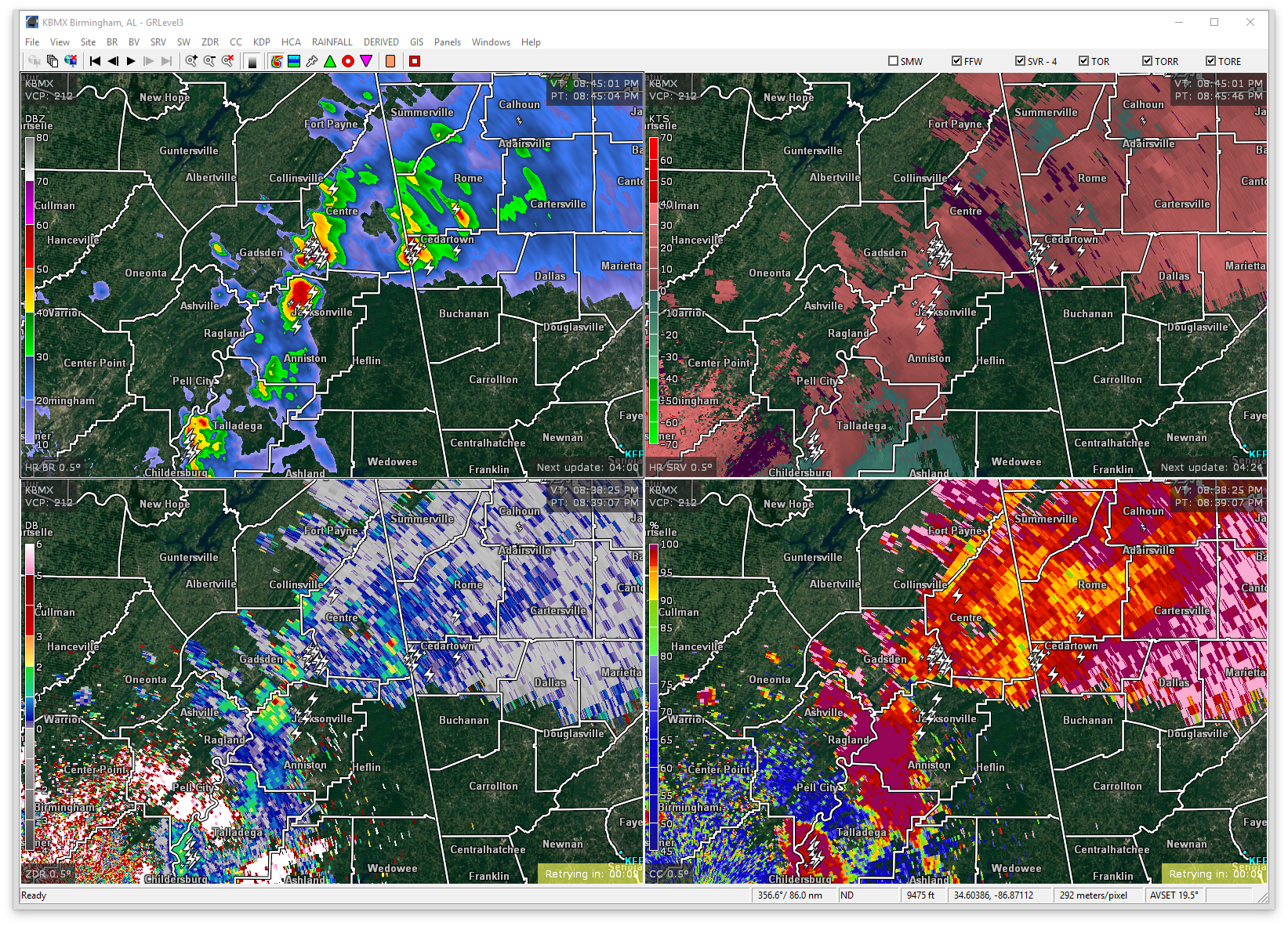
At 842 PM CDT, Doppler radar was tracking a strong thunderstorm near Glencoe, or 9 miles south of Hokes Bluff, moving northeast at 50 mph. Dime size hail and winds in excess of 40 mph will be possible with this storm.
Therefore, a Significant Weather Advisory has been issued for Northern Calhoun and Southeastern Etowah counties until 9:15PM.
Locations in the path are Jacksonville, Rainbow City, Piedmont, Hokes Bluff, Glencoe, Alexandria, Jacksonville State University, Southside, Cobb City, Knightens Crossroads, Sulphur Springs and Wellington.
Torrential rainfall is also occurring with this storm, and may lead to localized flooding. Do not drive your vehicle through flooded roadways. Frequent cloud to ground lightning is occurring with this storm. Lightning can strike 10 miles away from a thunderstorm. Seek a safe shelter inside a building or vehicle.
Category: ALL POSTS, Severe Weather
About the Author (Author Profile)
Scott Martin is an operational meteorologist, professional graphic artist, musician, husband, and father. Not only is Scott a member of the National Weather Association, but he is also the Central Alabama Chapter of the NWA president. Scott is also the co-founder of Racecast Weather, which provides forecasts for many racing series across the USA. He also supplies forecasts for the BassMaster Elite Series events including the BassMaster Classic.Subscribe
If you enjoyed this article, subscribe to receive more just like it.


