

Severe Thunderstorm Warning Expired For Parts Of Cherokee County
…THE SEVERE THUNDERSTORM WARNING FOR SOUTHERN CHEROKEE COUNTY WILL
EXPIRE AT 915 PM CDT…
The severe thunderstorm which prompted the warning has weakened.
Therefore, the warning will be allowed to expire. However small hail
and gusty winds are still possible with this thunderstorm.
Severe Thunderstorm Warning Issued For Parts Of Cherokee And Etowah Counties Until 9:15PM
Mar 27th @ 8:46 pm
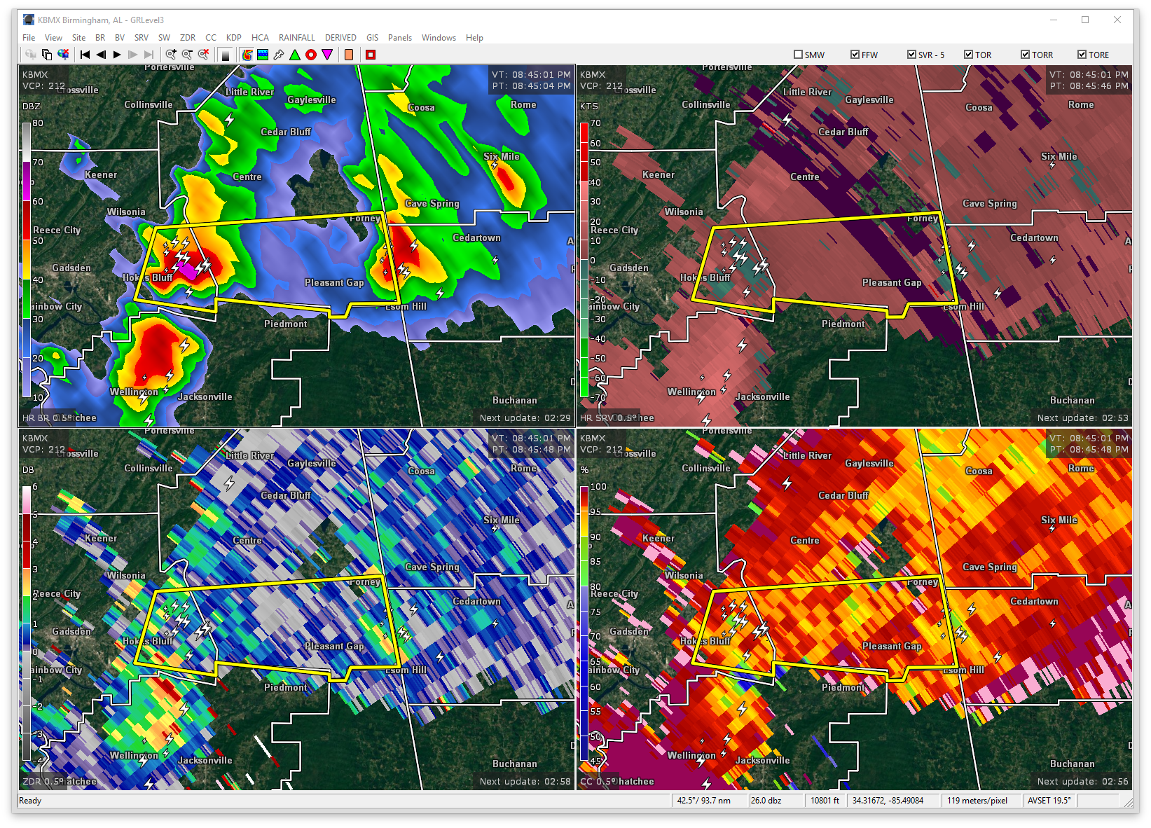

The National Weather Service in Birmingham has issued a
* Severe Thunderstorm Warning for…
East central Etowah County in northeastern Alabama…
Southern Cherokee County in northeastern Alabama…
* Until 915 PM CDT
* At 846 PM CDT, a severe thunderstorm was located over Ball Flat, or near Hokes Bluff, moving east at 40 mph.
HAZARD…60 mph wind gusts and quarter size hail.
SOURCE…Radar indicated.
IMPACT…Hail damage to vehicles is expected. Expect wind damage to roofs, siding, and trees.
* Locations impacted include…
Piedmont, Hokes Bluff, Forney, Pleasant Gap, Ballplay, Ball Flat, Coloma, Reaves and Spring Garden.
Category: ALL POSTS, Archived Warnings
About the Author (Author Profile)
Subscribe
If you enjoyed this article, subscribe to receive more just like it.


