

A Late Look At Thursday’s Threat Of Strong To Severe Storms
Back when I was growing up, my dad had a saying about the weather… “You want to know what’s about to happen with the weather? Go outside and look left, cause here it comes.” The reason why he said “look left” is because our house faced to the north, so looking to the left meant looking to the west. That is the approach we will probably have to take with this event.
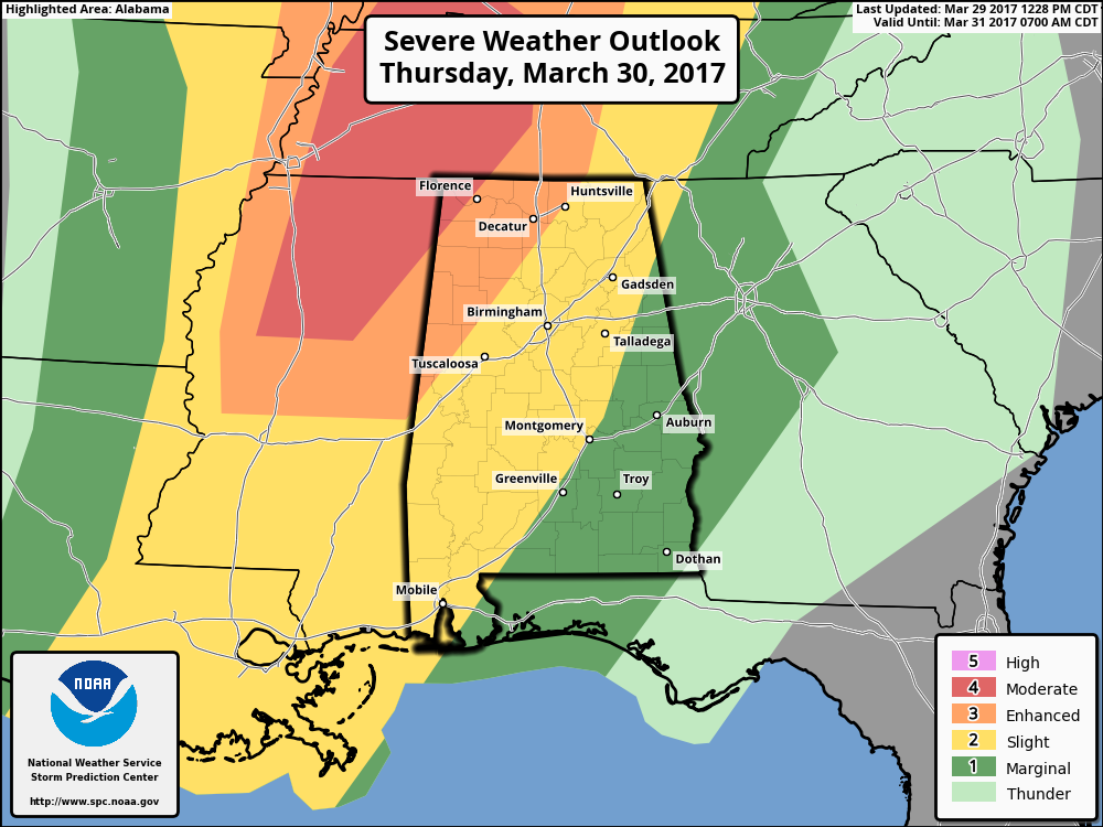
Thursday’s threat for strong to severe weather across North/Central Alabama is definitely still on the table, as we will have favorable dynamics, shear, lapse rates, and moisture in place. The Storm Prediction Center has the extreme northwestern corner of the state in a moderate risk for severe storms throughout the day on Thursday, including locations just west of Florence and just north of Red Bay, and an enhanced risk for locations west of a line from Huntsville to Carbon Hill to Gordo. A slight risk for severe storms stretches as far to the east as Anniston, Montgomery, and Atmore, with a marginal risk for the remainder of the state.
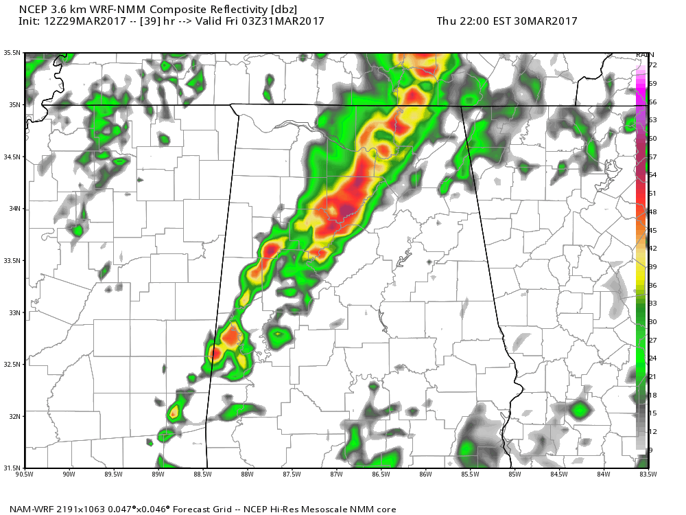
NCEP WRF-4km Simulated Radar valid at 9PM Thursday.
Latest trend on the forecast models are showing that the line of storms moving through the ArkLaTex region will either become scattered in nature or dissipate, which will be a non-factor in the strength of the storms in the western parts of the state, but may weaken the storms as they move into the eastern parts of Alabama.
Also, the latest trend on the convective activity developing along the Gulf Coast associated with the southern branch of the jet stream is showing that the storms may develop either too far to the south or too late in the day to cut off the flow to the north. So this probably not inhibit the destabilization of the atmosphere or supercell development ahead of the front over northern Mississippi and into northern Alabama.
If the opposite happens, the destabilization will be greatly reduced and supercell development will not happen. Severe risk for the area will be greatly reduced, and it may turn out to be near the event we had back on Saturday. We’ll have to “go outside and look left,” to see what’s coming tomorrow afternoon.
CAPE values of 1000-2000 J/kg, along with 50-plus knots of southwesterly shear, will be favorable of supercell development and will keep those storms out ahead of the lagging surface front. The potential is there for these supercells to move into the western parts of the area during the late afternoon and early evening hours. With decent helicity and surface backed winds, the threat for a few tornadoes and large hail will be there.

Latest thinking from the National Weather Service in Birmingham will have the better risk of supercells with large hail, damaging winds in excess of 60 MPH, and tornadoes over the west and northwestern parts of the area. The window for severe weather in this part of the area will start right after 3:00PM. For the central parts of the area, the main window will start around or after 8:00PM, with the main threats of damaging winds up to 60 MPH, large hail, and an isolated tornado or two. For the eastern parts of the area, the window for strong to severe storms will start at or around 11:00PM with the lesser threat from damaging winds up to 60 MPH and some hail. The tornado risk will be very low for this area, but cannot rule it out completely.
Category: Alabama's Weather, ALL POSTS
About the Author (Author Profile)
Scott Martin is an operational meteorologist, professional graphic artist, musician, husband, and father. Not only is Scott a member of the National Weather Association, but he is also the Central Alabama Chapter of the NWA president. Scott is also the co-founder of Racecast Weather, which provides forecasts for many racing series across the USA. He also supplies forecasts for the BassMaster Elite Series events including the BassMaster Classic.Subscribe
If you enjoyed this article, subscribe to receive more just like it.


