

A Brief Update On North/Central Alabama’s Weather Situation at 10:15AM
In my short time as a meteorologist, this has been and will continue to be the most challenging forecast that I have worked on until this event comes to an end. There are a couple of outflow boundaries that are currently moving through parts of North/Central Alabama.
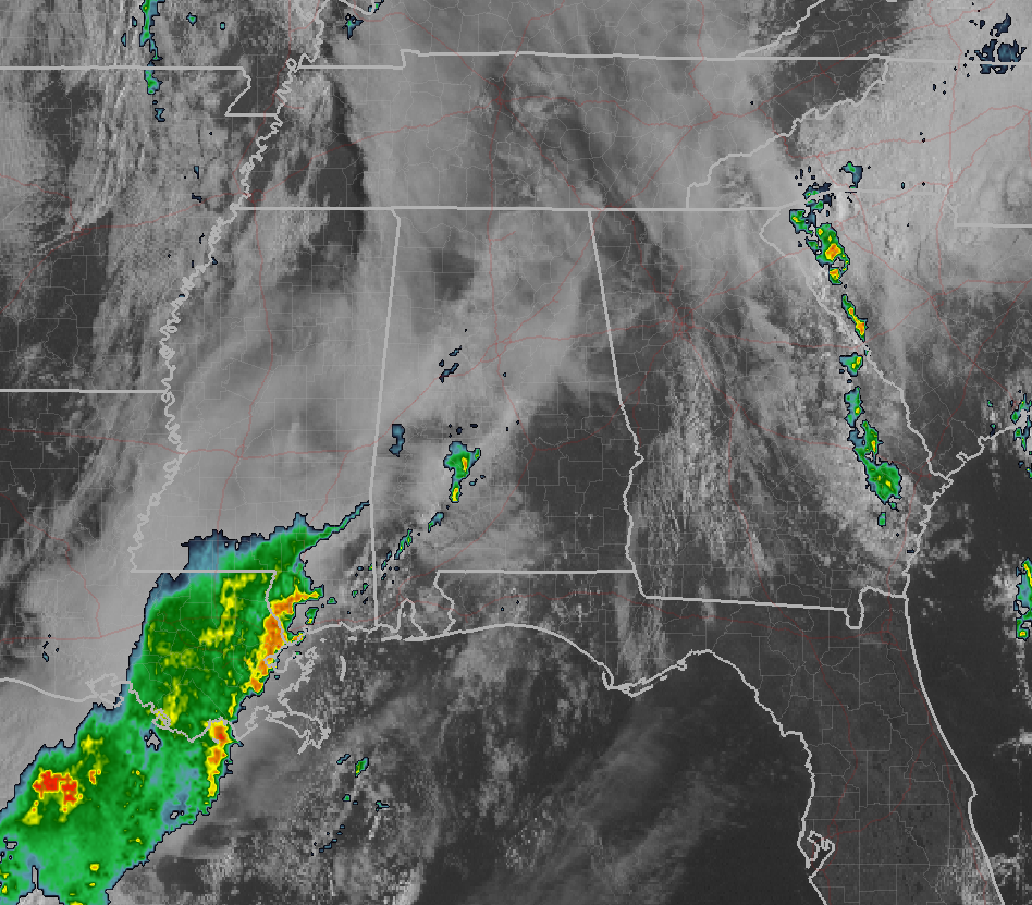
The first boundary is located near Childersburg to Selma and southward. A few thunderstorms have developed along this boundary to the south of the Central Alabama area, and are currently moving to the northeast. The part of the boundary that is in the area has very small showers associated with it, and rainfall amounts with is feature will tally 0.01 of an inch or less. On the tail end of this boundary back to the southwest is a large swath of showers and storms that is draped across the southern portions of Mississippi and the eastern parts of Louisiana. This activity is expected to move northeastward and could hold together long enough to make it into the southern parts of the area. There could be an isolated severe storm or two possible with this feature, but this feature could also hamper the environment in North/Central Alabama from becoming destabilized.
The second boundary currently located from near Cullman to near Tuscaloosa and back to the southwest, appears to have a wake low or a gravity wave that is causing gusty winds for the last several hours. Gusts from 25 up to 55 MPH have been reported with this feature, and some minor damage along with some trees have been blown down in Mississippi. These gusts of 25-45 MPH will continue to move through a fairly large stable zone in Central Alabama.
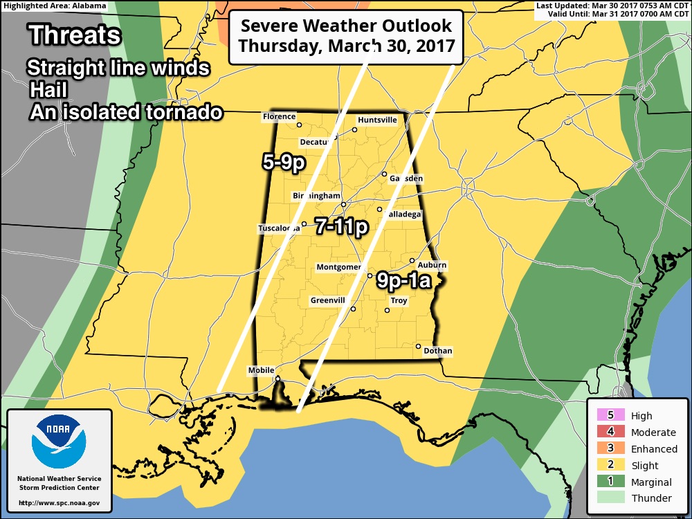
As of right now, the NWS Birmingham has lowered confidence on this system as the model guidance does not agree with the mesoscale developments. The slight risk area has been expanded to cover the entire state, after the SPC removed the enhanced and moderate risks from the area completely. The latest model trends have differing timing and buoyancy with this system, so the best this is to stay with what they are expecting, especially based on the overall forcing.
Be sure you have a way of getting warnings. A NOAA Weather Radio is the baseline, and a good smart phone app is the other tier. Identify the safe place in your home, and be sure everyone knows where it is. And, in that safe place have helmets for everyone, along with hard sole shoes and preferably a portable airhorn in case you need help. Be prepared for the possibility of severe storms anytime today or tonight.
Category: ALL POSTS, Severe Weather
About the Author (Author Profile)
Scott Martin is an operational meteorologist, professional graphic artist, musician, husband, and father. Not only is Scott a member of the National Weather Association, but he is also the Central Alabama Chapter of the NWA president. Scott is also the co-founder of Racecast Weather, which provides forecasts for many racing series across the USA. He also supplies forecasts for the BassMaster Elite Series events including the BassMaster Classic.Subscribe
If you enjoyed this article, subscribe to receive more just like it.


